Maps of Cord. Cantábrica

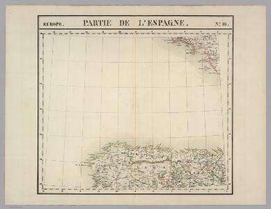
Partie, l'Espagne. Europe 18.
1 : 1641836 Vandermaelen, Philippe, 1795-1869
[131][134] Galliae, Biscajae et Gallissiae Sinus ... De Bocht van Vranckryck ..., uit: Atlas sive Descriptio terrarum orbis
Annotatie: Gedigitaliseerde versie. Amsterdam. Heiloo : Picturae (vervaardiger), 2015. tiff-bestand. Gedigitaliseerd: 07-01-2015; Origineel: Universiteitsbibliotheek Vrije Universiteit (XL.05127.-) ; Netherlands; Titelpagina ontbreekt Wit, Frederik de Amsterdam : Frederick de Wit
Galliæ, Biscajæ et Gallissiæ sinus
1 Karte : Kupferdruck ; 48 x 55 cm Renard gedruckt bÿ L. Renard
Pas-caert van de bocht van Vranckrijck, Biscajen en Galissen; tusschen Heyssant en C. de Finisterre
1 Karte : Kupferdruck ; 42 x 53 cm Doncker bÿ Hendrick Doncker inde Nieuwbrug steegh in 't Stuurmans gereetschap
Accurate chart of the Bay of Biscay
Neptune Occidental. A Compleat Pilot for the West-Indies, including the British Channel, Bay of Biscay, and all the Atlantic islands; with their bays, harbours, keys, rocks, land-marks, depths of water, latitudes, longitudes &c. &c. ... Done from actual surveys, by the late Thomas Jefferys ... on twenty-eight large imperial plates. Jefferys, Thomas. London : Printed for R. Sayer and J. Bennett
Atlantischer Ozean
1 : 600000 Atlantský oceán Admiralität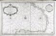
Carte reduite du golphe de Gascogne
1 Karte : Kupferdruck ; 53 x 84 cm Bellin s.n.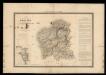
Mapa de Galicia con las nuevas divisiones
1 Mapa. Atlas Nacional de España Dufour, A.H. 0
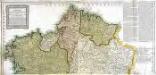
Regnorum Castellæ veteris Legionis et Gallæciæ principatuumque Biscaiæ et Asturiarum accuratissima descriptio, 1
1 Blatt : 48 x 41 cm Visscher
Karte von Frankreich in XVI Blättern, No. 9 und [No. 13]
2 Blätter : 52 x 33 cm Königl. Preuss. Academischen Kunst und Buchhandlung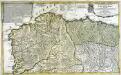
Le royaume de Galice divisé en plusieurs territoires, et les Asturies divisees en Asturie d'Oviedo et de Santillana
1 Karte auf 2 Blättern : Kupferdruck ; 43 x 71 cm Nolin; Rousseau; Silva; Julien chez le Sr. Julien a l'hotel de Soubise
Il principato delle Astvrie
1 Karte : Kupferdruck ; 37 x 50 cm Cantelli da Vignola; Rossi Domenico de Rossi

Gallæcia regnum
1 Karte : Kupferdruck ; 35 x 39 cm Mercator; Hondius Henricus Hondius
Gallicia
1 Karte : Kupferdruck ; 17 x 24 cm Mercator Cloppenburgh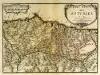
Principauté des Asturies
1 Karte : Kupferdruck ; 30 x 42 cm Fer N. de Fer

Carte de France, 5
2 Blätter : Kupferdruck ; 53 x 44 cm Crepy
Asturiae principatus
1 Karte : Kupferdruck ; 42 x 56 cm Güssefeld; López; Concha Miera; Reiter Homännische Erben
Mapa de el principado de Asturias
1 Karte auf 4 Blättern : Kupferdruck ; 65 x 74 cm López; Concha Miera; Reiter s.n.
Gallaecia, Regnum [Karte], in: Theatrum orbis terrarum, sive, Atlas novus, Bd. 2, S. 223.
1 Karte aus Atlas Blaeu, Joan Blaeu, Willem Janszoon
Gallaecia, Regnum [Karte], in: Novus Atlas, das ist, Weltbeschreibung, Bd. 2, S. 225.
1 Karte aus Atlas Blaeu, Joan Blaeu, Willem Janszoon
Le royaume de Galice
1 Karte : Kupferdruck ; 43 x 47 cm Fer chez le Sr. de Fer dans l'isle du Palais sur le Quay de l'Orloge a la sphere royale
Gallaecia Regnum [Karte], in: Gerardi Mercatoris et I. Hondii Newer Atlas, oder, Grosses Weltbuch, Bd. 2, S. 189.
1 Karte aus Atlas Mercator, Gerhard und Hondius, Jodocus Jansson, Jan
Gallaecia, Regnum [...] [Karte], in: Le théâtre du monde, ou, Nouvel atlas contenant les chartes et descriptions de tous les païs de la terre, Bd. 2, S. 216.
1 Karte aus Atlas Blaeu, Willem Janszoon und Blaeu, Joan Blaeu, Willem Janszoon
Gallaecia Regnum [Karte], in: Novus atlas absolutissimus, Bd. 6, S. 34.
1 Karte aus Atlas Janssonius Offizin
GALLÆCIA, | REGNVM
descripta a F. Fer. Ojea Ord. Præd. | et postmodum multis in locis | emendata et aucta Apud Guilj. Blaeu.
Carte de la France, no. 22
1 Blatt : 60 x 41 cm s.n.
Oviedo o Principado de Asturias
1 : 200000 1 Mapa, b/n. Dins: Atlas de España y sus posesiones de ultramar Coello, Francisco ; Madoz, Pascual [Imprenta del Atlas de España]