Maps of Mount Vernon
Mt. Vernon wards 4-5.
1 : 2400 Bromley, George Washington; Bromley, Walter Scott; G.W. Bromley & Co.
84-85 Mt. Vernon.
1 : 3600 G.W. Bromley & Co.
86-87 Mt. Vernon.
1 : 3600 G.W. Bromley & Co.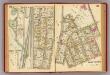
88-89 Mt. Vernon.
1 : 3600 G.W. Bromley & Co.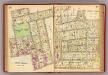
90-91 Mt. Vernon.
1 : 3600 G.W. Bromley & Co.
Lakeville - Washingtonville - East Chester.
from County atlas of Westchester, New York. Published by J.B. Beers & Co., assisted by S.W. Wilson and others.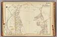
Mt. Vernon wards 4-5.
1 : 2400 Bromley, George Washington; Bromley, Walter Scott; G.W. Bromley & Co.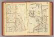
82-83 Mt. Vernon.
1 : 3600 G.W. Bromley & Co.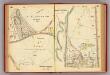
80-81 Mt. Vernon.
1 : 3600 G.W. Bromley & Co.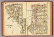
96-97 Mt. Vernon.
1 : 3600 G.W. Bromley & Co.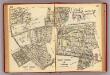
120-121 Mt. Vernon, Pelham.
1 : 5400 G.W. Bromley & Co.
Mount Vernon, Town of East Chester, Westchester Co., N.Y. (insets) Washingtonville. East Chester. Lakeville.
1 : 5940 Beers, J.B.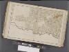
Westchester, Double Page Plate No. 11 [Map bounded by East Chester, E. 2nd St., Mount Vernon Ave., City of Yonkers] / prepared under the direction of Joseph R. Bien, from general surveys and official records.
From Atlas of Westchester County, New York
Plate 34: Mount Vernon, Westchester Co. N.Y.
from Atlas of New York and vicinity : from actual surveys / by and under the direction of F. W. Beers, assisted by A. B. Prindle & others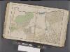
Westchester, Double Page Plate No. 12 [Map bounded by Pelham, E. 5th St., Rich Ave., East Chester] / prepared under the direction of Joseph R. Bien, from general surveys and official records.
From Atlas of Westchester County, New York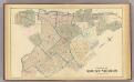
Mount Vernon.
1 : 7200 Bromley, George Washington; Bromley, Walter Scott; G.W. Bromley & Co.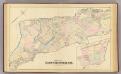
East Chester.
1 : 14400 Bromley, George Washington; Bromley, Walter Scott; G.W. Bromley & Co.
2A - N.Y. City (Aerial Set).
from Sectional aerial maps of the City of New York / [photographed and assembled under the direction of the chief engineer, July 1st, 1924].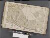
Westchester, Double Page Plate No. 10 [Map bounded by 15th Ave., City of Yonkers, Mount Vernon Ave.] / prepared under the direction of Joseph R. Bien, from general surveys and official records.
From Atlas of Westchester County, New York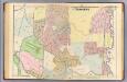
21. Yonkers.
1 : 3600 Kiser, Ellis; Mueller, A. H.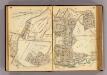
24-25 Yonkers.
1 : 7200 G.W. Bromley & Co.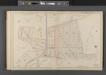
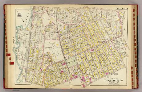
Mount Vernon, Double Page Plate No. 21 [Map bounded by California Rd., Wartburg St., Frederick Pl.] / compiled and published by John F. Fairchild.
From Atlas of the city of Mount Vernon and the town of Pelham : compiled from official records, personal surveys, and other private plans and surveys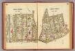
92-93 Mt. Vernon.
1 : 3600 G.W. Bromley & Co.
E. Chester, Town.
1 : 21120 Beers, F. W. (Frederick W.)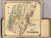
2 Yonkers.
1 : 18000 Hyde & Company
Westchester, Pelham towns.
1 : 21120 Bien, Joseph Rudolf
Topographical atlas of the city of New York, including the annexed territory showing original water courses and made land. / prepared under the direction of Egbert L. Viele.
From Topographical atlas of the city of New York, including the annexed territory showing original water courses and made land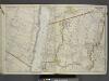
Portion of Bergen County, N.J.; Portion of City of Yonkers. And Westchester County
from Atlas of the Hudson River Valley from New York city to Troy, including a section of about 8 miles in width. Published by Watson & co. Compiled from official records and careful surveys, under the supervision of F. W. Beers.
Yonkers and East Chester, Westchester County, New York.
1 : 23760 Beers, J.B.