Cataloged map
Westchester, Double Page Plate No. 11 [Map bounded by East Chester, E. 2nd St., Mount Vernon Ave., City of Yonkers] / prepared under the direction of Joseph R. Bien, from general surveys and official records.
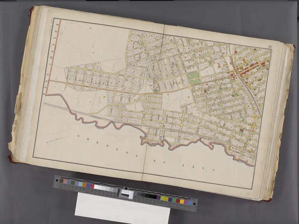

Full title:Westchester, Double Page Plate No. 11 [Map bounded by East Chester, E. 2nd St., Mount Vernon Ave., City of Yonkers] / prepared under the direction of Joseph R. Bien, from general surveys and official records.
Physical Size:20 x 30 cm
Lakeville - Washingtonville - East Chester.
1872
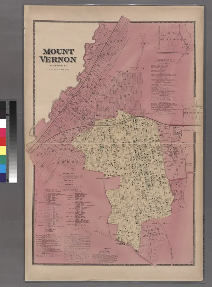
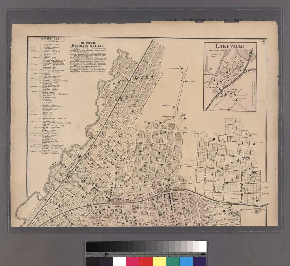
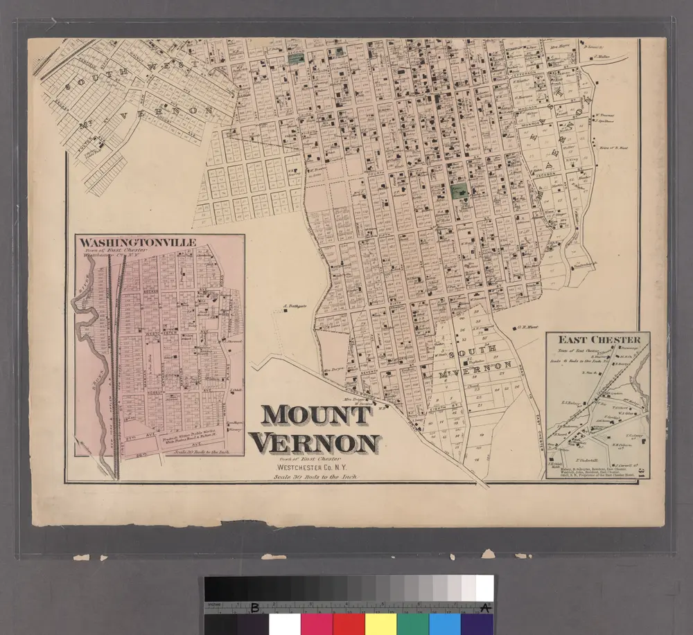
Plate 34: Mount Vernon, Westchester Co. N.Y.
1868
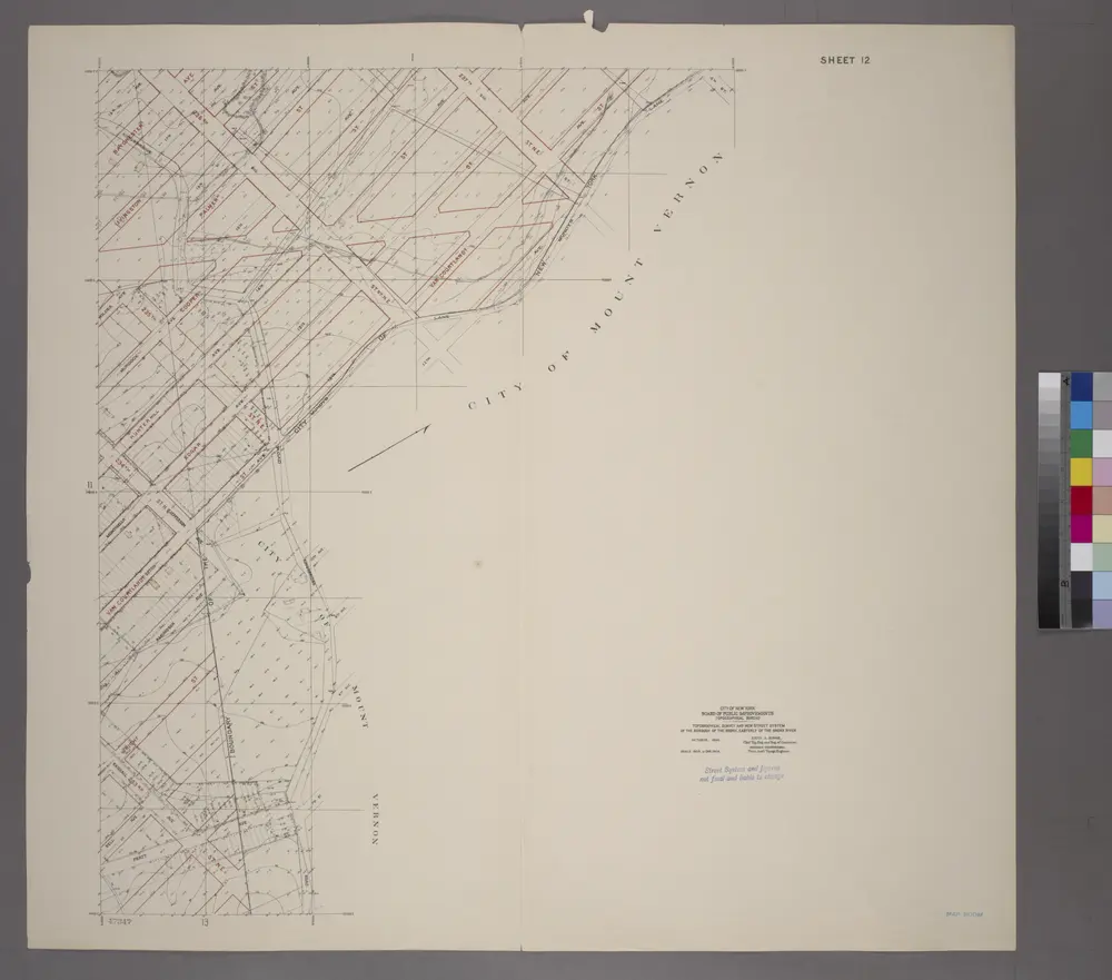
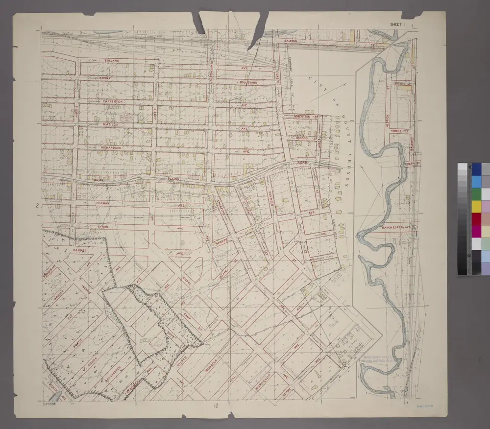
Sheet 12: Grid #12000E - 16000E, #15000N - 18000N. [Includes part of the City of Mount Vernon, Seton Avenue, Monticello Avenue, Hill Avenue, Murdock Avenue, Wilder Avenue, Amundson Avenue, Bell Avenue, Pratt Avenue and Northern boundary of the City of Ne
1905
Lakeville - Washingtonville - East Chester.
1872
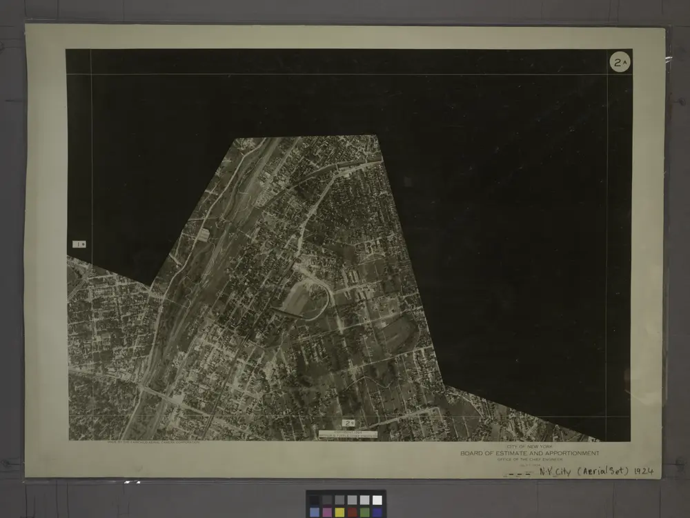
2A - N.Y. City (Aerial Set).
1924
Planning Grid of the Office of the Topographical Bureau of Bronx.
1905
Planning Grid of the Office of the Topographical Bureau of Bronx.
1905
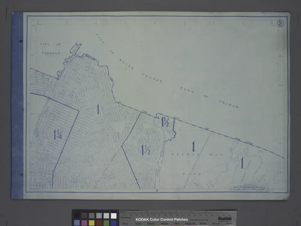
Height District Map Section No. 2; Height district map / City of New York, Board of Estimate and Apportionment.
1916
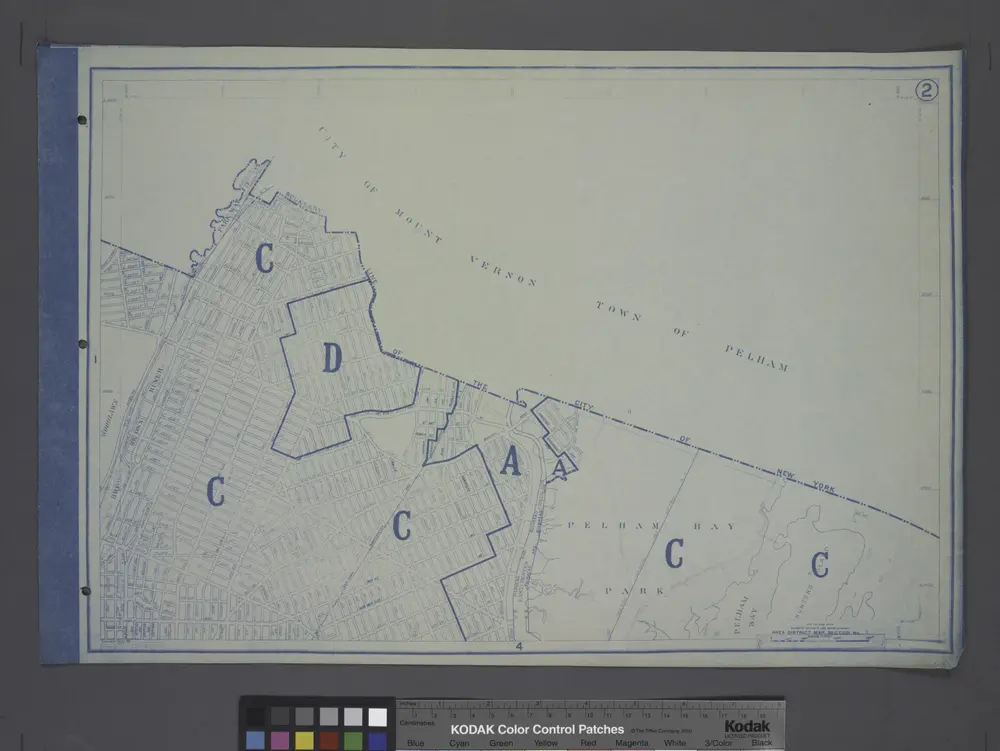
Use District Map Section No. 2; Use district map / City of New York, Board of Estimate and Apportionment.
1916
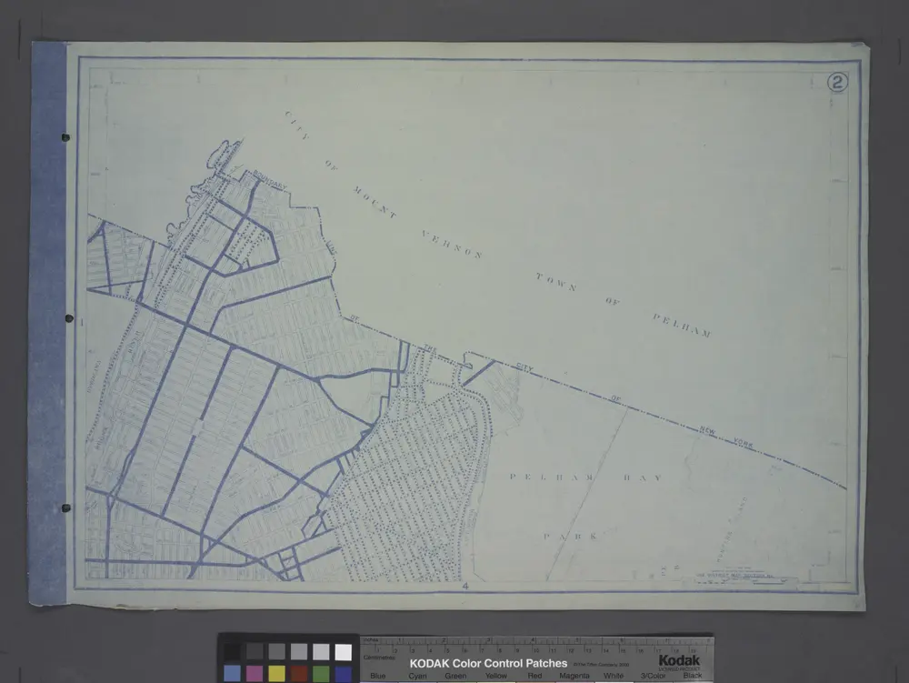
Area District Map Section No. 2
1916