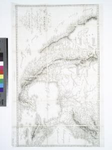
Maps of United States
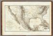
Carte Du Mexique et des Pays Limitrophes Situes Au Nord.
1 : 8000000 Humboldt, Alexander von, 1769-1859
Carte du Mexique et des pays limitrophes situés au nord et à l'est: dressée d'après la grande carte de la Nouvelle Espagne de Mr. A. de Humboldt et d'autres matériaux / par J.B. Poirson; gravé par Barriere; et l'écriture par L. Aubert.
from Mexico J. B. Poirson; Barriere; L. Aubert; A. de Humboldt,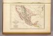
Etats-Unis du Mexique, 1835.
1 : 17000000 Malte-Brun, Conrad, 1775-1826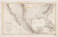
Carte du Mexique : et des pays limitrophes situés au nord et à l'est
1 : 8000000 Poirson, J. B F. Schoell
Mexico, California and Texas.
1 : 13305600 Tallis, J. & F.
North America, 1722.
1 : 25000000 Wells, Edward
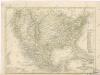
Mexico.
1 : 15000000 Finley, Anthony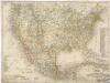
Vereinigte Staaten von Nord America - und Mexico
Vereinigte Staaten von Nord - America und Mexico

Mexico, Mittel-America, Texas.
1 : 12300000 Flemming, Carl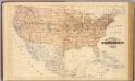
Topographical map of the United States.
1 : 9500000 Andreas, A. T. (Alfred Theodore), 1839-1900

Atlas für Handel und Industrie: Für Kaufleute, Fabrikante u. Gewerbetreibende, Handlungs- u. Gewerbe-Schulen
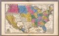
United States ... Texas ... Mexico and Guatimala.
1 : 11404800 Mitchell, Samuel Augustus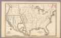
Map of the United States and Texas ... Mexico and Guatimala.
1 : 11404800 Mitchell, Samuel Augustus
Map of the United States and Mexico: including Oregon, Texas and the Californias.
from Parts s.n.: [New York?],
Map Atlantic Coast Line.
1 : 12503000 Atlantic Coast Line Railroad Company
[Vereinigte Staaten v. Nord-Amerika nebst Mexico und Canada]
[Allgemeiner Atlas über alle Theile der Erde in 29 Blättern] Ziegler, Jakob Melchior Top. Anstalt v. J. Wurster u. Comp.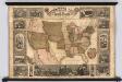
Pictorial Map Of The United States.
1 : 6336000 Atwood, J.M.; Ensign & Thayer
Mexico, Texas und Californien
1 : 6000000 bearb. und gezeichnet von H. Kiepert Situation und Schrift gestochen von K. Mädel ; Terrain von C. Jungmann Weimar : Verlag des Geographischen Institus
Mexico & Guatemala.
1 : 11800000 Mitchell, Samuel Augustus
Mexico & Guatemala.
1 : 12000000 Tanner, Henry S.
Mexico & Guatemala.
1 : 12000000 Tanner, Henry S.
[Verein-Staaten von Nord-America, Mexico, Yucatan u.A.]
Handatlas über alle Theile der Erde und über das Weltgebäude Stieler, Adolf Justus Perthes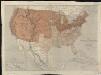
Map of the United States of North America, upper & lower Canada, New Brunswick, Nova Scotia & British Columbia, Mexico, Cuba, Jamaica, St. Domingo and the Bahama Islands
1 : 5800000
Mexico, Guatimala.
1 : 20500000 Grigg, John
Mexico, Guatamala.
1 : 37500000 Fenner, Rest.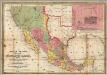
Map Of Mexico, Including Yucatan & Upper California.
1 : 7223000 Mitchell, Samuel Augustus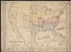
Military map of the United States & territories showing the location of the military posts, arsenals, Navy Yards, & ports of entry