Maps of Kings County

Handy map of Brooklyn.
From Brooklyn
Map of the consolidated city of Brooklyn.
From Brooklyn
New York city map.
From Manhattan
Geologic map and sections of Manhattan Island, State of New York
From Manhattan
Map of the consolidated city of Brooklyn, for Bishop's manual of the corporation.
From Brooklyn
Map of the city of Brooklyn
From Brooklyn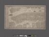
New York City map. Including an index to the streets of New York and Brooklyn.
From Manhattan
[General map of the city of New York, Boroughs of Manhattan, Brooklyn, Bronx, Queens, and Richmond ; designed and prepared by Louis A. Risse. New York : Board of Public Improvements. Topographical Bureau.] Photos of part of map only (Manhattan)
From Manhattan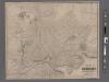
New map of the city of Brooklyn
From Brooklyn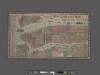
New York City Map. Extracted from Phelps' strangers and citizens' guide to New York City, with maps and engravings.
From Manhattan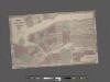
Johnson's Map of NYC.
From Manhattan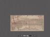
Map of the Borough of Manhattan, New York City, centering on the campus of Columbia University.
From Manhattan
Outline & Index Map of the City of Brooklyn, Kings County, N.Y.
from Robinson's atlas of the city of Brooklyn, New York : embracing all territory within its corporate limits; from official records ... / by and under the supervision of E. Robinson and R.H. Pidgeon, civil engineers.
Plate 6: Plan of New York and Brooklyn.
from Atlas of New York and vicinity : from actual surveys / by and under the direction of F. W. Beers, assisted by A. B. Prindle & others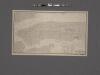
Map of New York City south of 118th street.
From Manhattan
Map of the city and county of New York : with the adjacent country / by David H. Burr.
from An atlas of the state of New York : containing a map of the state and of the several counties. / Projected and drawn under the superintendence and direction of Simeon de Witt ... And also the physical geography of the State ...
King's bird's-eye view of Brooklyn
From Brooklyn
City & county map of New York, Brooklyn, Williamsburgh, Jersey City & the adjacent waters.
From Manhattan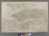
Outline & Index Map of New York City. Index I.
from Atlas of the city of New York : embracing all territory within its corporate limits from official records, private plans & actual surveys / by and under the supervision of E. Robinson & R.H. Pidgeon, civil engineers.
Map of the city and county of New York : with the adjacent country / by David H. Burr.
from An atlas of the state of New York, designed for the use of engineers, containing a map of the state and of the several counties. / Projected and drawn ... under the superintendence and direction of Simeon de Witt.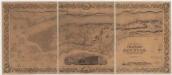
Topographical map of the city and county of New-York and the adjacent country : with views in the border of the principal buildings and interesting scenery of the island
1 : 16000 S. Stiles & Co Sherman & Smith
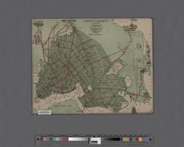
Map of the Borough of Brooklyn Published for the Brooklyn Directory.
From Brooklyn
City of New York, Borough of Brooklyn ; map showing section stations, stables, and dumps.
From Brooklyn
New York and vicinity.
1 : 42240 Morse, Sidney E. (Sidney Edwards), 1794-1871
Map of part of New York City, showing underground mains of the Edison Electric Illuminating Co. of New York.
From Manhattan
Map of the city and county of New York, showing routes and stations of the elevated railroads.
From Manhattan
Map of the cities of New York, Jersey City, Hoboken, with part of Brooklyn.
From Manhattan
Taunton's pocket edition of the merchant's and shipper's guide map to the port of New York / S.D.L. Taunton.
from Whole
New York City
from New topographical atlas and gazetteer of New York, comprising a topographical view of the several counties of the state, ... including ... map of the United States and territories ... Compiled from the latest astronomical observations, official surveys and records of the United States and territories ...