Maps of Kings County

Map of the city of Brooklyn
From Brooklyn
Map of the consolidated city of Brooklyn, for Bishop's manual of the corporation.
From Brooklyn
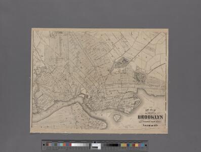
Map of the consolidated city of Brooklyn.
From Brooklyn
New map of the city of Brooklyn
From Brooklyn
Map of the Borough of Brooklyn Published for the Brooklyn Directory.
From Brooklyn
City of New York, Borough of Brooklyn ; map showing section stations, stables, and dumps.
From Brooklyn
Handy map of Brooklyn.
From Brooklyn
Map of the Borough of Brooklyn showing location of racial colonies.
From Brooklyn
Queens, Vol. 2, Double Page Plate No. 20; Part of Ward Two Maspeth; [Map bounded by Maurice Ave., Jay Ave., Nielson St., Buerman PL., Hull Ave., Prospect Ave., Linden St., Elm St., Fulton St.; Including Franklin St., Fisk Ave., Calamus Ro
from First and second wards: Long Island City and Newtown.
Geologic map and sections of Manhattan Island, State of New York
From Manhattan
[Map of Brooklyn.]
From Brooklyn
Outline & Index Map of the City of Brooklyn, Kings County, N.Y.
from Robinson's atlas of the city of Brooklyn, New York : embracing all territory within its corporate limits; from official records ... / by and under the supervision of E. Robinson and R.H. Pidgeon, civil engineers.
Guide map of Brooklyn, Kings County, N.Y. ....for Brooklyn daily eagle almanac.
From Brooklyn
Guide map of the borough of Brooklyn, Kings County, New York.
From Brooklyn
Map of Brooklyn.
From Brooklyn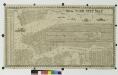
New York city map.
From Manhattan
King's bird's-eye view of Brooklyn
From Brooklyn
Brooklyn.
1 : 31000 Rand McNally and Company
Brooklyn - Liberty Loan Committee - division of districts.
From Brooklyn
[General map of the city of New York, Boroughs of Manhattan, Brooklyn, Bronx, Queens, and Richmond ; designed and prepared by Louis A. Risse. New York : Board of Public Improvements. Topographical Bureau.] Photos of part of map only (Manhattan)
From Manhattan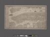
New York City map. Including an index to the streets of New York and Brooklyn.
From Manhattan
Map of Brooklyn, House Number and Subway Guide.
From Brooklyn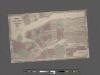
Johnson's Map of NYC.
From Manhattan
Map of New York City south of 118th street.
From Manhattan
City of New Manhattan : proposed May 1911, revised May 1930 / T. Kennard Thomson, consulting engineer, New York City.
from Manhattan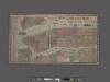
New York City Map. Extracted from Phelps' strangers and citizens' guide to New York City, with maps and engravings.
From Manhattan
Map of the Borough of Manhattan, New York City, centering on the campus of Columbia University.
From Manhattan
Plate 6: Plan of New York and Brooklyn.
from Atlas of New York and vicinity : from actual surveys / by and under the direction of F. W. Beers, assisted by A. B. Prindle & others
New York and vicinity.
1 : 42240 Morse, Sidney E. (Sidney Edwards), 1794-1871