Maps of Ulster County

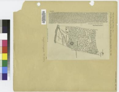
Map of Livingston Manor, 1714
from Cities and towns, A-Z
Map of the county of Greene / by David H. Burr ; engd. by Rawdon, Clark & Co., Albany, & Rawdon, Wright & Co., New York.
from An atlas of the state of New York, designed for the use of engineers, containing a map of the state and of the several counties. / Projected and drawn ... under the superintendence and direction of Simeon de Witt.
Map of the county of Greene / by David H. Burr ; engd. by Rawdon, Clark & Co., Albany, & Rawdon, Wright & Co., New York.
from An atlas of the state of New York : containing a map of the state and of the several counties / by David H. Burr.
The Hudson by daylight map, from New York Bay to the head of tide water : containing names of streams, islands, and heights of mountains according to the latest coast survey : also the names of prominent residences, historic land marks, the old reaches o
from Hudson River
Columbia Co.
from Atlas of Columbia County, New York. From actual surveys and official records. Compiled & published by D. G. Beers & Co.
Map of the county of Greene / by David H. Burr ; engd. by Rawdon, Clark & Co., Albany, & Rawdon, Wright & Co., New York.
from An atlas of the state of New York : containing a map of the state and of the several counties. / Projected and drawn under the superintendence and direction of Simeon de Witt ... And also the physical geography of the State ...
Pittsfield
1 : 100000
Pittsfield
1 : 100000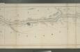
Map of the Hudson River Rail Road from New York to Albany / engraved by Robt. Haering, N.Y. ; W.C. Moore, del.
from Hudson River
Ulster County.
1 : 151000 Burr, David H., 1803-1875
Map of Dutchess County, New-York from original surveys / J.C. Sidney C.E., author of 12 miles around New York.
from Counties
Map of Dutchess County New York
from New illustrated atlas of Dutchess County, New York. / Compiled & drawn from personal examinations, surveys etc. under the personal supervision of O.W. Gray & Son and F.A. Davis, and published under the superintendence of H. L. Kochersperger.
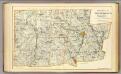
Greene County.
1 : 151000 Burr, David H., 1803-1875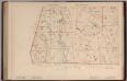
Massachusetts. Atlas Plate No. 27.
1 : 63360 Walker, O.W.
Sheffield quadrangle, Massachusetts
1 : 62500 Geological Survey (U.S.) U.S. Geological Survey
New York
1 : 2000000 Breese, S.
Livington [Township]; Glenco Mills [Village]; Livington Business Notices.; Lebanon Springs [Village]; Johnstown [Village]
from Atlas of Columbia County, New York. From actual surveys and official records. Compiled & published by D. G. Beers & Co.
Waterbury
1 : 100000
Waterbury
1 : 100000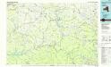
Pepacton Reservoir
1 : 100000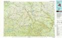
Pepacton Reservoir
1 : 100000
Columbia County.
1 : 151000 Burr, David H., 1803-1875
Housatonic
1 : 125000
Housatonic
1 : 125000
Housatonic
1 : 125000
Housatonic
1 : 125000
Housatonic
1 : 125000
Housatonic
1 : 125000
Dutchess County.
1 : 158400 Bien, Joseph Rudolf