Maps of Lower Saxony

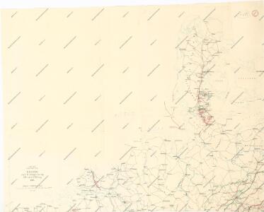
Skizze zur Orientirung ϋber den Feldzug 1814
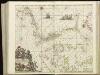
[124][127] Daniae, Frisiae, Groningae et Orientalis Frisiae littora, uit: Atlas sive Descriptio terrarum orbis
Annotatie: Gedigitaliseerde versie. Amsterdam. Heiloo : Picturae (vervaardiger), 2015. tiff-bestand. Gedigitaliseerd: 07-01-2015; Origineel: Universiteitsbibliotheek Vrije Universiteit (XL.05127.-) ; Netherlands; Titelpagina ontbreekt Wit, Frederik de Amsterdam : Frederick de Wit
Daniæ, Frisiæ, Groningæ et Orientalis Frisiæ littora
1 Karte : Kupferdruck ; 48 x 56 cm Renard apud L. Renard
[Velká Británie a Irsko]
Velká Británie Lotter, Tobias Conrad Lotter, Matthäus Albrecht
Carte des trois royaumes d'Angleterre d'Ècosse et d'Irlande
Velká Británie Raffelsperger, Franz Kitchin, Thomas
Konigreich Grossbrittanien und Irland
Velká Británie Raffelsperger, Franz Kitchin, Thomas
Gross-Britanien und Irland
Velká Británie Raffelsperger, Franz Kitchin, Thomas Franz Raffelsperger
Die britischen Inseln
Velká Británie Wyld, James Kitchin, Thomas
Grossdeutsches Reich und angrenzende Gebiete

Danemark vizt Jutland, Zeland, Sleswick, Holstein.
from A new systeme of the mathematicks: containing I. Arithmetick, as well natural and decimal, as in species, or the principles of algebra. II. Practical geometry, together with the first six books of Euclid's Elements, as also the eleventh and twelfth, symbo
Denmark with Northwest portion of the German Empire
1 : 1332000 Johnston, W. & A.K.
[Das Deutsches Reich, Blatt 1]
Adolf Stieler's Handatlas über alle Theile der Erde und über das Weltgebäude Stieler, Adolf Justus Perthes
Denmark with Northwest portion of the German Empire
1 : 1332000 Johnston, Alexander Keith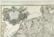
Kriegs Expeditions Karte von Devtschland
1 : 1700000 Mollova mapová sbírka Rizzi Zannoni, Giovanni Antonio Homann, Johann Baptista - dědici
Denmark with Northwest portion of the German Empire
1 : 1332000 Johnston, Alexander Keith
Denmark.
1 : 1250000 Teesdale, Henry

Denmark.
1 : 1837440 Tallis, J. & F.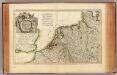
L'Alemagne 1.
1 : 1800000 Rizzi Zannoni, Giovanni Antonio Bartolomeo, 1736-1814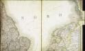
Carte des iles britanniques ou Royaume-Uni de la Grande Bretagne et d'Irlande, 4
2 Blätter : je 48 x 39 cm
Nordwestl. Deutschland und Daenemark
[Allgemeiner Atlas über alle Theile der Erde in 29 Blättern] Ziegler, Jakob Melchior Top. Anstalt v. J. Wurster u. Comp.
Denmark, Hanover, Brunswick, Mecklenburg, Oldenburg.
1 : 1332000 Johnston, Alexander Keith, 1804-1871
Denmark.
1 : 1800000 Mitchell, Samuel Augustus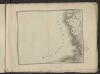
Théatre de la guerre actuelle, en Allemagne, en Pologne et en Turquie. n2 (bis)
1 : 900000 Chanlaire, Pierre Grégoire 1758-1817 Paris : chez l'auteur P. G. Chanlaire
Hiberniae regnum
1 : 888000 Irsko Visscher, Nicolaus Vilém Oranžský per Nicolaum Visscher
Magna Britannia complectens Angliae, Scotiae et Hiberniae regn. in suas prov. et comitat.
Velká Británie Seutter, Matthäus Vilém Oranžský per Homannum
Pas-caert van Texel tot aen de Hoofden
1 Karte : Kupferdruck ; 43 x 53 cm Doncker bÿ Hendrick Doncker boekverkoper en graadbooghmaker in de Nieubrugsteegh in 't Stuurmans gereetschap
Denmark.
1 : 1500000 Colton, G.W.
Mappa geographica summo labore, accurate et novissime exarata, exhibens circulos aliquot Germaniae, praesertim illos ubi bellum nunc geritur
1 : 1300000 Nizozemsko Lotter, Tobias Conrad Tob. Conr. Lotter