Maps of Czech Republic

Příruční mapa království Českého

Handkarte des königreiches Böhmen
Archeologická mapa království Českého
Bez titulu: Soubor statistických map Čech

Mapa Králowstwj českého
1 : 740000 Čechy (Česko) David, Martin Alois Berka, Jan Nepomuk nákladem p. p. Benesse Jana Nepom. Pfeifera
Mapa Králowstwj českého
1 : 740000 Česko David, Martin Alois Berka Jan Nepomuk nákladem p. p. Benesse Jana Nepom. Pfeifera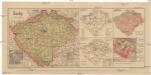
Čechy
1 : 1300000 Praha-oblast (Česko) Salač, Klement B. Kočí
Generální mapa Království českého
1 : 220000 Čechy (Česko) Wagner, Jan Eduard F. Kytka
Přehlední mappa [sic] silnic v Čechách
1 : 680000 Čechy (Česko)
Strassen-Uebersichtskarte von Böhmen
1 : 680000 Čechy (Česko)
Strassenkarte von Böhmen
1 : 441000 Čechy (Česko)
Strassenkarte von Böhmen
1 : 441000 Čechy (Česko)
Vodopisná mapka Čech
1 : 902000 Česko
Böhmen
Čechy (Česko) Trausel, W. Steyrer, Fr. C.
Karte des oesterreichischen Kronlandes Böhmen
Čechy (Česko) Adam, Jakob Friedr. Kretzschmar
Karte des oesterreichischen Kronlandes Böhmen
Čechy (Česko) Fils Kretzschmar, Friedrich Friedr. Kretzschmar
Bohemia
1 : 750000 Sudety (Česko)
Bohemia
1 : 750000 Sudety (Česko)
Bez titulu: Soubor statistických map Čech

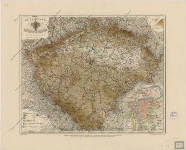
General-Karte des Königreiches Böhmen
1 : 378000 Čechy (Česko) Kořistka, Karel František Edvard Sommer, Adolf Eduard Hölzel's Verlag
Das Königreich Böhmen
Čechy (Česko) Benecke Bormann, E. Ignaz Fuchs
Karte des Königreiches Böhmen
1 : 490000 Česko F. Tempsky
Karte des Königreiches Böhmen
Česko F. Tempsky
Karte des Königreiches Böhmen
Česko F. Tempsky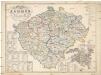
Karte des Königreiches Böhmen
Česko F. Tempsky
Politická a místopisná mapa království Českého

Národnostní mapka království Českého dle politických a soudních okresů 1910
Čechy (Česko) Schmidt, Eduard Steyrer, Fr. C. Národní rada česká
Karte vom Königreiche Böhmen in Cameralämtlicher Hinsicht
Praha (Česko) Seidler, Karl Friedrich
Čechy
Česko Gräf, C. Langhans, J.
Königreich Böhmen
Česko Tachauer, Ludwig Langhans, J.