Maps of Vinohrady

Monumentální plán královského města Prahy

Polohopisný plán Kr. Vinohradů, Nuslí a Vršovic
1 : 4000
Situations-Plan Kgl. Weinberge, Nusle und Vršovic

[Praha-Nové Město]
Praha (Česko) Vasquez Pinos, Karl Weiss, Fr.
Polohopisný plán královského hlavního města Prahy

Město Král. Vinohrady

Město Král. Vinohrady
Vinohrady (Praha, Česko) Srp, Jan Trávníček, František
Polohopisný plán města Král. Vinohradů
Plán královského hlavního města Prahy 1815
Polohopisný plán města Král. Vinohrady
1 : 3600 Vinohrady (Praha, Česko) Štverák, Jan Josef Fuksa
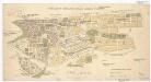
Orientační plán města "Král. Vinohrady"
1 : 2200 Vinohrady (Praha, Česko) Poláček, K. Wallenfels, F. nákladem města Královské Vinohrady
Praha. Mapy staré Prahy k letům 1200, 1348 a 1419

Hlavní město Praha...

Polohopisný plán Královských Vinohradů, Vršovic a Nuslí
1 : 4000 Nusle (Praha, Česko) Hurtig, Alfred F. Kytka
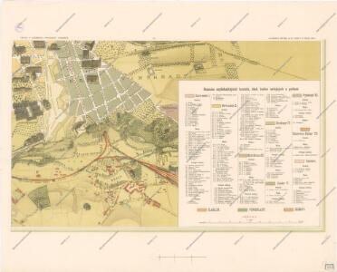
Orientační plán měst Král. Vinohrad, Nuslí a Vršovic
1 : 5760 Nusle (Praha, Česko) Herold, Theofil České lidové knihkupectví a antikvariát (Jos. Springer)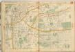
Auto-Praha : automobilní plán Velké Prahy a příručka pro automobilisty
1 : 50000
Wrschowitz - c8866-1-001 - Kaiserpflichtexemplar der Landkarten des stabilen Katasters
1 : 2880
Wrschowitz - c8866-1-002 - Kaiserpflichtexemplar der Landkarten des stabilen Katasters
1 : 2880
Wrschowitz - c8866-1-003 - Kaiserpflichtexemplar der Landkarten des stabilen Katasters
1 : 2880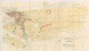
Orientační plán města Vršovic
1 : 2880
Orientační plán král. Hl. města Prahy

Plán hlavního města království českého Praha
Přehledný regulační plán města Vršovic
Vršovice (Praha, Česko) Zdeněk, Jaroslav Šimáček, Josef
Orientační plán hlavního města Prahy s okolím
1 : 5000
Bez titulu: Praha

Orientační plán hlavního města Prahy s okolím

Orientační plán hlavního města Prahy s okolím
1 : 5000
Orientační plán Prahy a obcí sousedních List 16.
1 : 5000
Orientační plán Prahy a obcí sousedních List 16.
1 : 5000