Maps of Košíře

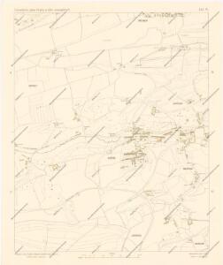
Orientační plán Prahy a obcí sousedních List 14.

Orientační plán král. Hl. města Prahy

Koschirz (Kossirz) - c3401-1-001 - Kaiserpflichtexemplar der Landkarten des stabilen Katasters
1 : 2880
Koschirz (Kossirz) - c3401-1-002 - Kaiserpflichtexemplar der Landkarten des stabilen Katasters
1 : 2880
Smíchov
1 : 5760
Plán voj. cvičiště v Motole
1 : 10000 Motol (Praha, Česko) Vojenský zeměpisný ústav
Smíchov

Smichow - c7068-1-001 - Kaiserpflichtexemplar der Landkarten des stabilen Katasters
1 : 2880
Smichow - c7068-1-005 - Kaiserpflichtexemplar der Landkarten des stabilen Katasters
1 : 2880
Smichow - c7068-1-003 - Kaiserpflichtexemplar der Landkarten des stabilen Katasters
1 : 2880
Smichow - c7068-1-002 - Kaiserpflichtexemplar der Landkarten des stabilen Katasters
1 : 2880
Smichow - c7068-1-004 - Kaiserpflichtexemplar der Landkarten des stabilen Katasters
1 : 2880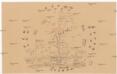
[Smíchov a Košíře]
Košíře (Praha, Česko)
Plán výstavy
Košíře (Praha, Česko) Schulz, R. A. Medau, Karel Vilém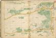
Auto-Praha : automobilní plán Velké Prahy a příručka pro automobilisty
1 : 50000
Plán královského hlavního města Prahy 1815

Výškopisný plán hlavního města Prahy s okolím

Orientační plán hlavního města Prahy s okolím
1 : 5000
Orientační plán hlavního města Prahy s okolím
1 : 5000
Orientační plán hlavního města Prahy s okolím

Orientační plán hlavního města Prahy s okolím

Gross Brzewnow (Welky Břewnow) - c0558-1-001 - Kaiserpflichtexemplar der Landkarten des stabilen Katasters
1 : 2880
Gross Brzewnow (Welky Břewnow) - c0558-1-002 - Kaiserpflichtexemplar der Landkarten des stabilen Katasters
1 : 2880
Gross Brzewnow (Welky Břewnow) - c0558-1-003 - Kaiserpflichtexemplar der Landkarten des stabilen Katasters
1 : 2880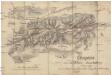
Croquis zur schriftlichen Ausarbeitung
1 : 13500 Bílá Hora (Praha, Česko)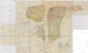
Situations-Plan der königl. Hauptstadt Prag nebst Smichov u. Karolinenthal
1 : 4000 Karlín (Praha, Česko) Mayr, Josef Spolek notářů v Čechách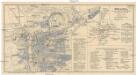
Praha
Praha (Česko) Salač, Klement Metzeroth, Carl B. Kočí
Orientační plán hlavního města Prahy
1 : 15000
Nejnovější a nejúplnější plán královského hlavního města Prahy a obcí sousedních
Praha (Česko) Brož, Josef Volk A. Štorch syn