Maps of Argyll and Bute

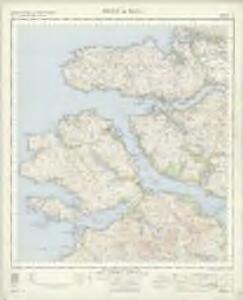
Sound of Mull - OS One-Inch Map
1 : 63360 Topographic maps Ordnance Survey Ordnance Survey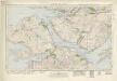
Sound of Mull (53) - OS One-Inch map
1 : 63360 Topographic maps Ordnance Survey Ordnance Survey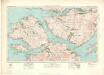
Sound of Mull (53) - OS One-Inch map
1 : 63360 Topographic maps Ordnance Survey Ordnance Survey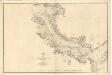
Sound of Mull
Great Britain. Hydrographic Office
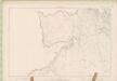
Tobermory - OS One-Inch map
1 : 63360 Topographic maps Ordnance Survey Ordnance Survey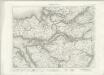
Tobermory - OS One-Inch map
1 : 63360 Topographic maps Ordnance Survey Ordnance Survey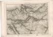
Tobermory - OS One-Inch map
1 : 63360 Topographic maps Ordnance Survey Ordnance Survey
Mull - OS One-Inch map
1 : 63360 Topographic maps Ordnance Survey Ordnance Survey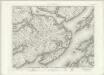
Mull - OS One-Inch map
1 : 63360 Topographic maps Ordnance Survey Ordnance Survey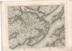
Mull - OS One-Inch map
1 : 63360 Topographic maps Ordnance Survey Ordnance Survey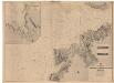
Treshnish Point to the Entrance of the Sound, including an enlarged plan of Loch Cuan
Great Britain. Hydrographic Office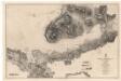
Loch Scridain
Great Britain. Hydrographic Office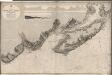
Lochs Buy and Spelve
Great Britain. Hydrographic Office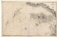
Loch Tuadh and the Isles
Great Britain. Hydrographic Office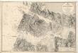
Loch Moidart
Great Britain. Hydrographic Office
Inverness-shire (Mainland), Sheet CXLVII (Inset CLVI) - OS 6 Inch map
1 : 10560 Topographic maps Ordnance Survey Ordnance Survey
Argyllshire (Island of Muck), Sheet LXXIV - OS 6 Inch map
1 : 10560 Topographic maps Ordnance Survey Ordnance Survey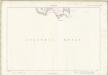
Inverness-shire - Isle of Skye Sheet LXXIV - OS 6 Inch map
1 : 10560 Topographic maps Ordnance Survey Ordnance Survey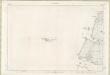
Inverness-shire - Mainland Sheet CXLVII (with inset CLVI) - OS 6 Inch map
1 : 10560 Topographic maps Ordnance Survey Ordnance Survey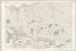
Inverness-shire - Mainland Sheet CXLVIII - OS 6 Inch map
1 : 10560 Topographic maps Ordnance Survey Ordnance Survey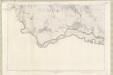
Inverness-shire - Mainland Sheet CLVII - OS 6 Inch map
1 : 10560 Topographic maps Ordnance Survey Ordnance Survey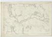
Inverness-shire (Mainland), Sheet CLVII - OS 6 Inch map
1 : 10560 Topographic maps Ordnance Survey Ordnance Survey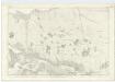
Inverness-shire (Mainland), Sheet CXLVIII - OS 6 Inch map
1 : 10560 Topographic maps Ordnance Survey Ordnance Survey
Argyllshire, Sheet XXXVIIIa - OS 6 Inch map
1 : 10560 Topographic maps Ordnance Survey Ordnance Survey
Argyllshire, Sheet XCIII - OS 6 Inch map
1 : 10560 Topographic maps Ordnance Survey Ordnance Survey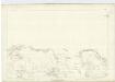
Argyllshire, Sheet CV - OS 6 Inch map
1 : 10560 Topographic maps Ordnance Survey Ordnance Survey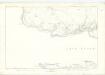
Argyllshire, Sheet LXVII - OS 6 Inch map
1 : 10560 Topographic maps Ordnance Survey Ordnance Survey
Argyll and Bute Sheet XXXVIIIa - OS 6 Inch map
1 : 10560 Topographic maps Ordnance Survey Ordnance Survey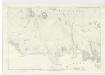
Argyllshire, Sheet XXV - OS 6 Inch map
1 : 10560 Topographic maps Ordnance Survey Ordnance Survey