Maps of Argyll and Bute
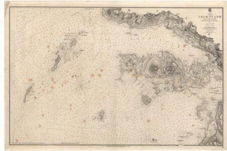
Loch Tuadh and the Isles
Great Britain. Hydrographic Office
Argyll and Bute Sheet LXXX - OS 6 Inch map
1 : 10560 Topographic maps Ordnance Survey Ordnance Survey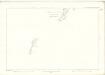
Argyllshire, Sheet LXXX - OS 6 Inch map
1 : 10560 Topographic maps Ordnance Survey Ordnance Survey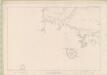
Argyll and Bute Sheet LXXXI - OS 6 Inch map
1 : 10560 Topographic maps Ordnance Survey Ordnance Survey
Argyllshire, Sheet LXXXI - OS 6 Inch map
1 : 10560 Topographic maps Ordnance Survey Ordnance Survey
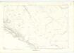
Argyllshire, Sheet LXVI - OS 6 Inch map
1 : 10560 Topographic maps Ordnance Survey Ordnance Survey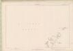
Argyll and Bute Sheet LXVI - OS 6 Inch map
1 : 10560 Topographic maps Ordnance Survey Ordnance Survey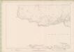
Argyll and Bute Sheet LXVII - OS 6 Inch map
1 : 10560 Topographic maps Ordnance Survey Ordnance Survey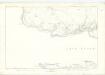
Argyllshire, Sheet LXVII - OS 6 Inch map
1 : 10560 Topographic maps Ordnance Survey Ordnance Survey
Argyllshire, Sheet XCIII - OS 6 Inch map
1 : 10560 Topographic maps Ordnance Survey Ordnance Survey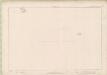
Argyll and Bute Sheet XCIII - OS 6 Inch map
1 : 10560 Topographic maps Ordnance Survey Ordnance Survey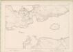
Argyll and Bute Sheet LXXXII - OS 6 Inch map
1 : 10560 Topographic maps Ordnance Survey Ordnance Survey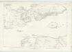
Argyllshire, Sheet LXXXII - OS 6 Inch map
1 : 10560 Topographic maps Ordnance Survey Ordnance Survey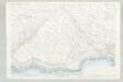
Argyll and Bute, Sheet LXVII.7 (Kilninian) - OS 25 Inch map
1 : 2500 Topographic maps Ordnance Survey Ordnance Survey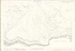
Argyll, Sheet 067.07 - 25 Inch Map
1 : 2500 Topographic maps Ordnance Survey Ordnance Survey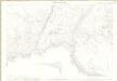
Argyll, Sheet 067.08 & 12 - 25 Inch Map
1 : 2500 Topographic maps Ordnance Survey Ordnance Survey
Argyll and Bute, Sheet LXVII.12 (Kilninian) - OS 25 Inch map
1 : 2500 Topographic maps Ordnance Survey Ordnance Survey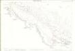
Argyll, Sheet 068.09 - 25 Inch Map
1 : 2500 Topographic maps Ordnance Survey Ordnance Survey
Argyll and Bute, Sheet LXVII.8 (Kilninian) - OS 25 Inch map
1 : 2500 Topographic maps Ordnance Survey Ordnance Survey
Argyll and Bute, Sheet LXVIII.9 (Kilninian) - OS 25 Inch map
1 : 2500 Topographic maps Ordnance Survey Ordnance Survey
Argyll and Bute, Sheet LXVIII.5 (Kilninian) - OS 25 Inch map
1 : 2500 Topographic maps Ordnance Survey Ordnance Survey
Argyll, Sheet 068.05 - 25 Inch Map
1 : 2500 Topographic maps Ordnance Survey Ordnance Survey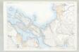
Argyll and Bute, Sheet LXXXII.2 (Kilninian) - OS 25 Inch map
1 : 2500 Topographic maps Ordnance Survey Ordnance Survey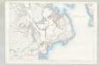
Argyll and Bute, Sheet LXXXII.6 (Kilninian) - OS 25 Inch map
1 : 2500 Topographic maps Ordnance Survey Ordnance Survey
Argyll, Sheet 082.02 - 25 Inch Map
1 : 2500 Topographic maps Ordnance Survey Ordnance Survey
Argyll, Sheet 082.06 - 25 Inch Map
1 : 2500 Topographic maps Ordnance Survey Ordnance Survey
Iona - OS One-Inch map
1 : 63360 Topographic maps Ordnance Survey Ordnance Survey
Iona - OS One-Inch map
1 : 63360 Topographic maps Ordnance Survey Ordnance Survey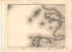
Iona - OS One-Inch map
1 : 63360 Topographic maps Ordnance Survey Ordnance Survey