Maps of Highland

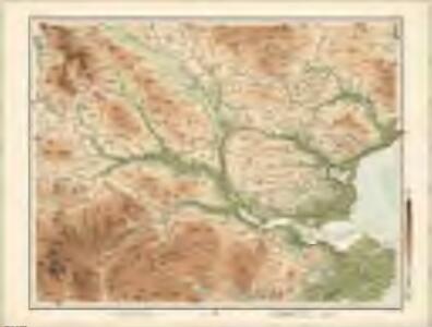
Lairg - Bartholomew's 'Survey Atlas of Scotland'
1 : 126720 Topographic maps John Bartholomew & Son, Ltd John Bartholomew & Son, Ltd
Sovtherlandia
1 Karte : Kupferdruck ; 36 x 51 cm Blaeu Joan Blaeu
Lairg - OS One-Inch map
1 : 63360 Topographic maps Ordnance Survey Ordnance Survey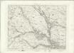
Lairg - OS One-Inch map
1 : 63360 Topographic maps Ordnance Survey Ordnance Survey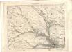
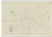
Lairg - OS One-Inch map
1 : 63360 Topographic maps Ordnance Survey Ordnance Survey
Bonar-Bridge - OS One-Inch Map
1 : 63360 Topographic maps Ordnance Survey Ordnance Survey
Lairg & Loch Shin (16) - OS One-Inch map
1 : 63360 Topographic maps Ordnance Survey Ordnance Survey
Lairg & Loch Shin (16) - OS One-Inch map
1 : 63360 Topographic maps Ordnance Survey Ordnance Survey
Lairg - OS One-Inch Map
1 : 63360 Topographic maps Ordnance Survey Ordnance Survey
Dornoch (21) - OS One-Inch map
1 : 63360 Topographic maps Ordnance Survey Ordnance Survey
Dornoch (21) - OS One-Inch map
1 : 63360 Topographic maps Ordnance Survey Ordnance Survey
Strath Oykell (20) - OS One-Inch map
1 : 63360 Topographic maps Ordnance Survey Ordnance Survey
Strath Oykell (20) - OS One-Inch map
1 : 63360 Topographic maps Ordnance Survey Ordnance Survey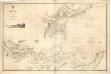
The Firth of Dornoch
Great Britain. Hydrographic Office
NH79 & Parts of NH89 - OS 1:25,000 Provisional Series Map
1 : 25000 Topographic maps Ordnance Survey Ordnance Survey
NH78 - OS 1:25,000 Provisional Series Map
1 : 25000 Topographic maps Ordnance Survey Ordnance Survey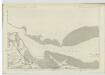
Ross-shire & Cromartyshire (Mainland), Sheet XXVIII - OS 6 Inch map
1 : 10560 Topographic maps Ordnance Survey Ordnance Survey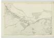
Ross-shire & Cromartyshire (Mainland), Sheet XXVII - OS 6 Inch map
1 : 10560 Topographic maps Ordnance Survey Ordnance Survey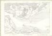
Ross and Cromarty Sheet XXVIII - OS 6 Inch map
1 : 10560 Topographic maps Ordnance Survey Ordnance Survey
Ross-shire & Cromartyshire (Mainland), Sheet XVIIIA - OS 6 Inch map
1 : 10560 Topographic maps Ordnance Survey Ordnance Survey
Ross-shire & Cromartyshire (Mainland), Sheet XI - OS 6 Inch map
1 : 10560 Topographic maps Ordnance Survey Ordnance Survey
Sutherland, Sheet C - OS 6 Inch map
1 : 10560 Topographic maps Ordnance Survey Ordnance Survey
Sutherland, Sheet XCII - OS 6 Inch map
1 : 10560 Topographic maps Ordnance Survey Ordnance Survey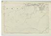
Ross-shire & Cromartyshire (Mainland), Sheet XXVI - OS 6 Inch map
1 : 10560 Topographic maps Ordnance Survey Ordnance Survey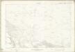
Ross and Cromarty Sheet XVIIIa - OS 6 Inch map
1 : 10560 Topographic maps Ordnance Survey Ordnance Survey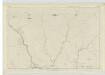
Sutherland, Sheet LXXXVIII - OS 6 Inch map
1 : 10560 Topographic maps Ordnance Survey Ordnance Survey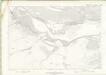
Ross and Cromarty Sheet XXVII - OS 6 Inch map
1 : 10560 Topographic maps Ordnance Survey Ordnance Survey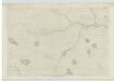
Sutherland, Sheet LXXXVII - OS 6 Inch map
1 : 10560 Topographic maps Ordnance Survey Ordnance Survey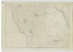
Sutherland, Sheet LXXXIII - OS 6 Inch map
1 : 10560 Topographic maps Ordnance Survey Ordnance Survey