Maps of Highland
Ross-shire & Cromartyshire (Mainland), Sheet XVIIIA - OS 6 Inch map
1 : 10560 Topographic maps Ordnance Survey Ordnance Survey
Ross and Cromarty Sheet XVIIIa - OS 6 Inch map
1 : 10560 Topographic maps Ordnance Survey Ordnance Survey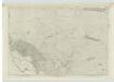
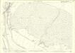
Sutherland, Sheet CVIII - OS 6 Inch map
1 : 10560 Topographic maps Ordnance Survey Ordnance Survey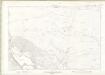
Sutherland Sheet CVIII - OS 6 Inch map
1 : 10560 Topographic maps Ordnance Survey Ordnance Survey
Ross and Cromarty, Ross-shire Sheet XVIIIa.9 - OS 25 Inch map
1 : 2500 Topographic maps Ordnance Survey Ordnance Survey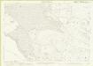
Ross-shire, Sheet 018a.09 - 25 Inch Map
1 : 2500 Topographic maps Ordnance Survey Ordnance Survey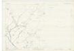
Sutherland, Sheet CVIII.15 (Combined) - OS 25 Inch map
1 : 2500 Topographic maps Ordnance Survey Ordnance Survey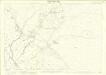
Sutherland, Sheet 108.15 - 25 Inch Map
1 : 2500 Topographic maps Ordnance Survey Ordnance Survey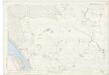
Sutherland, Sheet CVIII.14 (Combined) - OS 25 Inch map
1 : 2500 Topographic maps Ordnance Survey Ordnance Survey
Sutherland, Sheet 108.14 - 25 Inch Map
1 : 2500 Topographic maps Ordnance Survey Ordnance Survey
Sutherland, Sheet 108.10 - 25 Inch Map
1 : 2500 Topographic maps Ordnance Survey Ordnance Survey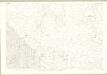
Sutherland, Sheet CVIII.10 - OS 25 Inch map
1 : 2500 Topographic maps Ordnance Survey Ordnance Survey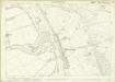
Ross-shire, Sheet 018a.13 - 25 Inch Map
1 : 2500 Topographic maps Ordnance Survey Ordnance Survey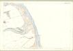
Ross and Cromarty, Ross-shire Sheet XVIIIa.13 - OS 25 Inch map
1 : 2500 Topographic maps Ordnance Survey Ordnance Survey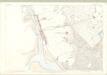
Sutherland, Sheet CXI.2 - OS 25 Inch map
1 : 2500 Topographic maps Ordnance Survey Ordnance Survey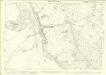
Sutherland, Sheet 111.02 - 25 Inch Map
1 : 2500 Topographic maps Ordnance Survey Ordnance Survey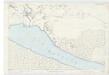
Sutherland, Sheet CXI.3 (Combined) - OS 25 Inch map
1 : 2500 Topographic maps Ordnance Survey Ordnance Survey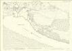
Sutherland, Sheet 111.03 - 25 Inch Map
1 : 2500 Topographic maps Ordnance Survey Ordnance Survey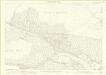
Sutherland, Sheet 111.04 - 25 Inch Map
1 : 2500 Topographic maps Ordnance Survey Ordnance Survey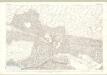
Sutherland, Sheet CXI.4 - OS 25 Inch map
1 : 2500 Topographic maps Ordnance Survey Ordnance Survey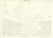
Sutherland, Sheet 112.01 - 25 Inch Map
1 : 2500 Topographic maps Ordnance Survey Ordnance Survey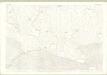
Sutherland, Sheet CXII.1 - OS 25 Inch map
1 : 2500 Topographic maps Ordnance Survey Ordnance Survey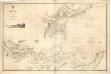
The Firth of Dornoch
Great Britain. Hydrographic Office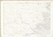
Sutherland Sheet CIX - OS 6 Inch map
1 : 10560 Topographic maps Ordnance Survey Ordnance Survey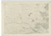
Sutherland, Sheet CIX - OS 6 Inch map
1 : 10560 Topographic maps Ordnance Survey Ordnance Survey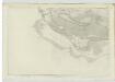
Sutherland, Sheet CXI - OS 6 Inch map
1 : 10560 Topographic maps Ordnance Survey Ordnance Survey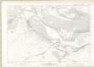
Sutherland Sheet CXI - OS 6 Inch map
1 : 10560 Topographic maps Ordnance Survey Ordnance Survey
Sutherland, Sheet 108.05 - 25 Inch Map
1 : 2500 Topographic maps Ordnance Survey Ordnance Survey
Sutherland, Sheet CVIII.5 - OS 25 Inch map
1 : 2500 Topographic maps Ordnance Survey Ordnance Survey