Maps of Fort William

Oban, Fort William - Bartholomew's 'Survey Atlas of Scotland'
1 : 126720 Topographic maps John Bartholomew & Son, Ltd John Bartholomew & Son, Ltd
The sound of Mull.
Mackenzie, Murdoch (Senior), 1712-1797
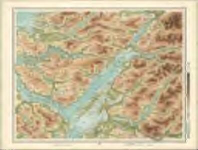
Loch Linnhe - OS One-Inch Map
1 : 63360 Topographic maps Ordnance Survey Ordnance Survey
Tobermory - OS One-Inch map
1 : 63360 Topographic maps Ordnance Survey Ordnance Survey
Tobermory - OS One-Inch map
1 : 63360 Topographic maps Ordnance Survey Ordnance Survey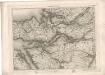
Tobermory - OS One-Inch map
1 : 63360 Topographic maps Ordnance Survey Ordnance Survey
Loch Etive & Glen Coe (54) - OS One-Inch map
1 : 63360 Topographic maps Ordnance Survey Ordnance Survey
Loch Etive & Glen Coe (54) - OS One-Inch map
1 : 63360 Topographic maps Ordnance Survey Ordnance Survey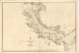
Sound of Mull
Great Britain. Hydrographic Office
Ben Nevis - OS One-Inch map
1 : 63360 Topographic maps Ordnance Survey Ordnance Survey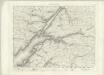
Ben Nevis - OS One-Inch map
1 : 63360 Topographic maps Ordnance Survey Ordnance Survey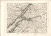
Ben Nevis - OS One-Inch map
1 : 63360 Topographic maps Ordnance Survey Ordnance Survey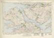
Sound of Mull (53) - OS One-Inch map
1 : 63360 Topographic maps Ordnance Survey Ordnance Survey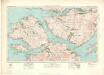
Sound of Mull (53) - OS One-Inch map
1 : 63360 Topographic maps Ordnance Survey Ordnance Survey
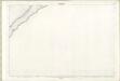
Loch Linnhe, Southern Part
Great Britain. Hydrographic Office
Lochs Etive and Creran
Great Britain. Hydrographic Office
Loch Eil, leading to the Caledonian Canal
Great Britain. Hydrographic Office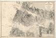
Loch Moidart
Great Britain. Hydrographic Office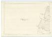
Inverness-shire (Mainland), Sheet CXLVII (Inset CLVI) - OS 6 Inch map
1 : 10560 Topographic maps Ordnance Survey Ordnance Survey
Inverness-shire (Mainland), Sheet CXLIXA - OS 6 Inch map
1 : 10560 Topographic maps Ordnance Survey Ordnance Survey
Inverness-shire (Mainland), Sheet CLVIII - OS 6 Inch map
1 : 10560 Topographic maps Ordnance Survey Ordnance Survey
Inverness-shire - Mainland Sheet CXLVII (with inset CLVI) - OS 6 Inch map
1 : 10560 Topographic maps Ordnance Survey Ordnance Survey
Inverness-shire - Mainland Sheet CXLVIII - OS 6 Inch map
1 : 10560 Topographic maps Ordnance Survey Ordnance Survey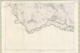
Inverness-shire - Mainland Sheet CLVII - OS 6 Inch map
1 : 10560 Topographic maps Ordnance Survey Ordnance Survey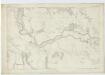
Inverness-shire (Mainland), Sheet CLVII - OS 6 Inch map
1 : 10560 Topographic maps Ordnance Survey Ordnance Survey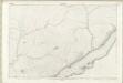
Inverness-shire - Mainland Sheet CXLIX (with inset CXLIXa) - OS 6 Inch map
1 : 10560 Topographic maps Ordnance Survey Ordnance Survey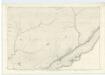
Inverness-shire (Mainland), Sheet CXLIX - OS 6 Inch map
1 : 10560 Topographic maps Ordnance Survey Ordnance Survey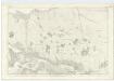
Inverness-shire (Mainland), Sheet CXLVIII - OS 6 Inch map
1 : 10560 Topographic maps Ordnance Survey Ordnance Survey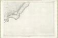
Inverness-shire - Mainland Sheet CLVIII - OS 6 Inch map
1 : 10560 Topographic maps Ordnance Survey Ordnance Survey