Maps of Norwich
Norfolk LXIII.11 (includes: Norwich; Thorpe Next Norwich) - 25 Inch Map
1 : 2500 Topographic maps Ordnance Survey Ordnance Survey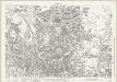
Norfolk LXIII.11 (includes: Norwich; Thorpe Next Norwich) - 25 Inch Map
1 : 2500 Topographic maps Ordnance Survey Ordnance Survey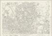
Norfolk LXIII.11 (includes: Norwich; Thorpe Next Norwich) - 25 Inch Map
1 : 2500 Topographic maps Ordnance Survey Ordnance Survey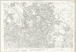
Norfolk LXIII.11 (includes: Norwich; Thorpe Next Norwich) - 25 Inch Map
1 : 2500 Topographic maps Ordnance Survey Ordnance Survey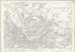
Norfolk LXIII.11 (includes: Norwich; Thorpe Next Norwich) - 25 Inch Map
1 : 2500 Topographic maps Ordnance Survey Ordnance Survey
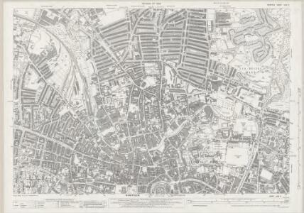
Insurance Plan of Norwich: Key Plan
1 : 2400 This "key plan" indicates coverage of the Goad 1894 series of fire insurance maps of Norwich that were originally produced to aid insurance companies in assessing fire risks. The building footprints, their use (commercial, residential, educational, etc.), the number of floors and the height of the building, as well as construction materials (and thus risk of burning) and special fire hazards (chemicals, kilns, ovens) were documented in order to estimate premiums. Names of individual businesses, property lines, and addresses were also often recorded. Together these maps provide a rich historical shapshot of the commercial activity and urban landscape of towns and cities at the time. The British Library holds a comprehensive collection of fire insurance plans produced by the London-based firm Charles E. Goad Ltd. dating back to 1885. These plans were made for most important towns and cities of the British Isles at the scales of 1:480 (1 inch to 40 feet), as well as many foreign towns at 1:600 (1 inch to 50 feet). Chas E Goad Limited Chas E Goad Limited
Insurance Plan of Norwich: sheet 3
1 : 480 This detailed 1894 plan of Norwich is one of a series of seven sheets in an atlas originally produced to aid insurance companies in assessing fire risks. The building footprints, their use (commercial, residential, educational, etc.), the number of floors and the height of the building, as well as construction materials (and thus risk of burning) and special fire hazards (chemicals, kilns, ovens) were documented in order to estimate premiums. Names of individual businesses, property lines, and addresses were also often recorded. Together these maps provide a rich historical shapshot of the commercial activity and urban landscape of towns and cities at the time. The British Library holds a comprehensive collection of fire insurance plans produced by the London-based firm Charles E. Goad Ltd. dating back to 1885. These plans were made for most important towns and cities of the British Isles at the scales of 1:480 (1 inch to 40 feet), as well as many foreign towns at 1:600 (1 inch to 50 feet). Chas E Goad Limited Chas E Goad Limited
Insurance Plan of Norwich: sheet 4
1 : 480 This detailed 1894 plan of Norwich is one of a series of seven sheets in an atlas originally produced to aid insurance companies in assessing fire risks. The building footprints, their use (commercial, residential, educational, etc.), the number of floors and the height of the building, as well as construction materials (and thus risk of burning) and special fire hazards (chemicals, kilns, ovens) were documented in order to estimate premiums. Names of individual businesses, property lines, and addresses were also often recorded. Together these maps provide a rich historical shapshot of the commercial activity and urban landscape of towns and cities at the time. The British Library holds a comprehensive collection of fire insurance plans produced by the London-based firm Charles E. Goad Ltd. dating back to 1885. These plans were made for most important towns and cities of the British Isles at the scales of 1:480 (1 inch to 40 feet), as well as many foreign towns at 1:600 (1 inch to 50 feet). Chas E Goad Limited Chas E Goad Limited
Insurance Plan of Norwich: sheet 5-1
1 : 480 This detailed 1894 plan of Norwich is one of a series of seven sheets in an atlas originally produced to aid insurance companies in assessing fire risks. The building footprints, their use (commercial, residential, educational, etc.), the number of floors and the height of the building, as well as construction materials (and thus risk of burning) and special fire hazards (chemicals, kilns, ovens) were documented in order to estimate premiums. Names of individual businesses, property lines, and addresses were also often recorded. Together these maps provide a rich historical shapshot of the commercial activity and urban landscape of towns and cities at the time. The British Library holds a comprehensive collection of fire insurance plans produced by the London-based firm Charles E. Goad Ltd. dating back to 1885. These plans were made for most important towns and cities of the British Isles at the scales of 1:480 (1 inch to 40 feet), as well as many foreign towns at 1:600 (1 inch to 50 feet). Chas E Goad Limited Chas E Goad Limited
Insurance Plan of Norwich: sheet 5-2
1 : 480 This detailed 1894 plan of Norwich is one of a series of seven sheets in an atlas originally produced to aid insurance companies in assessing fire risks. The building footprints, their use (commercial, residential, educational, etc.), the number of floors and the height of the building, as well as construction materials (and thus risk of burning) and special fire hazards (chemicals, kilns, ovens) were documented in order to estimate premiums. Names of individual businesses, property lines, and addresses were also often recorded. Together these maps provide a rich historical shapshot of the commercial activity and urban landscape of towns and cities at the time. The British Library holds a comprehensive collection of fire insurance plans produced by the London-based firm Charles E. Goad Ltd. dating back to 1885. These plans were made for most important towns and cities of the British Isles at the scales of 1:480 (1 inch to 40 feet), as well as many foreign towns at 1:600 (1 inch to 50 feet). Chas E Goad Limited Chas E Goad Limited
Insurance Plan of Norwich: sheet 7
1 : 480 This detailed 1894 plan of Norwich is one of a series of seven sheets in an atlas originally produced to aid insurance companies in assessing fire risks. The building footprints, their use (commercial, residential, educational, etc.), the number of floors and the height of the building, as well as construction materials (and thus risk of burning) and special fire hazards (chemicals, kilns, ovens) were documented in order to estimate premiums. Names of individual businesses, property lines, and addresses were also often recorded. Together these maps provide a rich historical shapshot of the commercial activity and urban landscape of towns and cities at the time. The British Library holds a comprehensive collection of fire insurance plans produced by the London-based firm Charles E. Goad Ltd. dating back to 1885. These plans were made for most important towns and cities of the British Isles at the scales of 1:480 (1 inch to 40 feet), as well as many foreign towns at 1:600 (1 inch to 50 feet). Chas E Goad Limited Chas E Goad Limited
Insurance Plan of Norwich: sheet 6
1 : 480 This detailed 1894 plan of Norwich is one of a series of seven sheets in an atlas originally produced to aid insurance companies in assessing fire risks. The building footprints, their use (commercial, residential, educational, etc.), the number of floors and the height of the building, as well as construction materials (and thus risk of burning) and special fire hazards (chemicals, kilns, ovens) were documented in order to estimate premiums. Names of individual businesses, property lines, and addresses were also often recorded. Together these maps provide a rich historical shapshot of the commercial activity and urban landscape of towns and cities at the time. The British Library holds a comprehensive collection of fire insurance plans produced by the London-based firm Charles E. Goad Ltd. dating back to 1885. These plans were made for most important towns and cities of the British Isles at the scales of 1:480 (1 inch to 40 feet), as well as many foreign towns at 1:600 (1 inch to 50 feet). Chas E Goad Limited Chas E Goad Limited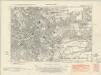
Norfolk LXIII.SE - OS Six-Inch Map
1 : 10560 Topographic maps Ordnance Survey Ordnance Survey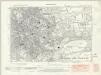
Norfolk LXIII.SE - OS Six-Inch Map
1 : 10560 Topographic maps Ordnance Survey Ordnance Survey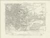
Norfolk LXIII.SE - OS Six-Inch Map
1 : 10560 Topographic maps Ordnance Survey Ordnance Survey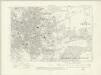
Norfolk LXIII.SE - OS Six-Inch Map
1 : 10560 Topographic maps Ordnance Survey Ordnance Survey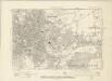
Norfolk LXIII.SE - OS Six-Inch Map
1 : 10560 Topographic maps Ordnance Survey Ordnance Survey
Norfolk LXIII.SE - OS Six-Inch Map
1 : 10560 Topographic maps Ordnance Survey Ordnance Survey
Insurance Plan of Norwich: sheet 8
1 : 480 This detailed 1894 plan of Norwich is one of a series of seven sheets in an atlas originally produced to aid insurance companies in assessing fire risks. The building footprints, their use (commercial, residential, educational, etc.), the number of floors and the height of the building, as well as construction materials (and thus risk of burning) and special fire hazards (chemicals, kilns, ovens) were documented in order to estimate premiums. Names of individual businesses, property lines, and addresses were also often recorded. Together these maps provide a rich historical shapshot of the commercial activity and urban landscape of towns and cities at the time. The British Library holds a comprehensive collection of fire insurance plans produced by the London-based firm Charles E. Goad Ltd. dating back to 1885. These plans were made for most important towns and cities of the British Isles at the scales of 1:480 (1 inch to 40 feet), as well as many foreign towns at 1:600 (1 inch to 50 feet). Chas E Goad Limited Chas E Goad Limited
TG20 - OS 1:25,000 Provisional Series Map
1 : 25000 Topographic maps Ordnance Survey Ordnance Survey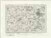
Norwich (Outline) - OS One-Inch Revised New Series
1 : 63360 Topographic maps Ordnance Survey Ordnance Survey
Norwich (Hills) - OS One-Inch Revised New Series
1 : 63360 Topographic maps Ordnance Survey Ordnance Survey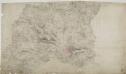
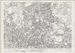
Norwich 23
1 : 31680 This plan covers part of Norfolk with the county town of Norwich,depicted at lower right., Built,on a hill, Norwich was of strategic importance to the invading Saxons, Romans and Normans.,,Light pencil interlining ('hachuring') is employed to represent the slight undulation,and the low hills of this part of East Anglia., The landscape is characterised by fertile farmland with a few woodland areas and wild heaths. Budgen, Charles
Norwich - OS One-Inch Map
1 : 63360 Topographic maps Ordnance Survey Ordnance Survey
A Coloured Chart of the Coast of Suffolk, from Orwell Haven to Gorlston, near Yarmouth
This is a map of the Suffolk coast stretching from Orwell Haven to Godeston near Yarmouth. It details the defences of the area may be part of the coastal survey of 1539. Fortification of large sections of coast was carried out at this time as Henry VIII feared an invasion from the combined forces of France and Spain. In 1538 Francis I of France, and Charles V Holy Roman Emperor and King of Spain signed a peace treaty. This union gave rise to the possibility that France and Spain may combine forces to invade England. France was England’s historical enemy and Henry VIII’s divorce of Catherine of Aragon, Charles V’s aunt, had offended the militantly catholic King of Spain. The map includes a vignette view of Ipswich, and a depiction of Orford Castle, built by Henry II in the 1160’s to guard what was then a busy port. Here a beacon is shown on the battlements, indicating that the castle, built on raised grown, has been incorporated into the early warning system that is depicted along the coast by numerous beacons. Two round tower forts are shown with gun ports and extended cannons. Such a large scale fortification plan was greatly aided by the significant advances in cartography and surveying which occurred in the Tudor period. The vast wealth Henry VIII had at his disposal after the dissolution of the monasteries provided the necessary finances for the survey.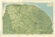
Norfolk, Sheet 15 - Bartholomew's "Half Inch to the Mile Maps" of England & Wales
1 : 126720 Topographic maps Bartholomew, John George John Bartholomew & Co
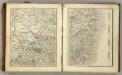
Suffolcia vernacula Suffolke
1 Karte : Kupferdruck ; 36 x 47 cm Valck; Schenk penes Gerardum Valk et Petrum Schenk
Svffolcia, vernacule Svffolke
1 Karte : Kupferdruck ; 37 x 48 cm Blaeu Joan Blaeu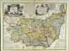
An accurate map of the county of Suffolk
1 Karte : Kupferdruck ; 50 x 69 cm Bowen; Hinton sold by I. Hinton at the Kings Arms in St. Pauls Church Yard