Maps of Cherwell
Oxfordshire XXII.16 (includes: Chesterton; Wendlebury; Weston on the Green) - 25 Inch Map
1 : 2500 Topographic maps Ordnance Survey Ordnance Survey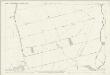
Oxfordshire XXII.16 (includes: Chesterton; Wendlebury; Weston on the Green) - 25 Inch Map
1 : 2500 Topographic maps Ordnance Survey Ordnance Survey
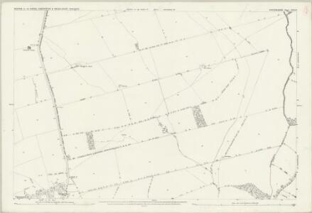
Oxfordshire XXII.SE - OS Six-Inch Map
1 : 10560 Topographic maps Ordnance Survey Ordnance Survey
Oxfordshire XXII.SE - OS Six-Inch Map
1 : 10560 Topographic maps Ordnance Survey Ordnance Survey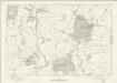
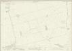
Oxfordshire XXII - OS Six-Inch Map
1 : 10560 Topographic maps Ordnance Survey Ordnance Survey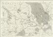
Oxfordshire XXII - OS Six-Inch Map
1 : 10560 Topographic maps Ordnance Survey Ordnance Survey
Ot Moor
1 : 31680 .The county border between Oxfordshire and Buckinghamshire is indicated on this map by a red dotted line near the left margin., Ot Moor, an area of some 4,000 acres of fenland, appears at the centre of the drawing., Depicted around the moor are the remains of ancient woodlands: Prattle Woods, Horton Spinney, Studley Wood and Whitecross Green Wood. Stanley, William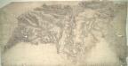
Bicester
1 : 31680 Enclosed farmland dominates the landscape of this part of Oxfordshire. Heythrop Park, at top left, and Middleton Park and Kirtlington Park, in the centre, are fine examples of 17th-century formal park landscapes. Stanley, William
Buckingham - OS One-Inch Map
1 : 63360 Topographic maps Ordnance Survey Ordnance Survey
Banbury - OS One-Inch Map
1 : 63360 Topographic maps Ordnance Survey Ordnance Survey
A new improved map of Oxfordshire
1 Karte : Kupferdruck ; 69 x 51 cm Kitchin; Hinton sold by J. Hinton at the Kings Arms in St. Pauls Church Yard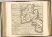

Oxford, Sheet 24 - Bartholomew's "Half Inch to the Mile Maps" of England & Wales
1 : 126720 Topographic maps Bartholomew, John George John Bartholomew & Co
England & Wales [Bartholomew's "Half-inch to the mile" Map of]
J. Bartholomew
Oxonium comitatus vulgo Oxford Shire
1 Karte : Kupferdruck ; 36 x 47 cm Valck; Schenk apud Gerardum Valk et Petrum Schenk
Oxonivm comitatus, vulgo Oxford Shire
1 Karte : Kupferdruck ; 37 x 42 cm Blaeu Joan Blaeu
Oxonium Comitatus vulgo Oxford Shire
1 : 220000 [Amstelodami] : [apud Joannem Janssonium]
OXONIVM | Comitatus, Vulgo | OXFORD SHIRE.
Ioh. Blaeu excud.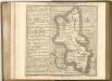

Bercheria Vernacule Bark Shire. [Karte], in: Theatrum orbis terrarum, sive, Atlas novus, Bd. 4, S. 186.
1 Karte aus Atlas Blaeu, Joan Blaeu, Willem Janszoon
Bercheria Vernacule Barkshire. [Karte], in: Le théâtre du monde, ou, Nouvel atlas contenant les chartes et descriptions de tous les païs de la terre, Bd. 4, S. 164.
1 Karte aus Atlas Blaeu, Willem Janszoon und Blaeu, Joan Blaeu, Willem Janszoon
Bercheria Vernacule Bark Shire. [Karte], in: Theatrum orbis terrarum, sive, Atlas novus, Bd. 4, S. 186.
1 Karte aus Atlas Blaeu, Joan Blaeu, Willem Janszoon
Buckinghamiensis Comitatus; Anglis Buckingham Shire. [Karte], in: Theatrum orbis terrarum, sive, Atlas novus, Bd. 4, S. 247.
1 Karte aus Atlas Blaeu, Joan Blaeu, Willem Janszoon
Buckinghamiensis Comitatus; Anglis Buckingham Shire. [Karte], in: Le théâtre du monde, ou, Nouvel atlas contenant les chartes et descriptions de tous les païs de la terre, Bd. 4, S. 219.
1 Karte aus Atlas Blaeu, Willem Janszoon und Blaeu, Joan Blaeu, Willem Janszoon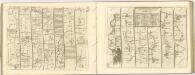

Buckinghamiensis Comitatus; Anglis Buckingham Shire. [Karte], in: Theatrum orbis terrarum, sive, Atlas novus, Bd. 4, S. 247.
1 Karte aus Atlas Blaeu, Joan Blaeu, Willem Janszoon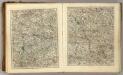
Sheets 23-24. (Cary's England, Wales, and Scotland).
1 : 360000 Cary, John, ca. 1754-1835
Oxonium Comitatus, Vulgo Oxford Shire. [Karte], in: Theatrum orbis terrarum, sive, Atlas novus, Bd. 4, S. 237.
1 Karte aus Atlas Blaeu, Joan Blaeu, Willem Janszoon
Oxonium Comitatus Vulgo Oxford Shire. [Karte], in: Novus atlas absolutissimus, Bd. 7, S. 230.
1 Karte aus Atlas Janssonius Offizin