Maps of Rousham
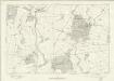
Oxfordshire XXII - OS Six-Inch Map
1 : 10560 Topographic maps Ordnance Survey Ordnance Survey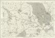
Oxfordshire XXII - OS Six-Inch Map
1 : 10560 Topographic maps Ordnance Survey Ordnance Survey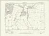
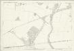
Oxfordshire XXII.NW - OS Six-Inch Map
1 : 10560 Topographic maps Ordnance Survey Ordnance Survey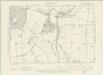
Oxfordshire XXII.NW - OS Six-Inch Map
1 : 10560 Topographic maps Ordnance Survey Ordnance Survey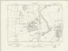
Oxfordshire XXII.SW - OS Six-Inch Map
1 : 10560 Topographic maps Ordnance Survey Ordnance Survey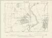
Oxfordshire XXII.SW - OS Six-Inch Map
1 : 10560 Topographic maps Ordnance Survey Ordnance Survey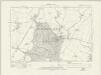
Oxfordshire XXII.NE - OS Six-Inch Map
1 : 10560 Topographic maps Ordnance Survey Ordnance Survey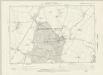
Oxfordshire XXII.NE - OS Six-Inch Map
1 : 10560 Topographic maps Ordnance Survey Ordnance Survey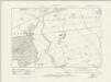
Oxfordshire XXII.SE - OS Six-Inch Map
1 : 10560 Topographic maps Ordnance Survey Ordnance Survey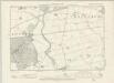
Oxfordshire XXII.SE - OS Six-Inch Map
1 : 10560 Topographic maps Ordnance Survey Ordnance Survey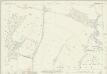
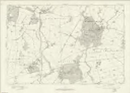
Oxfordshire XXII.1 (includes: Lower Heyford; Rousham; Steeple Aston; Steeple Barton) - 25 Inch Map
1 : 2500 Topographic maps Ordnance Survey Ordnance Survey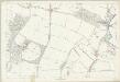
Oxfordshire XXII.1 (includes: Lower Heyford; Rousham; Steeple Aston; Steeple Barton) - 25 Inch Map
1 : 2500 Topographic maps Ordnance Survey Ordnance Survey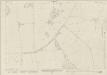
Oxfordshire XXII.5 (includes: Rousham; Steeple Barton; Tackley; Wootton) - 25 Inch Map
1 : 2500 Topographic maps Ordnance Survey Ordnance Survey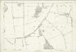
Oxfordshire XXII.5 (includes: Rousham; Steeple Barton; Tackley; Wootton) - 25 Inch Map
1 : 2500 Topographic maps Ordnance Survey Ordnance Survey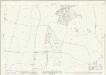
Oxfordshire XXII.9 (includes: Tackley; Wootton) - 25 Inch Map
1 : 2500 Topographic maps Ordnance Survey Ordnance Survey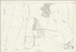
Oxfordshire XXII.9 (includes: Tackley; Wootton) - 25 Inch Map
1 : 2500 Topographic maps Ordnance Survey Ordnance Survey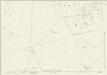
Oxfordshire XXII.13 (includes: Tackley; Wootton) - 25 Inch Map
1 : 2500 Topographic maps Ordnance Survey Ordnance Survey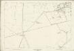
Oxfordshire XXII.13 (includes: Tackley; Wootton) - 25 Inch Map
1 : 2500 Topographic maps Ordnance Survey Ordnance Survey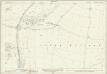
Oxfordshire XXII.2 (includes: Lower Heyford; Rousham; Steeple Aston; Upper Heyford) - 25 Inch Map
1 : 2500 Topographic maps Ordnance Survey Ordnance Survey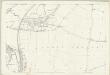
Oxfordshire XXII.2 (includes: Lower Heyford; Rousham; Steeple Aston; Upper Heyford) - 25 Inch Map
1 : 2500 Topographic maps Ordnance Survey Ordnance Survey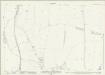
Oxfordshire XXII.6 (includes: Kirtlington; Lower Heyford; Rousham; Tackley) - 25 Inch Map
1 : 2500 Topographic maps Ordnance Survey Ordnance Survey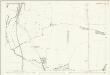
Oxfordshire XXII.6 (includes: Kirtlington; Lower Heyford; Rousham; Tackley) - 25 Inch Map
1 : 2500 Topographic maps Ordnance Survey Ordnance Survey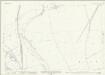
Oxfordshire XXII.10 (includes: Kirtlington; Tackley) - 25 Inch Map
1 : 2500 Topographic maps Ordnance Survey Ordnance Survey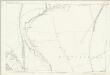
Oxfordshire XXII.10 (includes: Kirtlington; Tackley) - 25 Inch Map
1 : 2500 Topographic maps Ordnance Survey Ordnance Survey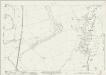
Oxfordshire XXII.14 (includes: Kirtlington; Tackley) - 25 Inch Map
1 : 2500 Topographic maps Ordnance Survey Ordnance Survey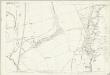
Oxfordshire XXII.14 (includes: Kirtlington; Tackley) - 25 Inch Map
1 : 2500 Topographic maps Ordnance Survey Ordnance Survey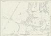
Oxfordshire XXII.7 (includes: Chesterton; Kirtlington; Lower Heyford; Middleton Stoney) - 25 Inch Map
1 : 2500 Topographic maps Ordnance Survey Ordnance Survey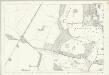
Oxfordshire XXII.7 (includes: Chesterton; Kirtlington; Lower Heyford; Middleton Stoney) - 25 Inch Map
1 : 2500 Topographic maps Ordnance Survey Ordnance Survey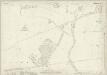
Oxfordshire XXII.11 (includes: Chesterton; Kirtlington; Weston on the Green) - 25 Inch Map
1 : 2500 Topographic maps Ordnance Survey Ordnance Survey