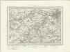
Maps of Northumberland
Northumberland XCV.SE - OS Six-Inch Map
1 : 10560 Topographic maps Ordnance Survey Ordnance Survey
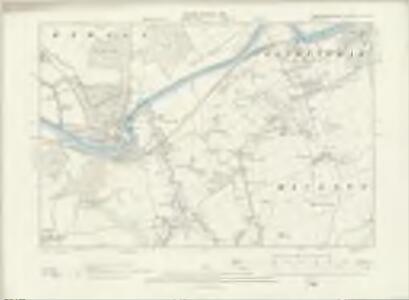
Northumberland (New Series) CI.4 (includes: Broomley And Stocksfield; Bywell; Eltringham; Mickley) - 25 Inch Map
1 : 2500 Topographic maps Ordnance Survey Ordnance Survey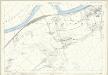
Northumberland (Old Series) XCV.12 (includes: Bearl; Broomley And Stocksfield; Bywell; Eltringham; Mickley; Ovington) - 25 Inch Map
1 : 2500 Topographic maps Ordnance Survey Ordnance Survey
Northumberland (Old Series) XCV.16 (includes: Broomley And Stocksfield; Hedley; Mickley) - 25 Inch Map
1 : 2500 Topographic maps Ordnance Survey Ordnance Survey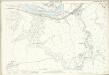
Northumberland (Old Series) XCV.15 (includes: Broomhaugh; Broomley And Stocksfield; Bywell) - 25 Inch Map
1 : 2500 Topographic maps Ordnance Survey Ordnance Survey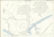
Northumberland (Old Series) XCV.11 (includes: Bearl; Broomhaugh; Broomley And Stocksfield; Bywell) - 25 Inch Map
1 : 2500 Topographic maps Ordnance Survey Ordnance Survey
Northumberland (New Series) CII.1 (includes: Broomley And Stocksfield; Eltringham; Mickley; Prudhoe) - 25 Inch Map
1 : 2500 Topographic maps Ordnance Survey Ordnance Survey
Northumberland (New Series) CII.1 (includes: Broomley And Stocksfield; Eltringham; Mickley; Prudhoe) - 25 Inch Map
1 : 2500 Topographic maps Ordnance Survey Ordnance Survey
Northumberland (New Series) CI.8 (includes: Broomley And Stocksfield; Hedley; Mickley) - 25 Inch Map
1 : 2500 Topographic maps Ordnance Survey Ordnance Survey
Northumberland XCV - OS Six-Inch Map
1 : 10560 Topographic maps Ordnance Survey Ordnance Survey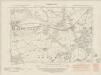
Northumberland nCI.NE - OS Six-Inch Map
1 : 10560 Topographic maps Ordnance Survey Ordnance Survey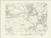
Northumberland nCI.NE - OS Six-Inch Map
1 : 10560 Topographic maps Ordnance Survey Ordnance Survey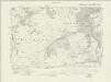
Durham V.NW - OS Six-Inch Map
1 : 10560 Topographic maps Ordnance Survey Ordnance Survey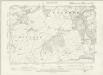
Durham V.NW - OS Six-Inch Map
1 : 10560 Topographic maps Ordnance Survey Ordnance Survey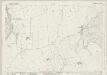
Northumberland (New Series) CII.5 (includes: Broomley And Stocksfield; Hedley; Mickley; Prudhoe) - 25 Inch Map
1 : 2500 Topographic maps Ordnance Survey Ordnance Survey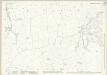
Northumberland (New Series) CII.5 (includes: Broomley And Stocksfield; Hedley; Mickley; Prudhoe) - 25 Inch Map
1 : 2500 Topographic maps Ordnance Survey Ordnance Survey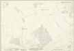
Northumberland (New Series) XCII.16 (includes: Bearl; Bywell; Eltringham; Newton Hall; Ovington) - 25 Inch Map
1 : 2500 Topographic maps Ordnance Survey Ordnance Survey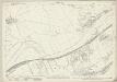
Northumberland (New Series) XCIII.13 (includes: Bearl; Bywell; Eltringham; Mickley; Ovingham; Ovington; Prudhoe Castle; Prudhoe) - 25 Inch Map
1 : 2500 Topographic maps Ordnance Survey Ordnance Survey
NZ06 - OS 1:25,000 Provisional Series Map
1 : 25000 Topographic maps Ordnance Survey Ordnance Survey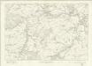
Northumberland nCI - OS Six-Inch Map
1 : 10560 Topographic maps Ordnance Survey Ordnance Survey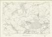
Durham V - OS Six-Inch Map
1 : 10560 Topographic maps Ordnance Survey Ordnance Survey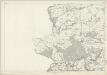
Durham V - OS Six-Inch Map
1 : 10560 Topographic maps Ordnance Survey Ordnance Survey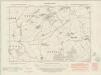
Northumberland nXCII.SE - OS Six-Inch Map
1 : 10560 Topographic maps Ordnance Survey Ordnance Survey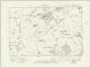
Northumberland nXCII.SE - OS Six-Inch Map
1 : 10560 Topographic maps Ordnance Survey Ordnance Survey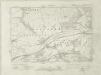
Durham I.SW - OS Six-Inch Map
1 : 10560 Topographic maps Ordnance Survey Ordnance Survey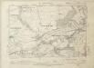
Durham I.SW - OS Six-Inch Map
1 : 10560 Topographic maps Ordnance Survey Ordnance Survey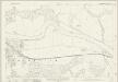
Northumberland (New Series) CI.3 (includes: Broomhaugh; Broomley And Stocksfield; Bywell; Riding; Styford) - 25 Inch Map
1 : 2500 Topographic maps Ordnance Survey Ordnance Survey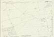
Northumberland (New Series) CI.7 (includes: Broomhaugh; Broomley And Stocksfield; Healey) - 25 Inch Map
1 : 2500 Topographic maps Ordnance Survey Ordnance Survey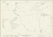
Northumberland (New Series) XCII.15 (includes: Bywell; Newton Hall; Newton; Styford) - 25 Inch Map
1 : 2500 Topographic maps Ordnance Survey Ordnance Survey
Newcastle upon Tyne (Hills) - OS One-Inch Revised New Series
1 : 63360 Topographic maps Ordnance Survey Ordnance Survey