Maps of Northumberland
Northumberland nXCII.SE - OS Six-Inch Map
1 : 10560 Topographic maps Ordnance Survey Ordnance Survey
Northumberland nXCII.SE - OS Six-Inch Map
1 : 10560 Topographic maps Ordnance Survey Ordnance Survey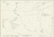
Northumberland (New Series) XCII.15 (includes: Bywell; Newton Hall; Newton; Styford) - 25 Inch Map
1 : 2500 Topographic maps Ordnance Survey Ordnance Survey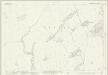
Northumberland (New Series) XCII.11 (includes: Newton Hall; Newton; Styford; Thornbrough) - 25 Inch Map
1 : 2500 Topographic maps Ordnance Survey Ordnance Survey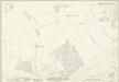
Northumberland (New Series) XCII.16 (includes: Bearl; Bywell; Eltringham; Newton Hall; Ovington) - 25 Inch Map
1 : 2500 Topographic maps Ordnance Survey Ordnance Survey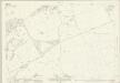
Northumberland (New Series) XCII.12 (includes: Bearl; Bywell; Nafferton; Newton Hall; Ovington; Stelling) - 25 Inch Map
1 : 2500 Topographic maps Ordnance Survey Ordnance Survey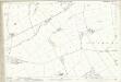
Northumberland (Old Series) XCV.7 (includes: Bearl; Bywell; Newton Hall; Newton; Ovington; Stelling) - 25 Inch Map
1 : 2500 Topographic maps Ordnance Survey Ordnance Survey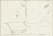
Northumberland (Old Series) XCV.6 (includes: Bywell; Newton Hall; Newton; Styford; Thornbrough) - 25 Inch Map
1 : 2500 Topographic maps Ordnance Survey Ordnance Survey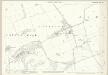
Northumberland (Old Series) XCV.3 (includes: Bearl; Bywell; Nafferton; Newton Hall; Newton; Ovington; Stelling) - 25 Inch Map
1 : 2500 Topographic maps Ordnance Survey Ordnance Survey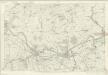
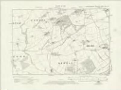
Northumberland XCV - OS Six-Inch Map
1 : 10560 Topographic maps Ordnance Survey Ordnance Survey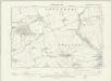
Northumberland XCV.NE - OS Six-Inch Map
1 : 10560 Topographic maps Ordnance Survey Ordnance Survey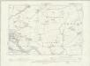
Northumberland XCV.NW - OS Six-Inch Map
1 : 10560 Topographic maps Ordnance Survey Ordnance Survey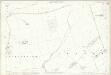
Northumberland (Old Series) XCV.2 (includes: Aydon; Newton Hall; Newton; Styford; Thornbrough) - 25 Inch Map
1 : 2500 Topographic maps Ordnance Survey Ordnance Survey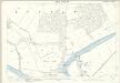
Northumberland (Old Series) XCV.11 (includes: Bearl; Broomhaugh; Broomley And Stocksfield; Bywell) - 25 Inch Map
1 : 2500 Topographic maps Ordnance Survey Ordnance Survey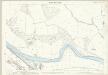
Northumberland (Old Series) XCV.10 (includes: Broomhaugh; Bywell; Riding; Styford) - 25 Inch Map
1 : 2500 Topographic maps Ordnance Survey Ordnance Survey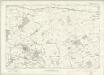
Northumberland nXCII - OS Six-Inch Map
1 : 10560 Topographic maps Ordnance Survey Ordnance Survey
NZ06 - OS 1:25,000 Provisional Series Map
1 : 25000 Topographic maps Ordnance Survey Ordnance Survey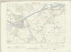
Northumberland XCV.SE - OS Six-Inch Map
1 : 10560 Topographic maps Ordnance Survey Ordnance Survey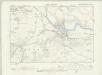
Northumberland XCV.SW - OS Six-Inch Map
1 : 10560 Topographic maps Ordnance Survey Ordnance Survey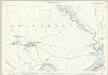
Northumberland (Old Series) XCV.8 (includes: Bearl; Bywell; Eltringham; Ovingham; Ovington; Prudhoe Castle; Whittle) - 25 Inch Map
1 : 2500 Topographic maps Ordnance Survey Ordnance Survey
Northumberland (Old Series) XCV.4 (includes: Horsley; Nafferton; Ovingham; Ovington; Whittle) - 25 Inch Map
1 : 2500 Topographic maps Ordnance Survey Ordnance Survey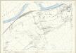
Northumberland (Old Series) XCV.12 (includes: Bearl; Broomley And Stocksfield; Bywell; Eltringham; Mickley; Ovington) - 25 Inch Map
1 : 2500 Topographic maps Ordnance Survey Ordnance Survey
Newcastle upon Tyne (Hills) - OS One-Inch Revised New Series
1 : 63360 Topographic maps Ordnance Survey Ordnance Survey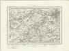
Newcastle upon Tyne (Outline) - OS One-Inch Revised New Series
1 : 63360 Topographic maps Ordnance Survey Ordnance Survey
Hexham - OS One-Inch Map
1 : 63360 Topographic maps Ordnance Survey Ordnance Survey
Newcastle Upon Tyne - OS One-Inch Map
1 : 63360 Topographic maps Ordnance Survey Ordnance Survey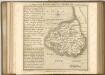

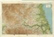
An accurate map of the county palatine of Durham
1 Karte : Kupferdruck ; 50 x 66 cm Kitchin; Hinton printed for J. Hinton at the Kings Arms in St. Pauls Church Yard
DUNELMIENSIS Episcopatus f.68
This is a map of County Durham by Christopher Saxton dating from 1577. It forms part of an atlas that belonged to William Cecil Lord Burghley, Elizabeth I’s Secretary of State. Burghley used this atlas to illustrate domestic matters. This map is actually a proof copy of one which forms part of Christopher Saxton’s Atlas of England and Wales. This atlas was first published as a whole in 1579. It consists of 35 coloured maps depicting the counties of England and Wales. The atlas is of great significance to British cartography as it set a standard of cartographic representation in Britain and the maps remained the basis for English county mapping, with few exceptions, until after 1750. During the reign of Elizabeth I, map use became more common, with many government matters referring to increasingly accurate maps with consistent scales and symbols, made possible by advances in surveying techniques. Illustrating the increasing use of maps in government matters, Lord Burghley, who had been determined to have England and Wales mapped in detail from the 1550s, selected the cartographer Christopher Saxton to produce a detailed and consistent survey of the country. The financier of the project was Thomas Seckford, Master of Requests at the Court of Elizabeth I, whose arms appear, along with the royal crest, on each map. Burghley has annotated this map, adding several place names. The map was engraved by Augustinus Ryther, the most accomplished member of a team of seven English and Flemish engravers employed to produce the copper plates for the atlas. Saxton, Christopher Ryther, Augustinus