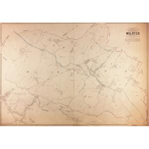
Maps of Wilrijk

Plan parcellaire de la commune de Wilryck : avec les mutations
1 : 5000 Royal Library of Belgium Map Room Popp, Philippe Christian (1805-1879) Popp, Philippe Christian (1805-1879)
Plan bijou de l'Exposition universelle
Antverpy (Belgie) Bertels, C.-H. H. Vankerkhoven
[Plán neznámého města]
Evropa Bodenehr, Gabriel Bertels, C.-H.
Plan parcellaire de la commune de Edeghem : avec les mutations
1 : 5000 Royal Library of Belgium Map Room Popp, Philippe Christian (1805-1879) Popp, Philippe Christian (1805-1879)
Plan parcellaire de la commune de Hoboken : avec les mutations
1 : 5000 Royal Library of Belgium Map Room Popp, Philippe Christian (1805-1879) Popp, Philippe Christian (1805-1879)
Plan de la ville d'Anvers et ses environs
1 : 9300 Richard Huybrechts & Cie. Editeurs chez Rich[ar]d Huybrechts & cie. editeurs
Plan parcellaire de la commune de Berchem lez-Anvers : avec les mutations
1 : 5000 Royal Library of Belgium Map Room Popp, Philippe Christian (1805-1879) Popp, Philippe Christian (1805-1879)
Plan parcellaire de la commune de Mortsel : avec les mutations
1 : 5000 Royal Library of Belgium Map Room Popp, Philippe Christian (1805-1879) Popp, Philippe Christian (1805-1879)
Plan parcellaire de la commune de Aertselaer : avec les mutations
1 : 5000 Royal Library of Belgium Map Room Popp, Philippe Christian (1805-1879) Popp, Philippe Christian (1805-1879)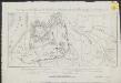
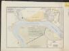
Aanvang van het beleg van de Citadel van Antwerpen door het Fransche leger in December 1832
1 : 8250 steend. Desguerrois
Plan parcellaire de la commune de Hemixem : avec les mutations
1 : 5000 Royal Library of Belgium Map Room Popp, Philippe Christian (1805-1879) Popp, Philippe Christian (1805-1879)
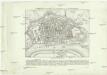
Développement du village de la commune de Berchem lez-Anvers
1 : 1250 Royal Library of Belgium Map Room Popp, Philippe Christian (1805-1879) Popp, Philippe Christian (1805-1879)
Karte der Umgebung von Antwerpen
Antverpy (Belgie)
Marchionatus Sacri Romani Imperii : Nobilißimo, Amplißimo, Prudentißimoq[ue] Senatuj Urbis Antverpiæ, nec non Marchionatus Sacri Imperij, Viris Consultissimis Sapientissimisq[ue]
Visscher, Nicolaes, 1618-1679 Nicolaus Jansenius Piscator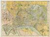
[Kaart], uit: Nieuw plan van Antwerpen, voorsteden en dokken : met aanduiding der kaainummers
1 : 12500 titelvariant: Antwerpen; Annotatie: Omslagtitel: Antwerpen : gids Brabo ... Antwerpen : Stappaers
Marchionatus Sacri Romani Imperii. [Karte], in: Novus atlas absolutissimus, Bd. 3, S. 55.
1 Karte aus Atlas Janssonius Offizin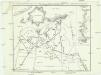
Plan officiel des travaux du siége de la citadelle d'Anvers exécutés par l'armée francaise en 1832
1 : 5300 Antverpy (Belgie) Tardieu, Ambroise Anselin Ambroise Tardieu
Marchionatus Sacri Romani Imperii
1 : 21000 C.J. Visscher excudebat [Amsterdam] : nunc apud Petrum Schenk Junior
Nouveau plan de la ville d'Anvers / dressé par A. Scheepers
1 : 10000 Scheepers, A.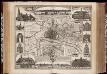
Marchionatus Sacri Romani Imperii / [C.J. Visscher]
1 : 60000 Annotatie: Origineel is Blad 44 in atlas factice; Met kaartje van de omgeving, afbeeldingen van de voornaamste gebouwen en 3 panorama's; Annotatie geografische gegevens: Oost boven Visscher, Claes Jansz. [Amsterdam : C.J. Visscher excudebat]
Antwerpen
Plan der Stadt und Citadelle von Antwerpen
Antverpy (Belgie) Tardieu, Auguste Ambroise Industrie Comptoir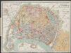
Plan-guide d'Anvers
1 : 12500 Librairie Ackermann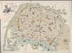
[Recto], uit: Plan instantané de la ville d'Anvers : indiquant les principaux monuments en relief, le tracé des tramways, les nouveaux quais, hangars, etc., etc. / dressé par E.V.D.H.
1 : 11600 E.V.D.H. Anvers : Huybrechts
Neuester Plan der Stadt u. Citadelle nebst der Umgegend von Antwerpen und der Lage der fr. Batterien
Antverpy (Belgie) Wappen C. Henning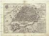
Anverpia
Antverpy (Belgie) Braun, Georg Hogenberg, Franz
Plan parcellaire de la commune de Contich : avec les mutations
1 : 5000 Royal Library of Belgium Map Room Popp, Philippe Christian (1805-1879) Popp, Philippe Christian (1805-1879)
Plan parcellaire de la commune de Burght : avec les mutations
1 : 5000 Royal Library of Belgium Map Room Popp, Philippe Christian (1805-1879) Popp, Philippe Christian (1805-1879)
Plan de la ville et citadelle d'Anvers
1 : 8300 Antverpy (Belgie) Muller, L. Mouqué, Alexander P. Tessaro