Maps of Scandinavia

Spesielle kart 130-3: Oversigt over salg av rektangel- (gradavdelingskarter) pr. aar i tidsrummet 1910-15.
1 : 2800000
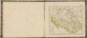
61-62. Svezia, Norvegia.
1 : 3000000 Touring club italiano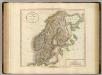
Sweden, Denmark and Norway.
1 : 4550000 Cary, John, ca. 1754-1835
Sweden & Norway.
1 : 7480000 Tanner, Henry S.
Sweden & Norway.
1 : 7600000 Tanner, Henry S.
Sweden & Norway.
1 : 7603200 Tanner, Henry S.
Spesielle kart 130-1: Folketæthed Efter Norges officielle statistik ...
1 : 2800000
Spesielle kart 66-4: Kart udvisende de med bidrag af Statskassen understøttende Dampskibsrouter
1 : 2400000
Schweden, Norwegen.
1 : 6000000 Andree, Richard
spesielle kart 129-2: Oversigtskart over Gradavdelingskarter og Rektangelkarter, bilag 2
1 : 2800000
Spesielle kart 62: Pflanzengeographisce Karte über das Königreich Norwegen
1 : 2000000

Statistikk kart 23: Les marchandises exportees
1 : 2400000
Statistikk kart 22: Tonnage de navires 1873
1 : 2400000
Charte von Schweden u. Norwegen
1 : 5300000 Norsko
CHARTE von SCHWEDEN u. NORWEGEN
1 : 5300000 Norsko
Charte von Schweden u. Norwegen
1 : 5170000 Norsko
Zweiter Theil der Karte von Europa welcher Dænemark, und Norwegen, Schweden, und Russland enthælt, 2
1 Blatt : 72 x 54 cm F.A. Schrämbl
Seconde partie de la carte d'Europe contenant le Danemark et la Norwege, la Suède et la Russie (a l'exeption de l'Ukraine), 2
1 Blatt : 71 x 53 cm chez l'auteur
Scandia, Scandinavia.
1 : 3050000 Faden, William, 1750?-1836
Schweden, Norwegen, Finnland.
1 : 15300000 Brudin, J. L.; Stieler, Adolf
Atlas für Handel und Industrie: Für Kaufleute, Fabrikante u. Gewerbetreibende, Handlungs- u. Gewerbe-Schulen

Statistikk 42: Døgnets normaltemperatur i Skandinavia, oktober måned
1 : 4000000
Suede, Danemark.
1 : 4650000 Andriveau-Goujon, J.
SYNOPSIS PLAGAE SEPTENTRIONALIS sive SUECIAE DANIAE ET NORWEGIAE REGN. accuratissime delineatum
1 : 4500000 Dánsko Seutter, Matthäus studio Matth. Seutteri
Synopsis plagae septemtrionalis sive Sueciae Daniae et Norwegiae regn. accuratissime delineatum
1 : 4500000 Dánsko Seutter, Matthäus Rogg, Gottfried studio Matth. Seutteri
Synopsis plagae septentrionalis sive Sueciae Daniae et Norwegiae regn. accuratissime delineatum
1 : 4500000 Dánsko Seutter, Matthäus studio Matth. Seutteri
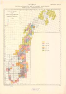
Spesielle kart 130-2: Oversigt over tætbebyggelse, stà ̧rre industrielle bedrifter og vigtige gruber ...
1 : 2800000