Maps of Grimstad

5B Grimstad
1 : 100000 H. Hagen | Arnt Magnus Andreassen Øgaard
Museumskart 60b: Kart over strekningen Kristiansand-Risør
1 : 200000 Rasmus Iuel
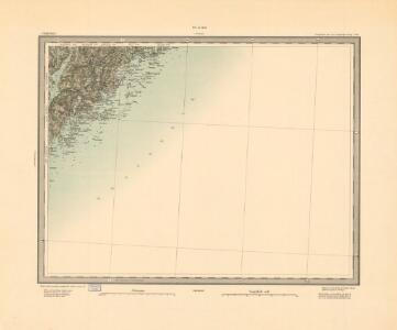
5B Grimstad
1 : 100000
5B Grimstad
1 : 100000 H. Hagen | Arnt Magnus Andreassen Øgaard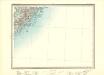
5B Grimstad
1 : 100000 H. C. Wanggård | Arnt Magnus Andreassen Øgaard
1611-1 Tromøy
1 : 50000 Statens kartverk
1611-1 Tromöy
1 : 50000 Norges Geografiske Oppmåling
1611-4 Arendal
1 : 50000 Statens kartverk
1611-1 Tromöy
1 : 50000 Norges Geografiske Oppmåling
1611-4 Arendal
1 : 50000 Norges Geografiske Oppmåling
5B 9 5B 10
1 : 50000 Johannes Solem
5B 5 5B 9 5B 10
1 : 50000 Ph. Sissener
1611-1 Tromöy
1 : 50000 Norges Geografiske Oppmåling
1611-1 Tromøy
1 : 50000 Statens kartverk
1611-4 Arendal
1 : 50000 Norges Geografiske Oppmåling
1611-4 Arendal
1 : 50000 Statens kartverk
1611-4 Arendal
1 : 50000 Statens kartverk
1611-4 Arendal
1 : 50000 Norges Geografiske Oppmåling
Museumskart 62: Kart over Indseilingen til Grimstad
1 : 25000 H. Wille Grimstads Sømands- og Handelsforening
5A 4 5A 8 5B 5
1 : 50000 Thorvald Kristian Oscar Holtan
Arendal
1 : 100000 P. M. Bye og Co. AS Oslo
Museumskart 54: Carte ofver Arendals Haufn
1 : 20000
5A 8 5A 12
1 : 50000 Birger Hielm
E39-2
1 : 20000 Toralf Øyen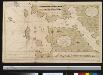
Nieuwe afteekening vant Gat en het eijland Maerdou of Merdøe aen de cust van Noorwegen
Norway Gerard van Keulen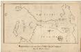
Museumskart 6 Miswiisende Kaart over Arendals havn og Indløbet til same samt Udhavnene
1 : 10000
E39-4-nv/4, E39-4-s/2
1 : 25000 Axel P. Printz
Geologiske kart 4ab: a. Næskilens ertsdrag b. Langsev, Thorbjørnsro samt Solberg ertsfelt
1 : 5000 Carl Schwenzen | Tellef Dahll
Arendal
1 : 2500 Søren Christian Gjessing