Maps of Frøya

48D Tarbuskjær
1 : 100000 C. Pedersen | Torgrim Lundtvedt
48D Tarbuskjær
1 : 100000 C. Pedersen | Torgrim Lundtvedt
48D Tarbuskjær
1 : 100000
1422-4 Sula
1 : 50000 Statens kartverk
1422-4 Sula
1 : 50000 Statens kartverk
1422-4 Sula
1 : 50000 Norges Geografiske Oppmåling
1422-4 Sula
1 : 50000 Statens kartverk
1422-4 Sula
1 : 50000 Norges Geografiske Oppmåling
48D 4; 49C 1
1 : 50000 Hans Paasche Schreuder
Norge 55-15: Accurat landcaart over Norges Rige anden Part
1 : 300000 G. Bordin
49C 2; 49C 5; 49C 6
1 : 50000 Hans Paasche Schreuder
1423-2 Froan
1 : 50000 Statens kartverk
1423-2 Froan
1 : 50000 Statens kartverk
48B 6; 48B 7; 48B 10; 48B 11
1 : 50000 Hans Paasche Schreuder
1423-2 Froan
1 : 50000 Norges Geografiske Oppmåling
1423-2 Froan
1 : 50000 Statens kartverk
48B 8; 48B 12
1 : 50000 Hans Paasche Schreuder | Ole Hagbart Bertrand Norgrenn
1422-1 Nord-Frøya
1 : 50000 Statens kartverk
1422-1 Nord-Frøya
1 : 50000 Statens kartverk
1422-1 Nord-Frøya
1 : 50000 Statens kartverk
1422-1 Nord-Fröya
1 : 50000 Norges Geografiske Oppmåling
1422-1 Nord-Fröya
1 : 50000 Norges Geografiske Oppmåling
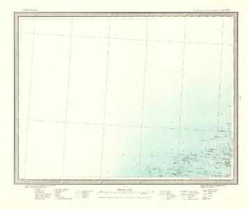
XIV
1 : 400000 K. Petersen
Statistikk 38-8: Bosettingskart over Norge. Blad 8
Statistisk Sentralbyrå
XIV
1 : 400000 K. Petersen
Museumskart 103: Situations-Cart over den Norske Søekyst fra Tronhiems Bye til Bergenhus-stift
1 : 50000 Niels Andreas Wibe
Norge 32a: Cituations Carte over en vis Bestreckning nemblig fra Trundhiem og til Opdalen
1 : 300000 G. M. D.
XIV
1 : 400000 K. Petersen
Museumskart 102: Situations Kaart over En Deel af den Norske Kyst, Todalsfjorden-Hanøya
1 : 40000