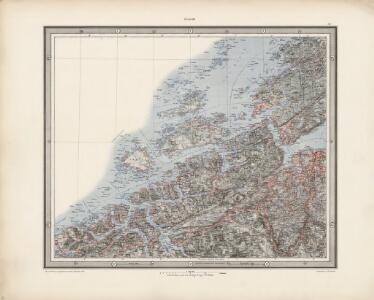
Maps of Sør-Trøndelag

XIV
1 : 400000 K. Petersen
XIV
1 : 400000 K. Petersen
Norge 32a: Cituations Carte over en vis Bestreckning nemblig fra Trundhiem og til Opdalen
1 : 300000 G. M. D.
Museumskart 103: Situations-Cart over den Norske Søekyst fra Tronhiems Bye til Bergenhus-stift
1 : 50000 Niels Andreas Wibe
Dioecesis Trundhemiensis Pars Australis. [Karte], in: Novus atlas absolutissimus, Bd. 1, S. 36.
1 Karte aus Atlas Janssonius Offizin
DIOECESIS | TRVNDHEMIENSIS | PARS AVSTRALIS.
[Amsterdam : Joan Blaeu]
XIV
1 : 400000 K. Petersen
Museumskart 102: Situations Kaart over En Deel af den Norske Kyst, Todalsfjorden-Hanøya
1 : 40000
Norge 32d: Cituations Carte over en vis Bestreckning nemblig fra Trundhiem og til Opdalen
1 : 300000 Stuarts
Norge 32e: Cituations Carte over en vis Bestreckning nemblig fra Trundhiem og til Opdalen
1 : 300000
Norge 32c: Cituations Carte over en vis Bestreckning nemblig fra Trundhiem og til Opdalen
1 : 300000 J. H. Emahusen
Museumskart 118: Trøndelagskysten, sør-øst
1 : 200000 Paus
Statistikk 43-15- Bosettingskart over Kristiansund. Blad 15
1 : 250000 Statistisk Sentralbyrå
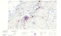
Statistikk 43-15-2: Bosettingskart over Kristiansund. Blad 15
1 : 250000 Statistisk Sentralbyrå
Norge 55-14: Accurat landcaart over Norges Rige anden Part
1 : 3000000 G. Bordin
Trigonometrisk grunnlag, Squelet-Cart 65-16

Trigonometrisk grunnlag, Squelet-Cart 56: kart over de i Sommeren 1859 bestemte Punkter
A. Heiberg
Geologiske kart 121-J2: Kart med magnetisk totalfelt. Kristiansund
1 : 250000 Norges geologiske undersøkelse
Kartblad 107: Situations Cart over det 2det Trondhiemske Regiments District
J. C. R.
Spesielle kart 122-8: Postkart over Norge
1 : 400000 Toralf à ̃yen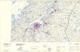
Statistikk 43-16- Bosettingskart over Bergen. Blad 16
1 : 250000 Statistisk Sentralbyrå
Trigonometrisk grunnlag, Squelet-Cart 65-15
Statistikk 43-16-2: Bosettingskart over Bergen. Blad 16
1 : 250000 Statistisk Sentralbyrå
Geologiske kart 121-D: Kart med magnetisk totalfelt. Trondheim
1 : 250000 Norges geologiske undersøkelse
Norge 55-15: Accurat landcaart over Norges Rige anden Part
1 : 300000 G. Bordin
Norge 55-10: Accurat landcaart over Norges Rige anden Part
1 : 300000 G. Bordin
Kartblad 112: Carte over det Wigsche-Nordmørsche Compagnie District
Johan Thomas Hornemann
Kartblad 96: Situations-Cart over det Redsenske Compagnie
Johan Christian Throne
Kartblad 77-2: Situations Chart over det Frostensche Compagnie; versjon 2
Ebbe Carsten Hendrich Coldevin