Maps of Nes

20A 12 nordøstre del, versjon 2
1 : 10000
20A 12 nordøstre del, versjon 1
1 : 10000 Hans Frederich Tambs
20C 4
1 : 50000 Berg | Beichmann
20A 12 sørøstre del, versjon 2
1 : 10000
20C 4 sø
1 : 10000 Frederich Waldemar Nicolai | Berg
2015-4 Odalen
1 : 50000 Norges Geografiske Oppmåling
2015-4 Odalen
1 : 50000 Norges Geografiske Oppmåling
2015-4 Skarnes
1 : 50000 Statens kartverk
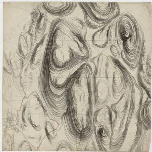
Trigonometrisk grunnlag, vedlegg 22: Kvadratmilien No 97, kvadratmilen No 58
1 : 10000
Trigonometrisk grunnlag, vedlegg 3 Fundament Kaartover den Østre Halvdeel af Qvadrat Milen No 120
1 : 10000
20A Nannestad
1 : 100000 Johan Ferdinand Nordmann | Ole Engh
20A Nannestad
1 : 100000 Johan Ferdinand Normann | Carl Christian Olberg
20A Nannestad
1 : 100000 Carl Christian Olberg | Johan Ferdinand Normann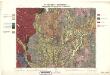
Geologiske kart 30: Den geologiske Undersøgelse, Nannestad
1 : 100000 T. Ch. Thomassen | Normann | Johan H. L. Vogt Norges geologiske undersøkelse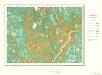
Geologisk kart 10 Nannestad
1 : 100000
20B Kongsvinger
1 : 100000 H. Hagen | Torgrim Lundtvedt
20A Nannestad
1 : 100000 Johan Ferdinand Normann | Carl Christian Olberg
20A Nannestad
1 : 100000 Johan Ferdinand Nordmann | Ole Engh
Portefølje nr 32
1 : 100000 F. Akrell
20C Eidsvoll
1 : 100000 Torgrim Lundtvedt | Gjestvang
Kartblad 44: Vej-Cart over det Oudahlske lette Infanterie Compagnies District

20C Eidsvoll
1 : 100000 Gjestvang | Torgrim Lundtvedt
Geologisk kart 39: Den Geologiske Undersøgelse, Nannestad
1 : 100000 Norges geologiske undersøkelse
Portefølje nr 32
1 : 100000
Portefølje nr 32
1 : 100000
20A Nannestad
1 : 100000 Johan Ferdinand Normann | Carl Christian Olberg
Trigonometrisk grunnlag, vedlegg 56
1 : 50000
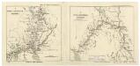
Spesielle kart 20-1: Christiania-Lillestrøm-Eidsvold
1 : 400000 Albert Cammermeyer Forlag
Spesielle kart 20-2: Lillestrøm-Kongsvinger-Charlottenberg
1 : 400000 Albert Cammermeyer Forlag