Maps of Nes

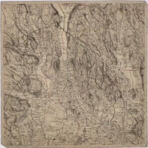
Portefølje nr 32
1 : 100000
Portefølje nr 32
1 : 100000
Portefølje nr 32
1 : 100000 F. Akrell
Trigonometrisk grunnlag, vedlegg 56
1 : 50000
20C Eidsvoll
1 : 100000 Gjestvang | Torgrim Lundtvedt
20C Eidsvoll
1 : 100000 Torgrim Lundtvedt | Gjestvang
20C Eidsvoll
1 : 100000 Gjestvang | Torgrim Lundtvedt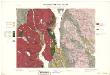
Geologisk kart 33: Den Geologiske Undersøgelse, Rektangel 20C Eidsvold
1 : 100000 Torgrim Lundtvedt | Gjestvang Norges geologiske undersøkelse
20C Eidsvoll
1 : 100000 Torgrim Lundtvedt | Gjestvang | H. C. Wanggård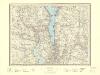
20C Eidsvoll
1 : 100000
20C Eidsvoll
1 : 100000 Gjestvang | Torgrim Lundtvedt
20C Eidsvoll
1 : 100000 H. C. Wanggård | Torgrim Lundtvedt | Gjestvang
20C Eidsvoll
1 : 100000 Gjestvang | Torgrim Lundtvedt
Kartblad 65: Wey-Cart over det Eidswoldske lette Infanterie Compagnie District

Kartblad 4 Cituations-Cart over det Edsvoldske Compagnies Distrigt
Neumann
Kartblad 44: Vej-Cart over det Oudahlske lette Infanterie Compagnies District

Trigonometrisk grunnlag, vedlegg 30: Fundament Tabel Quadrat-Miilen No 116 og 117
1 : 10000
1915-1 Eidsvoll
1 : 50000 Statens kartverk
1915-1 Eidsvoll
1 : 50000 Statens kartverk
1915-1 Eidsvoll
1 : 50000 Norges Geografiske Oppmåling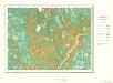
Geologisk kart 10 Nannestad
1 : 100000
20A Nannestad
1 : 100000 Johan Ferdinand Normann | Carl Christian Olberg
Geologiske kart 30: Den geologiske Undersøgelse, Nannestad
1 : 100000 T. Ch. Thomassen | Normann | Johan H. L. Vogt Norges geologiske undersøkelse
Trigonometrisk grunnlag, vedlegg 23: Fundament Kaart over Qvadrat Milene No 105 og 106
1 : 50000
20A Nannestad
1 : 100000 Johan Ferdinand Normann | Carl Christian Olberg
20A Nannestad
1 : 100000 Carl Christian Olberg | Johan Ferdinand Normann
Trigonometrisk grunnlag, vedlegg 58
1 : 50000
20A Nannestad
1 : 100000 Johan Ferdinand Normann | Carl Christian Olberg
20A Nannestad
1 : 100000 Johan Ferdinand Nordmann | Ole Engh