Maps of Tysfjord

M11 nordre del
1 : 50000 Erling Bjørstad
M11; nordvestre del
1 : 50000 Kjeld Andreas Bugge
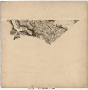
2230-1 Bjørntoppen
1 : 50000 Statens kartverk
2230-1 Bjørntoppen
1 : 50000 Statens kartverk
M11 Hellemobotn
1 : 100000 Torgrim Lundtvedt | Ole Engh
M11 Hellemobotn
1 : 100000 Ole Engh | Torgrim Lundtvedt
Geologisk kart 8 Geologisk kart: Hellembotn
1 : 100000 Steinar Foslie Norges geologiske undersøkelse
M11 Hellemobotn
1 : 100000
M11 Hellemobotn
1 : 100000 Torgrim Lundtvedt | Ole Engh
2230-4 Hellemobotn
1 : 50000 Statens kartverk
2230-4 Hellemobotn
1 : 50000 Norges Geografiske Oppmåling
2230-4 Vuodnabahta
1 : 50000 Statens kartverk
2230-4 Hellemobotn
1 : 50000 Norges Geografiske Oppmåling
2230-1 Björntoppen
1 : 50000 Norges Geografiske Oppmåling
2230-1 Bjørntoppen
1 : 50000 Statens kartverk
2230-1 Björntoppen
1 : 50000 Norges Geografiske Oppmåling
M11; sørvestre del
1 : 50000 Kjeld Andreas Bugge
1331-3 Gásluokta
1 : 50000 Statens kartverk
1331-3 Kjøpsvik
1 : 50000 Statens kartverk
M10; sørøstre del
1 : 50000 Ole Berg Getz | Sven Nielsen
L11 nordøstre del
1 : 50000 Henrik Christian Rørholt | Thorleif Barlag
M10; sørvestre del
1 : 50000 Harald Hjort
M10; sørvestre del
1 : 50000 David Ebbesen | Harald Hjort | Oskar Jakob Nikolai Rieck | Oscar Thue | Sigvald Hansen
M10; sørøstre del
1 : 50000 Oscar Thue | Sven Nielsen | Ole Berg Getz
M10 Tysfjord
1 : 100000 Ellef Nilsen | Torgrim Lundtvedt
M10 Tysfjord
1 : 100000 Torgrim Lundtvedt | Ellef Nilsen
M10 Tysfjord
1 : 100000
Norway 1:100,000 , Series GSGS 4090, Tysfjord
Norway 1:100,000 , Series GSGS 4090. Great Britain. War Office. General Staff. Geographical Section. [London] : War Office
M10 Tysfjord
1 : 100000 Ellef Nilsen | Torgrim Lundtvedt