Maps of Tysfjord

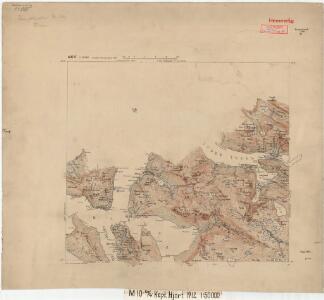
M10; sørvestre del
1 : 50000 Harald Hjort
1331-3 Gásluokta
1 : 50000 Statens kartverk
1331-3 Kjøpsvik
1 : 50000 Statens kartverk
1331-3 Tysfjord
1 : 50000 Norges Geografiske Oppmåling
1331-3 Tysfjord
1 : 50000 Norges Geografiske Oppmåling
1331-3 Kjöpsvik
1 : 50000 Statens kartverk
1331-3 Tysfjord
1 : 50000 Norges Geografiske Oppmåling
M10; sørvestre del
1 : 50000 David Ebbesen | Harald Hjort | Oskar Jakob Nikolai Rieck | Oscar Thue | Sigvald Hansen
M10 Tysfjord
1 : 100000 Torgrim Lundtvedt | Ellef Nilsen
M10 Tysfjord
1 : 100000 Ellef Nilsen | Torgrim Lundtvedt
M10 Tysfjord
1 : 100000 Ellef Nilsen | Torgrim Lundtvedt
M10 Tysfjord
1 : 100000
M10 Tysfjord
1 : 100000
Norway 1:100,000 , Series GSGS 4090, Tysfjord
Norway 1:100,000 , Series GSGS 4090. Great Britain. War Office. General Staff. Geographical Section. [London] : War Office
M10 Tysfjord
1 : 100000 Torgrim Lundtvedt | Ellef Nilsen
M10 Tysfjord
1 : 100000 Torgrim Lundtvedt | Ellef Nilsen
M10; nordvestre del
1 : 50000 Oskar Jakob Nikolai Rieck
L10 sørøstre del
1 : 50000 Finn Abrahamson | Bjarne Gjølme
M10
1 : 50000 Oscar Thue
M11; nordvestre del
1 : 50000 Kjeld Andreas Bugge
M10; nordvestre del
1 : 50000 Oscar Thue | Karl August Hansen | Oskar Jakob Nikolai Rieck | Otto Hjersing Munthe-Kaas
L10 Hamarøy
1 : 100000
M11 Hellemobotn
1 : 100000 Torgrim Lundtvedt | Ole Engh
L10 Hamarøy
1 : 100000 C. Pedersen | John Gulbrandsen Natrud
1231-2 Innhavet
1 : 50000 Norges Geografiske Oppmåling
M11 nordre del
1 : 50000 Erling Bjørstad
1231-2 Ulvsvåg
1 : 50000 Statens kartverk
L10 Hamarøy
1 : 100000 John Gulbrandsen Natrud | C. Pedersen
M10; sørøstre del
1 : 50000 Ole Berg Getz | Sven Nielsen