Maps of Nordre Land

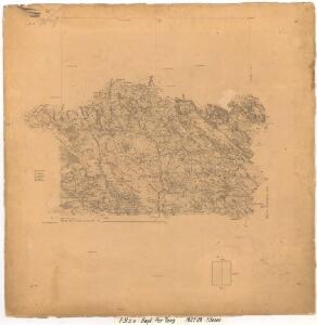
F31-5, F31-6
1 : 50000 Per Tang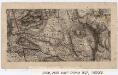
25C 8; 25D 5
1 : 100000 Niels Arntzen Ramm
25D 5
1 : 50000 Johan Ferdinand Normann
25D 5
1 : 50000 Johan Ferdinand Normann
25D 6
1 : 50000 Wilhelm Sørensen
F31 aust Synnfjell
1 : 100000
Finmarkens amt 54-3: HÃ¥ndtegnet kopi/skisse av kartlinje
1 : 200000 Gerhard Munthe, Fredrik Rode
F31 aust Synnfjell
1 : 100000
F31 aust Synnfjell
1 : 100000
F31 aust Synnfjell
1 : 100000
1817-3 Follebu
1 : 50000 Norges Geografiske Oppmåling
1817-3 Follebu
1 : 50000 Statens kartverk
1817-3 Follebu
1 : 50000 Norges Geografiske Oppmåling
1817-3 Follebu
1 : 50000 Statens kartverk
1817-3 Follebu
1 : 50000 Statens kartverk
1817-3 Follebu
1 : 50000 Statens kartverk
25D 6
1 : 50000 Wilhelm Sørensen
F31-4
1 : 50000 Thorleif Barlag
F31-6
1 : 50000 Erling Bjørstad
F31-4, F31-5, F35-10
1 : 50000 Erling Bjørstad
25D 9
1 : 50000 Johan Ferdinand Normann
F31 aust Synnfjell
1 : 100000
F31 aust Synnfjell
1 : 100000
25D Lillehammer
1 : 100000 Einar Sigurd Ween | Johan Ferdinand Normann
Spesielle kart 58-1: Kart over Drammenselvens Flødningsdistrikt
1 : 100000 Thurmann | Seip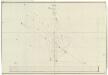
Trigonometrisk grunnlag, dublett 29- Kart over trigonometriske punkter foretatt i 1807 og 1810
Hans Lemmich Juell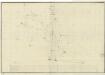
Trigonometrisk grunnlag, Squelet-Cart 29: Skelet-kart over Oppland og Hedmark 1807 og 1810
Hans Lemmich Juell
Trigonometrisk grunnlag, dublett 29-2: Kart over trigonometriske punkter foretatt i 1807 og 1810
Hans Lemmich Juell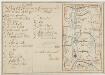
Kartblad 58: Carte over det Ringeboiske Compagnie District
Jens Bull | Kraft