Maps of Åseral

D38-2, D38-3
1 : 50000 Arne Schau
D38-2, D38-3
1 : 50000 B. Kvåle | Øyvind Brandsæter
7B2 7B 3
1 : 50000 Christoffer Fredrik von Lowzow
D38-1, D38-2
1 : 50000 Brynjulf Skaar
1412-1 Austad
1 : 50000 Norges Geografiske Oppmåling
D38-3
1 : 50000 Ingolf Hådem
D38-2, D38-3
1 : 50000 Arne Schau
D38-3, D38-9
1 : 50000 Asbjørn Olden
1412-1 Bortelid
1 : 50000 Statens kartverk
1412-1 Austad
1 : 50000 Statens kartverk
C38-6; 38-12; D38-1; D38-2; D38-7; D38-8
1 : 50000 Adler Gleditsch
D38-2, D38-3, D38-8, D38-9
1 : 50000 Adler Gleditsch
D38-9
1 : 50000 Øystein Mogen
4D 12 5C 9 7B 48A 1
1 : 50000 Johannes Falkenberg
1412-2 Åseral
1 : 50000 Statens kartverk
1412-2 Åseral
1 : 50000 Statens kartverk
1412-2 Åseral
1 : 50000 Norges Geografiske Oppmåling
1412-2 Asereal
1 : 50000 Norges Geografiske Oppmåling
1412-2 Åseral
1 : 50000 Norges Geografiske Oppmåling
1412-2 Åseral
1 : 50000 Statens kartverk
Portefølje nr 6
1 : 100000
Portefølje nr 6
1 : 100000
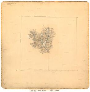
Trigonometrisk grunnlag, Squelet-Cart 47: Kart for 1851
C. S. Grimsgaard
Trigonometrisk grunnlag, Squelet-Cart 46: Kart for 1850
C. Bassøe
Kart over Lister og Mandals amt
1 : 200000 Norsko Gjessing, Soren Christian Geografiske opmaaling
Geologiske kart 121-F: Kart med magnetisk totalfelt. Mandal
1 : 250000 Norges geologiske undersøkelse
Trigonometrisk grunnlag, Squelet-Cart 45: Kart for 1849
F. Næser
Statistikk 43-1-2: Bosettingskart over Mandal. Blad 1
1 : 250000 Statistisk Sentralbyrå
Statistikk 43-1- Bosettingskart over Mandal. Blad 1
1 : 250000 Statistisk Sentralbyrå