Maps of Atlas Mountains

North Africa or Barbary : Marocco
1 : 2800000 Society for the Diffusion of Useful Knowledge (Great Britain) George Cox
North Africa or Barbary : Tripoli
1 : 2000000 Society for the Diffusion of Useful Knowledge (Great Britain) George Cox
North Africa or Barbary : Algier
1 : 2000000 Society for the Diffusion of Useful Knowledge (Great Britain) George Cox
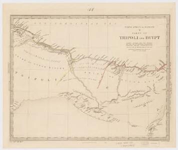
North Africa or Barbary : Parts of Tripoli and Egypt
1 : 2000000 Society for the Diffusion of Useful Knowledge (Great Britain) George Cox
North Africa or Barbary : Tunis and part of Tripoli
1 : 2000000 Society for the Diffusion of Useful Knowledge (Great Britain) George Cox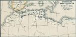
Osmanische Vasallenstaaten in Nordwest-Afrika
1 : 27000000 Osmanisches Reich, Maghreb , Protektorat
Parts of Barbary.
1 : 7700000 Bowen, Emanuel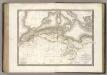
La Barbarie.
1 : 6500000 Lapie, M. (Pierre), 1779-1850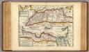
West and east parts of Barbary.
1 : 11000000 Moll, Herman, d. 1732
Aphricae Tabula II. [Karte], in: Claud. Ptolemaeus. Geographia lat. cum mappis [...], S. 287.
1 Karte aus Atlas Münster, Sebastian [und Ptolemaeus, Claudius]
Mittelländisches Meer
1 : 8250000 Středozemní moře-oblast Elfert, P. Geogr. Anstalt von Wagner & Debes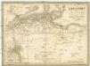
Berberei enthält das Reich Fez und Marocco, Algier, Tunis u. Tripoli
1 : 4500000 Afrika severní Biller, B. Tranquillo Mollo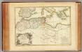
Barbarie.
1 : 8600000 Bonne, Rigobert, 1727-1794
Mare Mediterraneum
1 Karte : Kupferdruck ; 48 x 56 cm Seutter Matthäus Seutter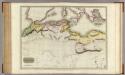
Northern Africa.
1 : 5300000 Pinkerton, John, 1758-1826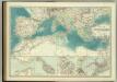
Mediterranean Basin.
1 : 6800000 Johnston, W. & A.K.
Libyae vel Africae.
1 : 8200000 Playfair, Principal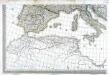
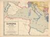
Carte d'Europe ou sont tracées les limites des empires, royaumes, et etats souverains, feuille 5
1 Blatt : 56 x 87 cm Semen etc
In notitiam ecclesiasticam Africæ tabula geographica
1 : 5700000
Tabula Prima Africae. [Karte], in: Claudii Ptolemei viri Alexandrini mathematice discipline philosophi doctissimi geographie opus [...], S. 181.
1 Karte aus Atlas Waldseemüller, Martin [und Ptolemaeus, Claudius] Übelin, Georg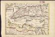
The west part of Barbary containing Fez, Marocco, Algiers and Tunis ; East part of Barbary containing Tripoli, Barca and the north part of Egypt
1 : 11000000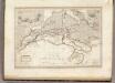
Afrique Septentrionale.
1 : 8000000 Montemont, A.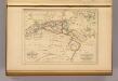
Barbarie.
1 : 12300000 Malte-Brun, Conrad, 1775-1826
Nord-Africa Berberei
1 : 9678000 Afrika severní Schlieben Gleditsch
Das Mittelländische Meer
Stieler's Hand-Atlas Stieler, Adolf bei Justus Perthes
Libyae, vel Africae pars borealis.
1 : 25000000 Fenner, Rest.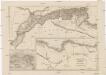
Mauritania, Africa propria, Cyrenaica
1 : 330000 Afrika severní Reichard, Christian Gottlieb Campius, D. a D. Campio
Africae tabula geographica.
1 : 5700000 L'Isle, Guillaume de, 1675-1726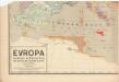
Evropa raného středověku: do konce VI. století po Kr.
Kašpar, Jan