Mappa catalogata
Nord-Africa Berberei


Titolo completo:Nord-Africa Berberei
Anno di illustrazione:1818 - 1830
Data di pubblicazione:1818 - 1830
Editore:Gleditsch
Dimensione fisica:20 x 30 cm
Scala della mappa:1:9 678 000
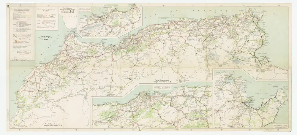
[Kaart], uit: Maroc-Algérie-Tunisie : carte au 2 millionième ... / Michelin
1949
Pneu Michelin, Paris
1:2m
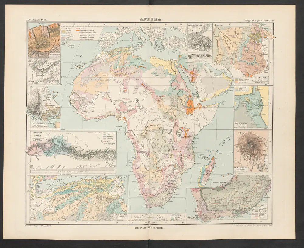
Afrika
1892
Zittel, K.v. ; Berghaus, Hermann
Algérie et Tunisie
1903
Niox, Gustave-Léon 1840-1921
1:2m
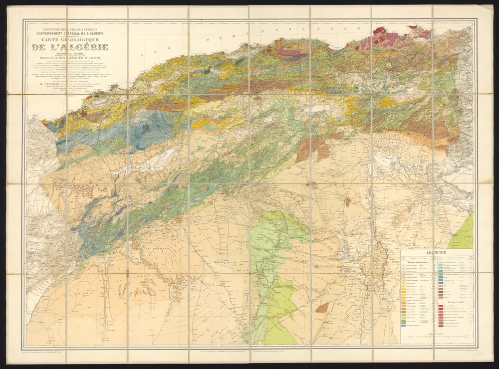
Carte géologique de l'Algérie
1900
Blayac, Joseph
1:800k
Carte du Maroc et de la frontière algérienne dressée au Bureau Militaire du Petit Journal
1912
Paris :
1:2m
[XXII], uit: Geognostische Karte des Oesterreichischen Kaiserstaates mit einem grossen Theile Deutschland's u. Italien / hauptsachlich nach ... Haidinger's geognostischer Karte dieses Staates bearb. von Josef Scheda
1847
Scheda, Joseph
1:3m
[Maroko]
1855
Zeithammer, Antonín Otakar
[Maroko]
1855
Zeithammer, Antonín Otakar
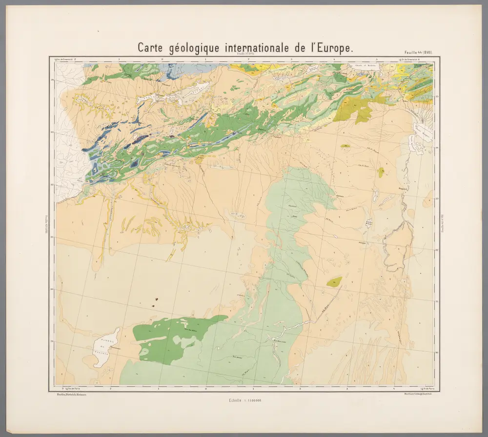
Feuille 44 (B VII), uit: Carte géologique internationale de l'Europe : la carte, votée au congrès géologique international de Bologne en 1881, est exécutée conformément aux décisions d'une commission internationale, avec le concours des gouvernements, sous le dir. de M.M. Beyrich et Hauchecorne
1881
Heinrich Ernst Beyrich 1815-1896; Wi. Hauchecorne
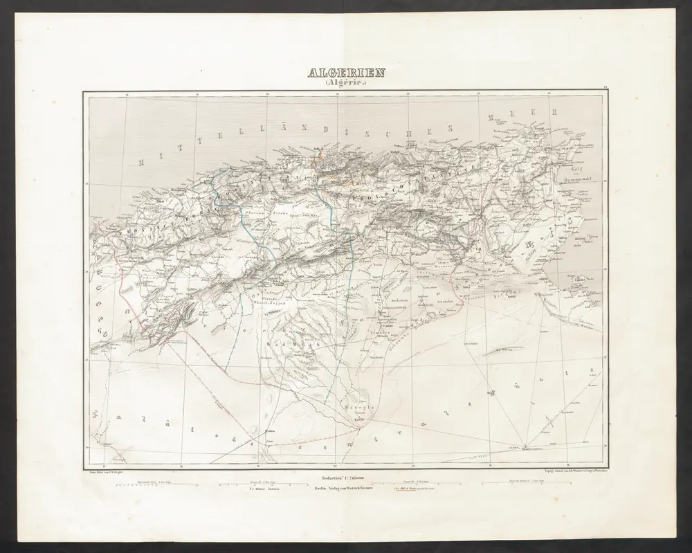
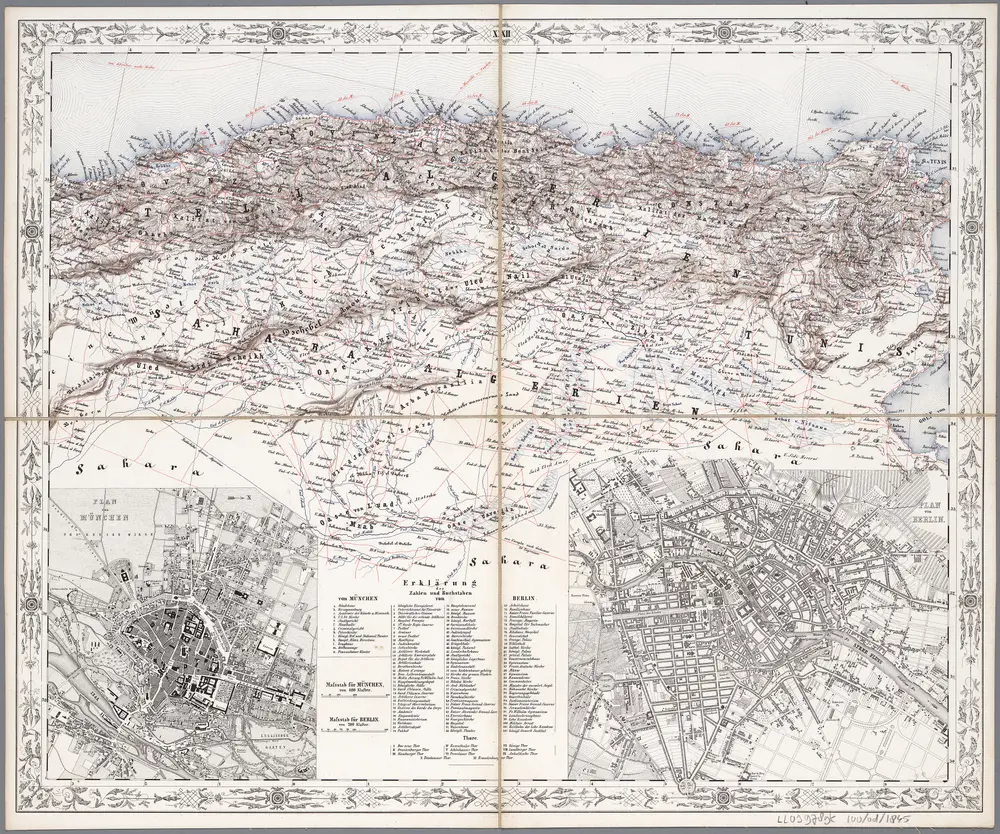
Algerien (Algérie.)
1851
Ziegler, Jakob Melchior