Maps of Northern European Plain

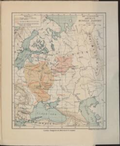
Map illustrating ancient Russian history
Russland Kiewer Reich Philip, George ; Philip, [Sohn v. G.]
Ruszland, Regenmenge u. Januar-Jsothermen
Russland / Europäischer Teil Pflanzenbau, Klima
Carte de la partie européenne de l'empire de Russie, avec l'indication des chemins de poste, ainsi que des douanes frontières et de la repartition actuelle en gouvernements et districts
1 : 3000000
Russisches Reich. Verwaltungsgrenzen von 1914. Europäischer Teil
Russland / Europäischer Teil Verwaltungsgliederung
Karta rossijskich želěznych dorog
1 : 5250000 Charkov-oblast (Ukrajina) Bangof, Eduard v artističeskom zavedenija A.F. Marksa
Russia, Poland.
1 : 5702400 Stanford, Edward
Europäisches Russland 1801-1855
1 : 15500000 Russland / Europäischer Teil
Schiffbare Flüsse u. Kanäle
Russland / Europäischer Teil Wasserstraße
Mineralien
Russland / Europäischer Teil Mineralischer Rohstoff
Anbau u. Juli-Jsothermen
Russland / Europäischer Teil Pflanzenbau, Klima
Geologische Übersicht
Russland / Europäischer Teil Geologie
Charte des europäischen Russlands
Russland / Europäischer Teil
Composite: Das Russische Reich in Europa.
1 : 4475000 Stein, Christ. Gottfr. Dan.
[Neuer Atlas der ganzen Erde nach den neuesten Bestimmungen ... : XXII.] Charte von dem Europaeisch-Russischen Reiche
Entworfen u. gezeichnet von Dr. F.W. Streit H. Leutemann sc. Leipzig : J.C. Hinrichssche Buchhandlung
Russia & Poland.
1 : 5639040 Arrowsmith, John
Russie d'Europe.
1 : 11000000 Monin, C.V.
Russia.
1 : 7000000 Hall, S. (Sidney)
Europäisches Russland
1 : 14500000 Russland / Europäischer Teil
Russia in Europe.
1 : 8900000 Teesdale, Henry
Karte des Europaeischen Russlands
Neuester Schul-Atlas Walch, Johann im Verlag bei Joh. Walch
Composite: Europaischen Russland.
1 : 5000000 Handtke, Friedrich H.
Europaeisches Russland mit Kasan, Astrachan und Georgien
Schul-Atlas über alle Theile der Erde nach dem neuesten Zustande, und über das Weltgebäude Stieler, Adolf bei Justus Perthes
Die allmähliche Bildung des Russischen Reiches vom Untergang des Freistaates Nowgorod 1478 bis zum Jahre 1715
Rusko Gindely, Antonín F. Tempsky
Die allmähliche Bildung des Russischen Reiches vom Untergang des Freistaates Nowgorod 1478 bis zum Jahre 1715
Rusko západní Gindely, Antonín F. Tempsky
Russland
1 : 15000000 Russland / Europäischer Teil
Europäisches Russland

Russland
Russland / Europäischer Teil
Russland Polen und Litthauen vom Untergang des Freistaats Nowgorod, 1478, und von der Auflösung der goldenen Horde, 1480, bis auf Peter den Grossen 1689
1 : 12000000 Russland, Polen-Litauen
Russia.
1 : 10000000 Colton, G.W.