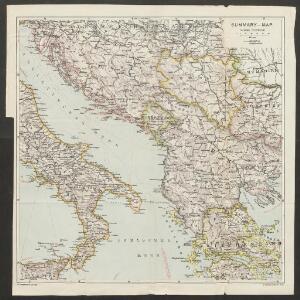
Maps of Balkan Pen.

Summary-map
1 : 2800000 Balkanhalbinsel Italien
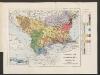
Types des villages
1 : 6000000 Balkanhalbinsel Südosteuropa Ländliche Siedlung
Formes de la propriété rurale
1 : 6000000 Balkanhalbinsel Südosteuropa Grundeigentum
Types des maisons
1 : 6000000 Balkanhalbinsel Südosteuropa Haus
[XVIII], uit: Geognostische Karte des Oesterreichischen Kaiserstaates mit einem grossen Theile Deutschland's u. Italien / hauptsachlich nach ... Haidinger's geognostischer Karte dieses Staates bearb. von Josef Scheda
1 : 3000000 titelvariant: General-Karte von Europa in 25 Blättern; Annotatie: Bijlage bij: General-Karte von Europa in 25 Blättern. - 1:2.592.000. - 1845-1847 Scheda, Joseph Wien : K.K. Militär. Geografisch. Institut
Die unterentwickelten Gemeinden in Jugoslwaien (schraffiert gekennzeichnet)
Jugoslawien Wirtschaftsentwicklung
Albanien mit Umgebung
Albanien Péch, Béla
Österreichisch-Ungarisch=Serbischer Kriegsschauplatz
Langhans, Paul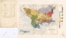
Ethnographische Karte von Europäischen Türkei...
Ethnographische Karte der europäischen Türkei und ihrer Dependenzen zu Anfang des Jahres 1877
Südosteuropa Ethnische Gruppe Sax, Carl
Carte de geographie des differents etats de la republique de Venise, l'abregé de son gouvernement politique et ecclesiastique, et les etats ou elle a porté la gloire de ses armes
1 : 4300000 Benátky-oblast (Itálie) Chatelain, Henri-Abraham Chatelain
Golfe de Venise
1 Karte : Kupferdruck ; 43 x 49 cm Aa Pieter van der Aa
Le golfe de Venise
1 Karte : Kupferdruck ; 51 x 58 cm Fer; Starckman chez l'auteur dans l'isle du Palais sur le quay de l'Orloge a la Sphere Royale
Partie Orientale De L'Italie qui comprend Les Royaumes De Naples Et De Sicile &c: [Karte] [südlicher Teil Siziliens] [Nebenkarte ], in: Atlas nouveau, contenant toutes les parties du monde [...], Bd. 2, S. 142.
1 Karte aus Atlas Sanson, Nicolas Jaillot, Alexis Hubert und Mortier, Pieter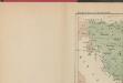
Les Serbes, les Croates et les Slovènes parmi les nations-voisines
Serbien Kroatien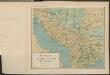
Le pays des Serbes, des Croates et des Slovenes
Jugoslawien Physische Geografie
Adriatischer Dienst inclusive Corfu u. Prevesa
Jaderské moře-oblast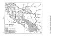
Historische Regionen des Königreichs SHS
Kraljevina Srba, Hrvata i Slovenaca Džambo, Jozo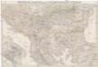
General-Karte von der europäischen Türkey
1 : 1000000 Bospor (Turecko : průliv) Kiepert, Heinrich Kratz, W. u. C. Dietrich Reimer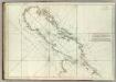
Carte De La Mer Mediterranee. VII.
Roux, Joseph
Artaria ́s Handkarte des Königreiches der Serben, Kroaten und Slovenen

Le Golfe de Venise :
1 : 180000 Mollova mapová sbírka Fer, Nicolas de Starckman, P. Danet, Guillaume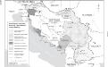
Besetzung und territoriale Aufteilung Jugoslawiens im Zweiten Weltkrieg
1 : 2500000 Jugoslawien Besetzung, Weltkrieg <1939-1945> Clewing, Konrad ; John, Holger W.
Karta srednej i južnoj Italīi
Italien Seeschlacht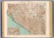
77-78. Jugoslavia.
1 : 1500000 Touring club italiano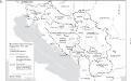
Staatenbildung im ehemaligen Jugoslawien, 1991 - 2008
1 : 2500000 Jugoslawien Auflösung, Staatenbildung Clewing, Konrad ; John, Holger W.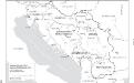
Jugoslawien nach dem Zweiten Weltkrieg (bis 1991) mit Republiken und Autonomen Provinzen
1 : 2500000 Jugoslawien Clewing, Konrad ; John, Holger W.
Generalkarte der Balkanhalbinsel
1 : 1580000 Balkánský poloostrov Handtke, Friedrich C. Flemming
Generalkarte der Balkanhalbinsel
1 : 1580000 Balkánský poloostrov Handtke, Friedrich C. Flemming