Maps of Baffin Island

[142][145] Septemtrionaliora Americae à Groenlandia, ..., uit: Atlas sive Descriptio terrarum orbis
Annotatie: Gedigitaliseerde versie. Amsterdam. Heiloo : Picturae (vervaardiger), 2015. tiff-bestand. Gedigitaliseerd: 07-01-2015; Origineel: Universiteitsbibliotheek Vrije Universiteit (XL.05127.-) ; Netherlands; Titelpagina ontbreekt Wit, Frederik de Amsterdam : Frederick de Wit
Septemtrionaliora Americæ à Groenlandia, per freta Davidis et Hudson, ad Terram Novam
1 Karte : Kupferdruck ; 48 x 55 cm Renard Louis Renard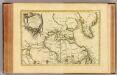
L'Amerique Septentrionale 1.
1 : 10050000 Bonne, Rigobert, 1727-1794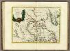
La Baja D'Hudson Terra di Labrador e Groenlandia.
1 : 9750000 Zatta, Antonio
Greenland, Labrador.
1 : 15000000 Peterson, Augusts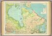
North-eastern Canada.
1 : 5000000 John Bartholomew and Son
Paskaert van de Noordelijckste kuste van America van Groenland door de Straet Davis en de Straet Hudson tot Terra Neuf
1 : 8000000 Colom, Jacob Aertsz Colom, Jacob Aertsz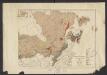
Geology. East sheet
1 : 6336000
Karten-Skizze des Treibeises bei Newfundland während der Zeit vom 11. März bis zum 5. Mai 1891, nach den Berichten, welche bis zum 20. Mai eingegangen sind
Newfoundland (Kanada : ostrov)
Karten-Skizze des Treibeises bei Newfundland während der Zeit von Anfang Mai bis Ende Juni, nach den Berichten, welche bis zum 8ten Juli eingegangen sind
Newfoundland (Kanada : ostrov)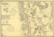
Fishing Chart. Greenland & the Davis Strait
Fishing Chart. Greenland & the Davis Strait. Compiled from the latest Danish information. Corrected to 29.11.1952. Chart no. 020. -- Insets: Approaches to Upernivik. Upernivik. Umanak. Godhavn, Jakobshavn, Holsteinsborg, Christianshaab, Holsteinsborg Havn. Approaches to Godthaabs Fjord. Disko Bay. Egedesminde Havn. Egedesminde. Sukkertoppen Havn. Approaches to Sukkertoppen. Godthaab & Skibshavn. Frederiskhaab. Frederikshaab Havn. Approach to Faeringerhavnen. Faeringerhavnen. Julianehaab. Approach to Julianehaab. Arsuk Fiord. St. Ives, Hunts : Imray, Laurie, Norie & Wilson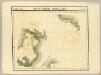
Decouvertes Boreales. Amer. Sep. 9.
1 : 1641836 Vandermaelen, Philippe, 1795-1869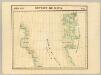
Detroit de Davis. Amer. Sep. 10.
1 : 1641836 Vandermaelen, Philippe, 1795-1869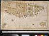
Oud Groenland van Staaten Hoek of C. Farawel tot de Visch Baij of Straet Davids int groot
Greenland Gerard van Keulen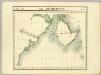
Ile Southampton. Amer. Sep. 17.
1 : 1641836 Vandermaelen, Philippe, 1795-1869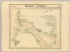
Detroit d'Hudson. Amer. Sep. 18.
1 : 1641836 Vandermaelen, Philippe, 1795-1869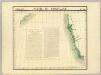
Partie du Groenland. Amer. Sep. 19.
1 : 1641836 Vandermaelen, Philippe, 1795-1869
A new map of the province of Quebec in North America, drawn from the best authorities
1 : 6500000
A Map of the British Empire in America. (Sheet 2).
1 : 2000000 Popple, Henry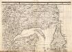
A Map of the British Empire in America. (Sheet 3).
1 : 2000000 Popple, Henry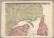
A Map of the British Empire in America. (Sheet 3).
1 : 2000000 Popple, Henry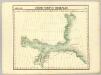
Decouvertes Boreales. Amer. Sep. 2.
1 : 1641836 Vandermaelen, Philippe, 1795-1869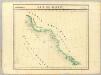
Baie de Baffin. Amer. Sep. 3.
1 : 1641836 Vandermaelen, Philippe, 1795-1869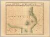
Partie, Nouvelle Bretagne. Amer. Sep. 27.
1 : 1641836 Vandermaelen, Philippe, 1795-1869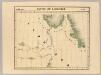
Partie du Labrador. Amer. Sep. 28.
1 : 1641836 Vandermaelen, Philippe, 1795-1869
Partie du Labrador. Amer. Sep. 29.
1 : 1641836 Vandermaelen, Philippe, 1795-1869
Cumberland Isle from the observations of Captain Penny
Cumberland Isle from the observations of Captain Penny, and from the ínformation of Enoolooapeck, an intelligent Esquimaux, 1839. [Admiralty Chart] [London]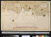
Afteekening van Oud Groenland in de Straet Davids
Greenland Bruijn, Ockkers & Groeneveld Gerard van Keulen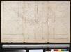
Een gedeelte van de Oostkust van Labrador
Canada Johannes van Keulen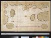
![[142][145] Septemtrionaliora Americae à Groenlandia, ..., uit: Atlas sive Descriptio terrarum orbis](https://images-2.georeferencer.com/images/iiif/573266003852/full/,300/0/native.jpg)

