Maps of Québec

Paskaert van de Noordelijckste kuste van America van Groenland door de Straet Davis en de Straet Hudson tot Terra Neuf
1 : 8000000 Colom, Jacob Aertsz Colom, Jacob Aertsz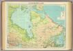
North-eastern Canada.
1 : 5000000 John Bartholomew and Son
A new map of the province of Quebec in North America, drawn from the best authorities
1 : 6500000
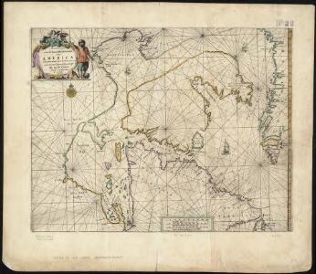
EXTREMA AMERICÆ | Versus Boream, ubi | TERRA NOVA | NOVA FRANCIA, Adjacentiaq.
Amstelaedami Io. Blaeu Exc.
188-189. Canada, East. The World Atlas.
1 : 5000000 USSR (Union of Soviet Socialist Republics).
Karten-Skizze des Treibeises bei Newfundland während der Zeit vom 11. März bis zum 5. Mai 1891, nach den Berichten, welche bis zum 20. Mai eingegangen sind
Newfoundland (Kanada : ostrov)
Karten-Skizze des Treibeises bei Newfundland während der Zeit von Anfang Mai bis Ende Juni, nach den Berichten, welche bis zum 8ten Juli eingegangen sind
Newfoundland (Kanada : ostrov)
Newfoundland &c.
1 : 3250000 Bowen, Emanuel
Partie orientale de la Nouvelle France ou du Canada avec l'isle de Terre-Neuve et de Nouvelle Escosse, Acadie et Nouv. Angleterre avec fleuve de St. Laurence
1 : 3500000 representé par T. Conr. Lotter dressé par Alb. Charl Seutter ; Tob. Conr. Lotter sc. Augsburg : T. C. Lotter
Canada Eastern.
1 : 5000000 Andree, Richard; Times (London, England)
British America.
1 : 10200000 Grigg, John
A General Map of the Northern British Colonies in America.
1 : 3700000 Robert Sayer and John Bennett (Firm)
A GENERAL MAP OF THE NORTHERN BRITISH COLONIES IN AMERICA
1 : 3800000 New Jersey Holland, Samuel
Ice Chart, Grand Banks Region, January.
U.S. Navy
Parte orientale de la Nouvelle France ou du Canada
1 : 3580000 Kanada východní Bellin, Jacques-Nicolas par les Heritiers de Homan
A general map of the northern British colonies in America: which comprehends the province of Quebec, the government of Newfoundland, Nova-Scotia, New-England and New-York / from the maps published by the Admiralty and Board of Trade, regulated by the astronomic and trigonometric observations of Major Holland, and corrected from Governor Pownall's late map 1776.
from Parts Samuel Holland,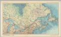
Canada - Ontario, Quebec, and Maritime Provinces. Pergamon World Atlas.
1 : 5000000 Polish Army Topography Service
A chart of the sea coast of New Foundland, New Scotland, New England, New York, New Jersey, with Virginia and Maryland.
from Charts and maps Sold by W & J Mount & T. Page on Tower Hill: London; Thornton, John,
A chart of the sea coast of New Foundland, New Scotland, New England, New York, New Jersey, with Virginia and Maryland.
from Whole Sold by Willm. Mount & Tho. Page at the Postern on Great Tower Hill: London,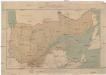
Carte de la province de Quebec
1 : 3120000 Québec (Québec) Rinfret, Gustave Taché, Eugene-Étienne The Canada Eng. & Litho.
Ice Chart, Grand Banks Region, February.
U.S. Navy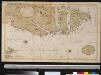
Oud Groenland van Staaten Hoek of C. Farawel tot de Visch Baij of Straet Davids int groot
Greenland Gerard van Keulen
Grand Banks Region, Index Chart for Ice Data Tables
U.S. Navy
Map of the European and North American Railway : showing its connection with the railways of the United States & Canada
1 : 1625000 Morton, A. C., engineer Bowen & Co.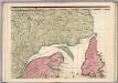
A Map of the British Empire in America. (Sheet 3).
1 : 2000000 Popple, Henry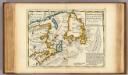
New Found Land, St. Laurence Bay, Acadia, New Scotland.
1 : 4800000 Moll, Herman, d. 1732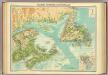
Maritime Provinces & Newfoundland.
1 : 2500000 John Bartholomew & Co.
A new & correct map of the Isles of New Foundland, Cape Breton &c. with the provinces of Nova Scotia / J. Gibson sculp.
1 : 4000000 Annotatie: Uit: The American gazetteer ... - London : A. Millar ; [etc.], 1762 Gibson, John (fl. 1762) [London : A. Millar] [etc.]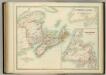
Eastern Canada.
1 : 2065500 Johnston, W. & A.K.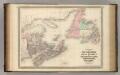
New Brunswick and Nova Scotia.
1 : 2300000 Johnson, A.J.