Maps of Les Laurentides

British America.
1 : 10200000 Grigg, John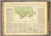
Possessions anglaises.
1 : 4700000 Buchon, J. A. C.; Carey, H. C.; Lea, I.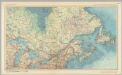
Canada - Ontario, Quebec, and Maritime Provinces. Pergamon World Atlas.
1 : 5000000 Polish Army Topography Service
Canada.
1 : 11088000 Lucas, Fielding Jr.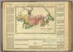
Map Of Upper And Lower Canada.
1 : 2217600 Lea, I.
188-189. Canada, East. The World Atlas.
1 : 5000000 USSR (Union of Soviet Socialist Republics).
British Provinces of North America.
1 : 10000000 Cornell, S. S. (Sarah S.)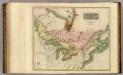
Canada, Nova Scotia.
1 : 4800000 Thomson, John
A General Map of the Northern British Colonies in America.
1 : 3700000 Robert Sayer and John Bennett (Firm)
Canada, N.B., N.S.
1 : 5100000 Hall, S. (Sidney)
A map of the northern and middle states

Map of the Northern and Middle States.
1 : 6950000 Morse, Jedidiah
Canada.
1 : 8870400 Finley, Anthony
(Vereinigte Staate)n v. Nordamerika II.
1 : 8000000 Berghaus, Heinrich; Flemming, Carl; Sohr, Karl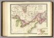
Canada, New Brusnwick, and Nova Scotia.
1 : 6600000 Teesdale, Henry
Map of the Northern and Middle States.
1 : 6900000 Morse, Jedidiah
A general map of the northern British colonies in America: which comprehends the province of Quebec, the government of Newfoundland, Nova-Scotia, New-England and New-York / from the maps published by the Admiralty and Board of Trade, regulated by the astronomic and trigonometric observations of Major Holland, and corrected from Governor Pownall's late map 1776.
from Parts Samuel Holland,
A GENERAL MAP OF THE NORTHERN BRITISH COLONIES IN AMERICA
1 : 3800000 New Jersey Holland, Samuel
A New and correct map of the British colonies in North America comprehending eastern Canada with the province of Quebec, New Brunswick, Nova Scotia, and the Government of Newfoundland: with the adjacent states of New England, Vermont, New York, Pennsylvania and New Jersey.
from Charts and maps Publish'd by Laurie & Whittle, 53 Fleet Street: London; Robert Laurie and James Whittle,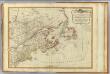
British colonies North America, New England.
1 : 3800000 Robert Laurie & James Whittle
A New and correct map of the British colonies in North America comprehending eastern Canada with the province of Quebec, New Brunswick, Nova Scotia, and the Government of Newfoundland: with the adjacent states of New England, Vermont, New York, Pennsylvania and New Jersey.
from John H. Levine Collection Publish'd by Laurie & Whittle, 53 Fleet Street: London; Robert Laurie and James Whittle,
British Provinces in Canada.
1 : 7247550 Fisher, Richard Swainson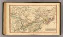
Canada.
1 : 11000000 Fenner, Rest.
Map of the Seat of War in North America.
1 : 4118400 Melish, John
Map of the Seat of War in North America.
1 : 4118400 Melish, John
Canada.
1 : 9000000 Finley, Anthony
N. section U.S.
1 : 4200000 Melish, John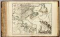
Nouvelle France ou le Canada.
1 : 4000000 Robert de Vaugondy, Gilles, 1688-1766
Canada.
1 : 9000000 Tanner, Henry S.


