Mappa catalogata
A general map of the northern British colonies in America: which comprehends the province of Quebec, the government of Newfoundland, Nova-Scotia, New-England and New-York / from the maps published by the Admiralty and Board of Trade, regulated by the astronomic and trigonometric observations of Major Holland, and corrected from Governor Pownall's late map 1776.

Titolo completo:A general map of the northern British colonies in America: which comprehends the province of Quebec, the government of Newfoundland, Nova-Scotia, New-England and New-York / from the maps published by the Admiralty and Board of Trade, regulated by the astronomic and trigonometric observations of Major Holland, and corrected from Governor Pownall's late map 1776.
Anno di illustrazione:1776
Dimensione fisica:20 x 30 cm
A new map of the province of Quebec in North America, drawn from the best authorities
1764
1:7m

Atlas Ameriquain Septentrional Contenant, mapa ze strany: [12]
1778
Chez le Rouge, Ingenieur Géographe du Roi, Rue des grands Augustins
Carte de la Province de Québec, Canada ; pour accompagner la brochure intitulée "La Province de Québec et l'Émigration européenne" = Map of the province of Quebec, Canada ; to accompany the pamphlet entitled "the province of Quebec and european emigration"
1870
Québec (province). Département des terres de la Couronne
1:2m
Paskaert van de Noordelijckste kuste van America van Groenland door de Straet Davis en de Straet Hudson tot Terra Neuf
1668
Colom, Jacob Aertsz
1:8m
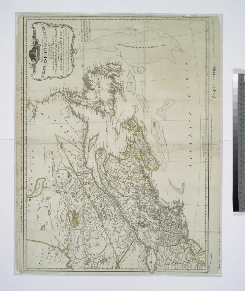
A general map of the northern British colonies in America: which comprehends the province of Quebec, the government of Newfoundland, Nova-Scotia, New-England and New-York / from the maps published by the Admiralty and Board of Trade, regulated by the astronomic and trigonometric observations of Major Holland, and corrected from Governor Pownall's late map 1776.
1776
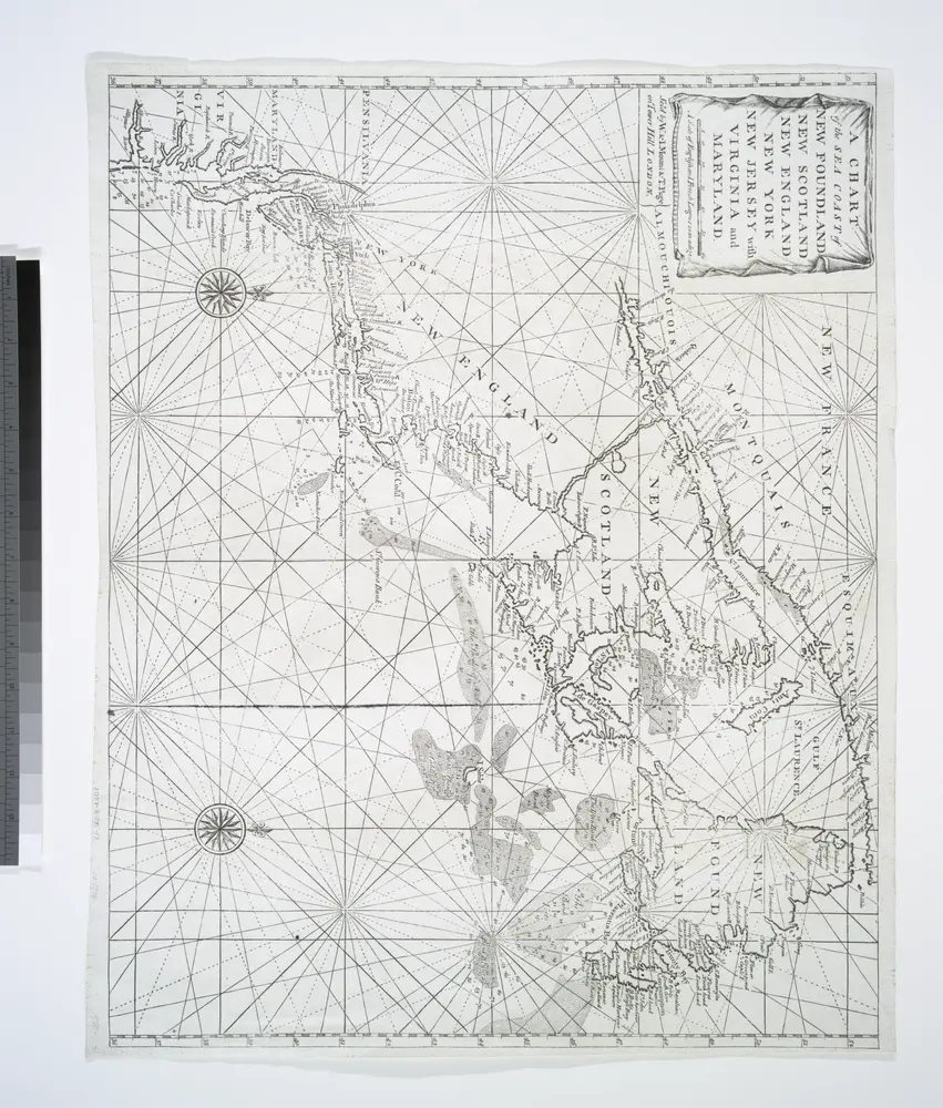
A chart of the sea coast of New Foundland, New Scotland, New England, New York, New Jersey, with Virginia and Maryland.
1770
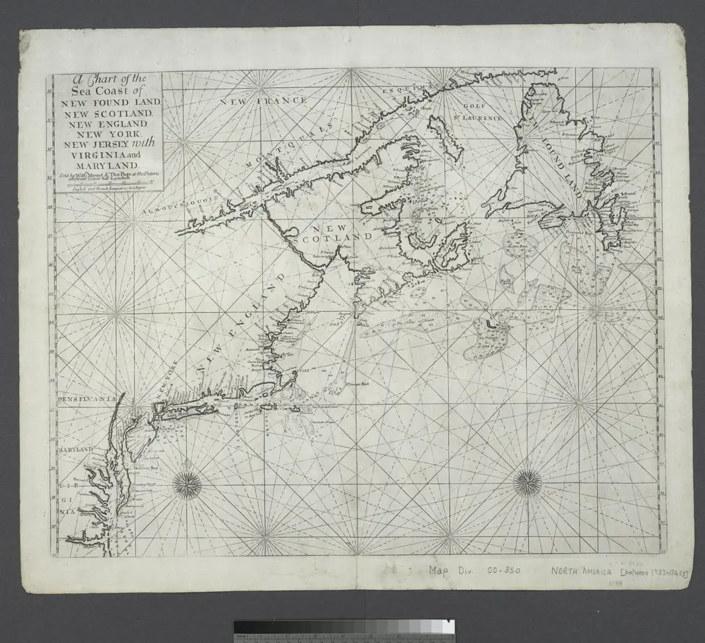
A chart of the sea coast of New Foundland, New Scotland, New England, New York, New Jersey, with Virginia and Maryland.
1745

Atlas Ameriquain Septentrional Contenant, mapa ze strany: [13]
1778
Chez le Rouge, Ingenieur Géographe du Roi, Rue des grands Augustins
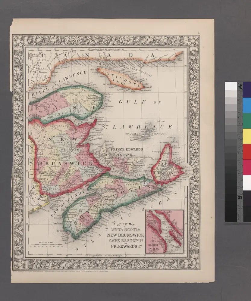
County map of Nova Scotia, New Brunswick, Cape Breton, and Prince Edward's Islands; City and harbor of Halifax [inset].
1860
Map of the European and North American Railway : showing its connection with the railways of the United States & Canada
1850
Morton, A. C., engineer
1:2m