Maps of Aveyron

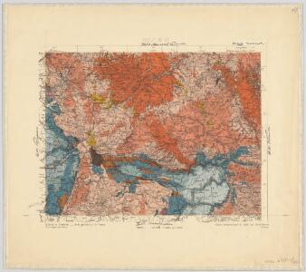
34) XI.N.E. ''Aurillac'', uit: Carte géologique de France
1 : 500000 Annotatie: Voor aanwezige bladen zie bladoverzicht [S.l : s.n.]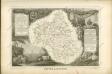

Dept. De L'Aveyron.
1 : 585000 Levasseur, Victor.
Département du Cantal
1 Karte : Kupferdruck ; 33 x 39 cm Capitaine s.n.
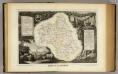
Département du Cantal
1 Karte : Kupferdruck ; 48 x 48 cm Houdan; Dumez chez Dumez directeur de l'atlas national rue de la Harpe n.o 26, et au dépôt du cet atlas placé au cabinet bibliographique rue de la Monnoye n.o 5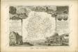


Dept. De La Lozere.
1 : 573000 Levasseur, Victor.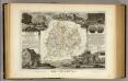
Dept. Du Cantal.
1 : 563000 Levasseur, Victor.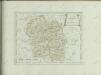

Département de la Lozere
1 Karte : Kupferdruck ; 49 x 48 cm Houdan; Dumez chez Dumez directeur de l'atlas national rue de la Harpe no. 26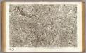
55 Mende.
1 : 86400 Cassini family; Cassini, Cesar-Francois, 1714-1784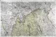
[Saint-Flour]
1 Blatt : 56 x 89 cm s.n.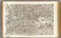
16 Rodez.
1 : 86400 Cassini family; Cassini, Cesar-Francois, 1714-1784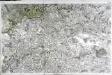
[Rodez]
1 Blatt : 56 x 89 cm s.n.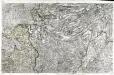
[Aurillac]
1 Blatt : 56 x 89 cm s.n.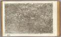
15 Aurillac.
1 : 86400 Cassini family; Cassini, Cesar-Francois, 1714-1784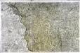
[Mende]
1 Blatt : 56 x 89 cm s.n.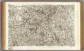
54 Saint-Flour.
1 : 86400 Cassini family; Cassini, Cesar-Francois, 1714-1784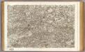
17 Albi.
1 : 86400 Cassini family; Cassini, Cesar-Francois, 1714-1784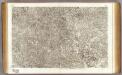
35 Sarlat.
1 : 86400 Cassini family; Cassini, Cesar-Francois, 1714-1784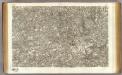
36 Cahors.
1 : 86400 Cassini family; Cassini, Cesar-Francois, 1714-1784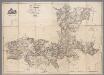
Carte topographique du Canton de St. Antonin, Arrond.t de Montauban, Département de Tarn-et-Garonne / par Aubry
1 : 30000 Aubry, ... [S.l. : s.n.]
Govverneme[n]t de Milhau
1 Karte : Kupferdruck ; 11 x 15 cm Sebastian Cramoisy
Partie orientale du gouvernement général de la Guienne
1 Karte : Kupferdruck ; 47 x 50 cm Robert de Vaugondy G. et D. Robert de Vaugondy
Le comte de Perigort
1 Karte : Kupferdruck ; 35 x 48 cm Janssonius apud Ioannem Ianssonium
La partie septentrionale du Languedoc
1 : 780000 Languedoc (Francie) Schenk, Pieter P. Schenk, et G. Valk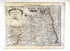
La partie septentrionale du Languedoc
1 Karte : Kupferdruck ; 17 x 24 cm Mercator Cloppenburgh