Maps of Gorges du Tarn Causses
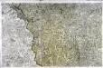
[Mende]
1 Blatt : 56 x 89 cm s.n.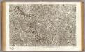
55 Mende.
1 : 86400 Cassini family; Cassini, Cesar-Francois, 1714-1784

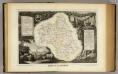
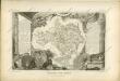
Dept. De La Lozere.
1 : 573000 Levasseur, Victor.
Le Theatre de Bellone :
Mollova mapová sbírka Schenk, Pieter Braakman, Adriaan
34) XI.N.E. ''Aurillac'', uit: Carte géologique de France
1 : 500000 Annotatie: Voor aanwezige bladen zie bladoverzicht [S.l : s.n.]

Carte dv hault La[n]guedoc
1 Karte : Kupferdruck ; 11 x 15 cm Sebastian Cramoisy
Partie orientale du gouvernement général de la Guienne
1 Karte : Kupferdruck ; 47 x 50 cm Robert de Vaugondy G. et D. Robert de Vaugondy
Gouvernement general de Languedoc qui comprend deux generalitéz sçavoir la generalité de Toulouse et celle de Montpellier, 2
1 Blatt : 79 x 48 cm Jaillot
Gouvernement general de Languedoc qui comprend deux generalitéz sçavoir la generalité de Toulouse et celle de Montpellier, 2
1 Blatt : 81 x 49 cm Jaillot
Le comte de Perigort
1 Karte : Kupferdruck ; 35 x 48 cm Janssonius apud Ioannem Ianssonium
[Languedoc]
Languedoc (Francie) Valk, Gerhard G. Valk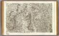
51 Gannat, St. Pourcain.
1 : 86400 Cassini family; Cassini, Cesar-Francois, 1714-1784
Partie orientale du gouvernement general de Languedoc
1 Karte : Kupferdruck ; 58 x 46 cm Fer; Starckman; Bénard chez Benard dans l'isle du Palais a la sphere royale
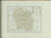
Département de la Lozere
1 Karte : Kupferdruck ; 49 x 48 cm Houdan; Dumez chez Dumez directeur de l'atlas national rue de la Harpe no. 26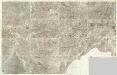
Composite 15: Carte de France.
1 : 86400 Cassini family; Cassini, Cesar-Francois, 1714-1784
Carte dv Languedoc
1 Karte : Kupferdruck ; 11 x 15 cm Sebastian Cramoisy
Partie occidentale du Languedoc
1 Karte : Kupferdruck ; 11 x 15 cm Sebastian Cramoisy
Le theatre de la guerre dans les Sevennes
1 Karte : Kupferdruck ; 58 x 49 cm Danckerts uyt gegeven door Cornelis Danckerts op de nieuwendyck in den atlas
Cemeniorum ager et montana in parte Languedociæ inferiori
1 Karte auf 2 Blatt : Kupferdruck ; 69 x 57 cm Valck Gerard Valck
Département de l'Ardeche
1 Karte : Kupferdruck ; 49 x 48 cm Houdan; Dumez chez Dumez directeur de l'atlas national rue de la Harpe no. 26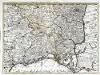
Partie des Sevennes, et le bas Vivarais, le diocese de Monpelliers, et de Nismes [et]c
1 Karte : Kupferdruck ; 42 x 57 cm chez I. Cóvens et C. Mortier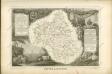

Dept. De L'Aveyron.
1 : 585000 Levasseur, Victor.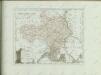

Département du Cantal
1 Karte : Kupferdruck ; 33 x 39 cm Capitaine s.n.
![[Mende]](http://biblio.unibe.ch/web-apps/maps/zoomify.php?pic=Ryh_2305_15.jpg&col=ryh)

