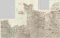
Maps of Normandy

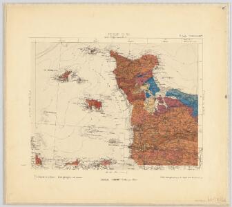
8) IV. N.E. ''Cherbourg'', uit: Carte géologique de France
1 : 500000 Annotatie: Voor aanwezige bladen zie bladoverzicht [S.l : s.n.]
Britanniae, et Normandiae Typus. 1594. Neustria. [Karte], in: Theatrum orbis terrarum, S. 67.
1 Karte aus Atlas Ortelius, Abraham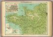
France - north-western section, environs of Paris.
1 : 1000000 John Bartholomew & Co.
Frankreich In 4 Blattern, Blatt 1.
1 : 1500000 Vogel, C.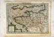
Breta[n]nia et Normandia cum confinijs
1 Karte : Kupferdruck ; 17 x 24 cm Mercator Cloppenburgh
Britanniae, et Normandiae Typus. 1594. Neustria. [Karte], in: Theatrum orbis terrarum, S. 114.
1 Karte aus Atlas Ortelius, Abraham Vrients, Jan Baptista
France
Carte de la France, 1
1 Blatt : 61 x 83 cm de Belleyme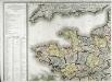
Carte de la France, 1
1 Blatt : 61 x 82 cm de Belleyme
France Flle. N.O.
1 : 1000000 Vivien St Martin, L.
Postkarte von Frankreichs norwestlichen Departements oder der Normandie und Bretagne
Bretaň (Francie) Müller, Franz im von Reillyschen Landkarten und Kunstwerke Verschleiss Komptoir
Carte de la France (NO)
1 : 345600 Cassini family
Karte von Frankreich in XVI Blättern, No. 2 und [No. 6]
2 Blätter : 52 x 34 cm Königl. Preuss. Academischen Kunst und Buchhandlung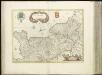
[16][16] Normandia Ducatus, uit: Atlas sive Descriptio terrarum orbis
Annotatie: Gedigitaliseerde versie. Amsterdam. Heiloo : Picturae (vervaardiger), 2015. tiff-bestand. Gedigitaliseerd: 07-01-2015; Origineel: Universiteitsbibliotheek Vrije Universiteit (XL.05127.-) ; Netherlands; Titelpagina ontbreekt Wit, Frederik de Amsterdam : Frederick de Wit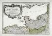
Premiere feuille contenant la Bretagne, la Normandie, le Maine et perche
1 Blatt : 39 x 56 cm Bourgoin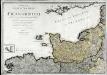
Neueste Generalkarte von Frankreich, 1
1 Blatt : 54 x 77 cm F.A. Schrämbl
Le gouvernement de Normandie & une partie de l'Isle de France d'Orléanois & de Bretagne
1 : 540000 A Amsterdam : chez Joachim Ottens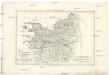
Gouvernement de Normandie, et celui Maine-Perche
1 : 5920000 Maine (Francie) Bonne, Rigobert André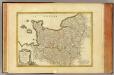
Normandie, Maine, Perche.
1 : 930000 Bonne, Rigobert, 1727-1794
Carte du gouvernement de Normandie avec celui du Maine et Perche
1 Karte : Kupferdruck ; 42 x 57 cm Bonne; Santini; Remondini chez Mr. Remondini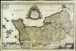
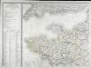
Le Duché et gouvernement de Normandie
1 Karte : Kupferdruck ; 55 x 87 cm Sanson; Jaillot chez H. Iaillot au deux Globes
Li governi di Normandia del Maine, e Perche
1 Karte : Kupferdruck ; 29 x 39 cm Zatta; Zuliani presso Antonio Zatta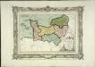
Carte des départemens de la Manche, du Calvados, de l'Orne, de l'Eure et de la Seine inférieure
1 Karte : Kupferdruck ; 22 x 32 cm, Bildgrösse 32 x 42 cm Brion de la Tour; Desnos chez le S. Desnos rue St. Jacques au globe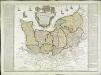
Carte de la province de Normandie qui comprend les gouvernements militaires de Normandie et du Havre de Grace
1 Karte : Kupferdruck ; 45 x 50 cm Nolin; Basset; Basset chez Basset rue St. Jacques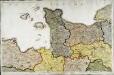
Carte de la France, no. 4
1 Blatt : 61 x 92 cm s.n.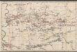
Le Duché et Gouvernement De Normandie divisée en Haute et Basse Normandie [...] [Karte], in: Atlas nouveau, contenant toutes les parties du monde [...], Bd. 1, S. 117.
1 Karte aus Atlas Sanson, Nicolas Jaillot, Alexis Hubert und Mortier, Pieter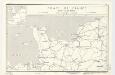
Coast of France : Dieppe to St. Brieuc
1 : 885000 Provisional ed. Inset: [Location map]. Shows main roads and railroads. Dated: 12 June 1944. United States. Office of Strategic Services. Research and Analysis Branch [Washington, D.C.] : R & A, OSS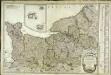
Carte du gouvernement de Normandie
1 Karte : Kupferdruck ; 47 x 64 cm Robert de Vaugondy; Fortin chés Fortin mécanicien du roy rue de la Harpe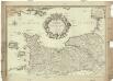
Le gouvernement general de Normandie, divisé en Haute et Basse
1 : 600000 Normandie (Francie) Fer, Nicolas de Danet, Guillaume Danet