Maps of West Indies

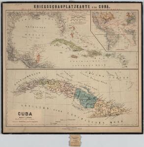
Kriegsschauplatzkarte von Cuba : Mittel-Amerika, Spanien und die Vereinigten-Staaten ; Cuba
1 : 8000000 Annotatie geografische gegevens: Toont bezittingen van Europese zeemachten; Inzet: [Transatlantische afstandenkaart] Berlin : Reimer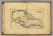
West Indies.
1 : 16000000 Seaman, James V.
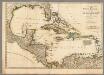
A new and correct general chart of the West Indies including the Gulf of Mexico & Bay of Honduras &c.
1 : 3900000 Heather, W. (William) Heather, W. (William)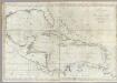
A new general chart of the West Indies.
1 : 4500000 Norman, William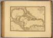
Iles Antilles, Etats-Unis de l'Amerique Centrale, Mer du Mexique.
1 : 8000000 Picquet, C.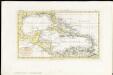
Indie Occidentali
1 : 15000000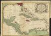
A new & accurate map of the West Indies and the adjacent parts of North & South America
1 : 10500000
Carte Particuliere des Antilles du Golfe du Mexique avec l'Isthme de Panama.
1 : 12700000 Vivien de St Martin, L.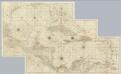
Composite: West Indies.
1 : 1560000 Jefferys, Thomas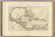
An index map to ...a compleat chart of the West Indies.
1 : 7800000 Jefferys, Thomas
Chart of the West Indies.
1 : 11750000 Carey, Mathew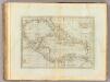
Chart of the West Indies.
1 : 11750000 Carey, Mathew
Chart of the West Indies.
1 : 11000000 Carey, Mathew
Chart of the West Indies.
1 : 11750000 Carey, Mathew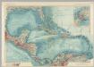
Central America and the West Indies. Pergamon World Atlas.
1 : 7500000 Polish Army Topography Service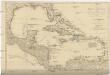
A COMPLEAT MAP OF THE WEST INDIES
1 : 9000000 Florida Dunn, Samuel
West India islands
1 : 1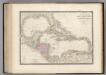
Golfe de Mexique, Iles Antilles, l'Amerique Centrale.
1 : 8000000 Levasseur, E.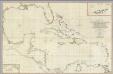
A General Chart of the West Indies And Gulf Of Mexico.
1 : 2100000 Dessiou, J. Foss
Insulae Americanae, nempe Cuba, Hispaniola Iamaica, Pto. Rico, Lucania, Antillae vulgo Caribae, Barlo-Et Sotto-Vento etc
1 : 6500000 Danckerts, Cornelis, 1664-1717 C. Danckerts, Cum Privilegio
[West-Indien und Centro-America, nebst dem Meerbusen von Mexico]
Schul-Atlas über alle Theile der Erde nach dem neuesten Zustande, und über das Weltgebäude Stieler, Adolf bei Justus Perthes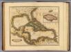
West India Islands.
1 : 13400000 Lizars, Daniel
Mittel-America und Westindien
1 : 8000000
[Central-Amerika und Westindien]
Geographischer Atlas über alle Theile der Erde Ziegler, Jakob Melchior Verlag von Dietrich Reimer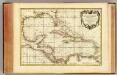
Golfe du Mexique.
1 : 10000000 Rizzi Zannoni, Giovanni Antonio Bartolomeo, 1736-1814
West India Islands.
1 : 14500000 Darton, William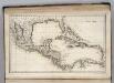
West Indies.
1 : 12500000 Carey, Mathew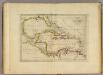
Chart of the West Indies.
1 : 11750000 Carey, Mathew