Maps of Saint-Dié-des-Vosges

176. Markirch, uit: Topographische Uebersichtskarte des Deutschen Reiches / herausgegeben v. d. Kartogr. Abt. d. Königl. Preuß. Landesaufnahme
1 : 200000 titelvariant: Topogr. Übersichtskarte des Deutschen Reiches; Annotatie: Titel boven bladen ook: Topogr. Übersichtskarte des Deutschen Reiches; Annotatie geografische gegevens: Op elk blad twee maatstokken: 10 Kilometer = 5,5 cm; 1 geogr. Meile = 3,6 cm; Legenda onder op elk blad Königlich Preußische Landesaufnahme. Kartographische Abtheilung [S.l : Königlich Preußische Landesaufnahme, Kartographische Abtheilung]
143 Mirecourt, Epinal.
1 : 86400 Cassini family; Cassini, Cesar-Francois, 1714-1784
[Mirecourt - Epinal]
1 Blatt : 60 x 92 cm s.n.
Le Flambeau de la Guerre Allumee au Rhin
Mollova mapová sbírka Delisle, Guillaume Schenk, Peter II
Blatt XI: Oberes Breuschthal, uit: Karte der Vogesen / herausgegeben vom Central-Ausschuss des Vogesen-Clubs ; bearbeitet im kartographischen Institut von Carl Flemming in Glogau
1 : 500000 Annotatie: Bladwijzer op omslag; Annotatie geografische gegevens: Legenda Vogesen-Club. Central-Ausschuss Strassburg : in Kommission bei J.H. Ed. Heitz (Heitz & Mündel)
Meßtischblatt 3660 : Münster (Im Elsass), 1886
1 : 250000 Münster (Im Elsass). - Aufn. 1884. - 1:25000. - [Berlin]: Reichsamt für Landesaufnahme, 1886. - 1 Kt.
Meßtischblatt 3652 : Rappoltsweiler, 1913
1 : 250000 Rappoltsweiler. - Aufn. 1884, . - 1:25000. - [Berlin]: Reichsamt für Landesaufnahme, [1913]. - 1 Kt.
Meßtischblatt 3651 : Urbeis, 1913
1 : 250000 Urbeis. - [Aufn. 18849. - 1:25000. - [Berlin]: Reichsamt für Landesaufnahme, [1913]. - 1 Kt.
Meßtischblatt 3651 : Urbeis, 1886
1 : 250000 Urbeis. - Aufn. 1884. - 1:25000. - [Berlin]: Reichsamt für Landesaufnahme, 1886. - 1 Kt.
Meßtischblatt 3652 : Rappoltsweiler, 1886
1 : 250000 Rappoltsweiler. - Aufn. 1884. - 1:25000. - [Berlin]: Reichsamt für Landesaufnahme, 1886. - 1 Kt.
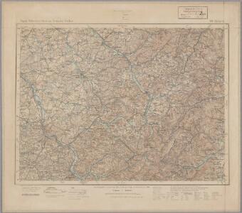
Meßtischblatt 3644 : Markirch, 1886
1 : 250000 Markirch. - Aufn. 1884. - 1:25000. - [Berlin]: Reichsamt für Landesaufnahme, 1886. - 1 Kt.
Meßtischblatt 3643 : Eckerich, 1914
1 : 250000 Eckerich. - Aufn. 1884, hrsg. 1885, Aufl.-dr. 1914. - 1:25000. - [Berlin]: Reichsamt für Landesaufnahme, 1914. - 1 Kt.
Meßtischblatt 3634 : Weiler, 1913
1 : 250000 Weiler. - Aufn. 1883, hrsg. 1885, gedr. [19]13. - 1:25000. - [Berlin]: Reichsamt für Landesaufnahme, 1913. - 1 Kt.
Meßtischblatt 3634 : Weiler, 1885
1 : 250000 Weiler. - Aufn. 1883. - 1:25000. - [Berlin]: Reichsamt für Landesaufnahme, 1885. - 1 Kt.
Meßtischblatt 3625 : Blen, 1916
1 : 250000 Blen. - Aufn. 1883, hrsg. 1885, B. 09, N. 13, Aufldr. 1916. - 1:25000. - [Berlin]: Reichsamt für Landesaufnahme, 1916. - 1 Kt.
Meßtischblatt [7509] : Schirmeck, 1885
1 : 250000 Schirmeck. - 1:25000. - [Berlin]: Reichsamt für Landesaufnahme, 1885. - 1 Kt.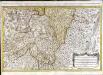
Les prevotez, offices, senéchaussée et comté, qui font partie des balliages de Vosge ou Mirecour et de Nancy
1 Karte : Kupferdruck ; 43 x 68 cm Jaillot Alexis-Hubert Jaillot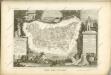

Lorraine, Vers Le Midy. [Karte], in: Novus atlas absolutissimus, Bd. 4, S. 91.
1 Karte aus Atlas Janssonius Offizin
[Lothringen, südlicher Teil] [Karte], in: Gerardi Mercatoris Atlas, sive, Cosmographicae meditationes de fabrica mundi et fabricati figura, S. 252.
1 Karte aus Atlas Mercator, Gerhard Montanus, Petrus
Lorraine, Vers Le Midy. [Karte], in: Gerardi Mercatoris et I. Hondii Newer Atlas, oder, Grosses Weltbuch, Bd. 2, S. 47.
1 Karte aus Atlas Mercator, Gerhard und Hondius, Jodocus Jansson, Jan
[Lothringen, südlicher Teil]
1 Karte : Kupferdruck ; 35 x 46 cm Mercator; Hondius Henricus Hondius
[Lothringen, südlicher Teil]
1 Karte : Kupferdruck ; 35 x 46 cm Mercator; Hondius Jodocus Hondius
[Lothringen, südlicher Teil]
1 Karte : Kupferdruck ; 34 x 46 cm Mercator s.n.
Colmar 140, uit: Special-Karte von Mittel-Europa / nach amtlichen Quellen bearbeitet von W. Liebenow
1 : 300000 titelvariant: W. Liebenow's Mittel-Europa; Annotatie: Titel boven de bladen: W. Liebenow's Mittel-Europa Johannes Wilhelm Liebenow 1822-1897 Frankfurt a. M. : Ludwig Ravenstein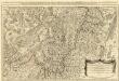
Les Prevotez Offices Senéchaussée, et Comté, qui font Partie de Balliages de Vosge ou Mirecour et de Nancy, dans le Duché Lorraine les Terres Adjacentes d'Épinal, de Chaté &c. :
1 : 180000 Mollova mapová sbírka Jaillot, Alexis-Hubert Jaillot, Alexis Hubert
La partie meridionale de Lorraine
1 : 1
[Atlas départemental : La France et ses colonies] No. 85 Vosges
1 : 670000 publ. par Michel fils ainé [dressé par A. Lorrain, et gravé par H. Dandeleux] Versailles [etc.] : Barreswil et Andrieux
Département des Vosges
1 : 265000 Vosges (Francie) Houdan, François d' P. G. Chanlaire