Maps of Kreis Paderborn

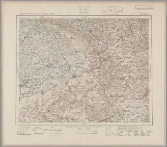
98. Detmold, uit: Topographische Uebersichtskarte des Deutschen Reiches / herausgegeben v. d. Kartogr. Abt. d. Königl. Preuß. Landesaufnahme
1 : 200000 titelvariant: Topogr. Übersichtskarte des Deutschen Reiches; Annotatie: Titel boven bladen ook: Topogr. Übersichtskarte des Deutschen Reiches; Annotatie geografische gegevens: Op elk blad twee maatstokken: 10 Kilometer = 5,5 cm; 1 geogr. Meile = 3,6 cm; Legenda onder op elk blad Königlich Preußische Landesaufnahme. Kartographische Abtheilung [S.l : Königlich Preußische Landesaufnahme, Kartographische Abtheilung]
Episcopatvs Paderbornensis descriptio nova
1 : 230000 Mollova mapová sbírka Gigas, Johann Michael Schenk, Peter I
Paderbornensis Episcopatus Descriptio Nova
1 : 220000 Mollova mapová sbírka Gigas, Johann Michael Blaeu, Willem Jansz.
Paderbornensis Episcopatus Descriptio Nova
1 : 220000 Mollova mapová sbírka Gigas, Johann Michael
Paderbornensis Episcopatus Descriptio Nova
1 : 220000 Mollova mapová sbírka Gigas, Johann Michael
PADERBORNENSIS | Episcopatus | DESCRIPTIO NOVA
Ioanne Gigante Ludense D. Med. et Math. auth. Amstelodami Judocus Hondius excudit
Tableau Topographique Qui comprend la Partie Septentrionale du Landgraviat de Hesse Cassel et de la Principauté de Waldeck, l'Eveché de Paderborn, Partie du Comté de Grubenhague et les Frontieres de ces Etats]
1 : 130000 Mollova mapová sbírka Julien, Roch-Joseph Julien, Roch Joseph
332. Gutersloh.
1 : 100000 Reichsamt fur Landesaufnahme
Composite: 333. Detmold.
1 : 100000 Reichsamt fur Landesaufnahme
333. Detmold.
1 : 100000 Reichsamt fur Landesaufnahme
Composite: 332. Gutersloh.
1 : 100000 Reichsamt fur Landesaufnahme
Meßtischblatt 2516 : Borgentreich, 1932
1 : 250000 Borgentreich. - Hrsg. 1898, bericht. 1907, einz. Nachtr. 1932. - 1:25000. - [Berlin]: Reichsamt für Landesaufnahme, 1932. - 1 Kt.
Meßtischblatt 2516 : Borgentreich, 1907
1 : 250000 Borgentreich. - Aufn. 1896, hrsg. 1898, bericht. 1907. - 1:25000. - [Berlin]: Reichsamt für Landesaufnahme, 1907. - 1 Kt.
Meßtischblatt Borgentreich
1 : 250000 Borgentreich. - Aufn. 1896. - 1:25000. - [Berlin]: Reichsamt für Landesaufnahme, 1898. - 1 Kt.
Meßtischblatt Peckelsheim
1 : 250000 Peckelsheim. - Aufn. 1896, bericht. 1937, gedr. 1945. - 1:25000. - [Berlin]: Reichsamt für Landesaufnahme, 1945. - 1 Kt.
Meßtischblatt Kleinenberg
1 : 250000 Kleinenberg. - Aufn. 1896. - 1:25000. - [Berlin]: Reichsamt für Landesaufnahme, 1898. - 1 Kt.
Meßtischblatt 2513 : Fürstenberg in Westfalen, 1932
1 : 250000 Fürstenberg in Westfalen. - Hrsg. 1896, einz. Nachtr. 1932. - 1:25000. - [Berlin]: Reichsamt für Landesaufnahme, 1932. - 1 Kt.
Meßtischblatt Fürstenberg in Westfalen
1 : 250000 Fürstenberg in Westfalen. - Aufn. 1894. - 1:25000. - [Berlin]: Reichsamt für Landesaufnahme, 1896. - 1 Kt.
Meßtischblatt 2512 : Büren, 1932
1 : 250000 Büren. - Hrsg. 1896, einz. Nachtr. 1932. - 1:25000. - [Berlin]: Reichsamt für Landesaufnahme, 1932. - 1 Kt.
Meßtischblatt 2512 : Büren, 1896
1 : 250000 Büren. - Aufn. 1894. - 1:25000. - [Berlin]: Reichsamt für Landesaufnahme, 1896. - 1 Kt.
Meßtischblatt 2511 : Effeln, 1932
1 : 250000 Effeln. - Hrsg. 1896, einz. Nachtr. 1932. - 1:25000. - [Berlin]: Reichsamt für Landesaufnahme, 1932. - 1 Kt.
Meßtischblatt 2443 : Borgholz, 1898
1 : 250000 Borgholz. - Aufn. 1896. - 1:25000. - [Berlin]: Reichsamt für Landesaufnahme, 1898. - 1 Kt.
Meßtischblatt 4320 : Willebadessen, 1945
1 : 250000 Willebadessen. - Stand 1937. - 1:25000. - [Berlin]: Reichsamt für Landesaufnahme, 1945. - 1 Kt.
Meßtischblatt 2441 : Lichtenau, 1898
1 : 250000 Lichtenau. - Aufn. 1896. - 1:25000. - [Berlin]: Reichsamt für Landesaufnahme, 1898. - 1 Kt.
Meßtischblatt 2440, neue Nr. 4318 : Etteln, 1937
1 : 250000 Etteln. - Hrsg. 1897, einz. Nachtr. 1937. - 1:25000. - [Berlin]: Reichsamt für Landesaufnahme, 1937. - 1 Kt.
Meßtischblatt 2439 : Geseke, 1937
1 : 250000 Geseke. - Hrsg. 1896, einz. Nachtr. 1937. - 1:25000. - [Berlin]: Reichsamt für Landesaufnahme, 1937. - 1 Kt.
Meßtischblatt 2438 : Lippstadt, 1932
1 : 250000 Lippstadt. - Hrsg. 1897, einz. Nachtr. 1932. - 1:25000. - [Berlin]: Reichsamt für Landesaufnahme, 1932. - 1 Kt.
Meßtischblatt 2369 : Bad Driburg, 1932
1 : 250000 Bad Driburg. - Hrsg. 1898, bericht. 1912, einz. Nachtr. 1932. - 1:25000. - [Berlin]: Reichsamt für Landesaufnahme, 1932. - 1 Kt.
Meßtischblatt 2370 : Brakel, 1898
1 : 250000 Brakel. - Aufn. 1896. - 1:25000. - [Berlin]: Reichsamt für Landesaufnahme, 1898. - 1 Kt.