Maps of Brakel

Meßtischblatt 2369 : Bad Driburg, 1932
1 : 250000 Bad Driburg. - Hrsg. 1898, bericht. 1912, einz. Nachtr. 1932. - 1:25000. - [Berlin]: Reichsamt für Landesaufnahme, 1932. - 1 Kt.
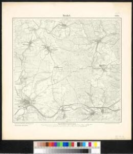
Meßtischblatt 2370 : Brakel, 1898
1 : 250000 Brakel. - Aufn. 1896. - 1:25000. - [Berlin]: Reichsamt für Landesaufnahme, 1898. - 1 Kt.
Corbeiensis Dioecesis pro ut nunc est, descriptio noua
1 : 60000 Mollova mapová sbírka Gigas, Johann Michael
Corbeiensis Dioecesis pro ut nunc est, descriptio noua
1 : 60000 Mollova mapová sbírka Gigas, Johann Michael
320. Furstenberg.
1 : 100000 Reichsamt fur Landesaufnahme
98. Detmold, uit: Topographische Uebersichtskarte des Deutschen Reiches / herausgegeben v. d. Kartogr. Abt. d. Königl. Preuß. Landesaufnahme
1 : 200000 titelvariant: Topogr. Übersichtskarte des Deutschen Reiches; Annotatie: Titel boven bladen ook: Topogr. Übersichtskarte des Deutschen Reiches; Annotatie geografische gegevens: Op elk blad twee maatstokken: 10 Kilometer = 5,5 cm; 1 geogr. Meile = 3,6 cm; Legenda onder op elk blad Königlich Preußische Landesaufnahme. Kartographische Abtheilung [S.l : Königlich Preußische Landesaufnahme, Kartographische Abtheilung]
Carte géographique du comté de Lippe
1 : 119000 Lippe (Německo) Lotter, Tobias Conrad Lotter, Georg F. par Tobie Conrad Lotter
Episcopatvs Paderbornensis descriptio nova
1 : 230000 Mollova mapová sbírka Gigas, Johann Michael Schenk, Peter I
Paderbornensis Episcopatus Descriptio Nova
1 : 220000 Mollova mapová sbírka Gigas, Johann Michael Blaeu, Willem Jansz.
Paderbornensis Episcopatus Descriptio Nova
1 : 220000 Mollova mapová sbírka Gigas, Johann Michael
Paderbornensis Episcopatus Descriptio Nova
1 : 220000 Mollova mapová sbírka Gigas, Johann Michael
PADERBORNENSIS | Episcopatus | DESCRIPTIO NOVA
Ioanne Gigante Ludense D. Med. et Math. auth. Amstelodami Judocus Hondius excudit
Episcopatvs Paderborn nec non Abbatiae Corvei Territorium seculare
1 : 190000 Mollova mapová sbírka Gigas, Johann Michael Homann, Johann Baptista - dědici
Paderbornensis Episcopatus Descriptio Nova [Karte], in: Le théâtre du monde, ou, Nouvel atlas contenant les chartes et descriptions de tous les païs de la terre, Bd. 1, S. 169.
1 Karte aus Atlas Blaeu, Willem Janszoon und Blaeu, Joan Blaeu, Willem Janszoon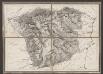
Episcopatus Paderbornensis descriptio nova [Karte], in: Gerardi Mercatoris et I. Hondii Newer Atlas, oder, Grosses Weltbuch, Bd. 1, S. 167.
1 Karte aus Atlas Mercator, Gerhard und Hondius, Jodocus Jansson, Jan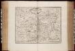
Episcopatus Paderbornensis descriptio nova / Iohanne Gigante Ludense ; [Henricus Hondius]
1 : 225000 Annotatie: Het eerst verschenen in: Novus Atlas ... Ersten Theils, Ander Stück. - Amstelodami : apud Ioannem Ianssonium, 1644; 1e staat: Amstelodami : Henricus Hondius, [1630]; Origineel is Blad 75 in atlas factice Gigas, Joannes (1580-1650); Hondius, Henricus Amstelodami : Joannes Janssonius excudit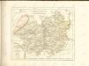

Paderbornensis Episcopatus Descriptio Nova [Karte], in: Novus Atlas, das ist, Weltbeschreibung, Bd. 1, S. 138.
1 Karte aus Atlas Blaeu, Joan Blaeu, Willem Janszoon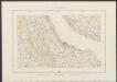
Paderbornensis Episcopatus, Descirptio Nova [Karte], in: Theatrum orbis terrarum, sive, Atlas novus, Bd. 1, S. 218.
1 Karte aus Atlas Blaeu, Joan Blaeu, Willem Janszoon
Episcopatus Paderbornensis descriptio nova [Karte], in: Novus atlas absolutissimus, Bd. 2, S. 124.
1 Karte aus Atlas Janssonius Offizin
Cassel 72, uit: [W. Liebenow's Special-Karte von Mittel-Europa]
1 : 300000 titelvariant: W. Liebenow's Mittel-Europa; Annotatie: Titel boven de bladen: W. Liebenow's Mittel-Europa Johannes Wilhelm Liebenow 1822-1897 Hannover : Hermann Oppermann
Cassel-Göttingen 72, uit: Special-Karte von Mittel-Europa / nach amtlichen Quellen bearbeitet von W. Liebenow
1 : 300000 titelvariant: W. Liebenow's Mittel-Europa; Annotatie: Titel boven de bladen: W. Liebenow's Mittel-Europa Johannes Wilhelm Liebenow 1822-1897 Frankfurt a. M. : Ludwig Ravenstein
Carte de l'Evêché de Paderborn
1 : 180000 Mollova mapová sbírka Carlet, Louis-François Lotter, Tobias Conrad
Paderbornensis episcopatus descripto nova
1 : 222000 Paderborn-oblast (Německo) Gigas, Johann Michael Blaeu, Willem Janszoon Guilielmus Blaeuw
Episcopatvs Hildesiensis descriptio novissima
1 : 317000 Hildesheim (Německo) Gigas, Johann Michael Ioanne Gigante
Episcopatvs Hildesiensis descriptio novissima
1 : 320000 Mollova mapová sbírka Gigas, Johann Michael Schenk, Peter I
Episcopatvs Hildesiensis descriptio novissima
1 : 320000 Mollova mapová sbírka Gigas, Johann Michael Janssonius, Johannes I
Episcopatvs Hildesiensis descriptio novissima
1 : 440000 Mollova mapová sbírka Merian, Matthaeus Merian, Matthäus - dědici
EPISCOPATVS | HILDESIENSIS | DESCRIPTIO NOVISSIMA
Authore Ioanne Gigante D. Med. et Math. [Amsterdam : Joan Blaeu]