Maps of Anklam-Land

44. Swinemünde, uit: Topographische Uebersichtskarte des Deutschen Reiches / herausgegeben v. d. Kartogr. Abt. d. Königl. Preuß. Landesaufnahme
1 : 200000 titelvariant: Topogr. Übersichtskarte des Deutschen Reiches; Annotatie: Titel boven bladen ook: Topogr. Übersichtskarte des Deutschen Reiches; Annotatie geografische gegevens: Op elk blad twee maatstokken: 10 Kilometer = 5,5 cm; 1 geogr. Meile = 3,6 cm; Legenda onder op elk blad Königlich Preußische Landesaufnahme. Kartographische Abtheilung [S.l : Königlich Preußische Landesaufnahme, Kartographische Abtheilung]
Composite: 121. Swinemunde. (Germany)
1 : 100000 Reichsamt fur Landesaufnahme
Composite: 120. Anklam. (Germany)
1 : 100000 Reichsamt fur Landesaufnahme
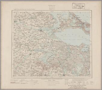
121. Swinemunde. (Germany)
1 : 100000 Reichsamt fur Landesaufnahme
Composite: 154. Pasewalk. (Germany)
1 : 100000 Reichsamt fur Landesaufnahme
120. Anklam. (Germany)
1 : 100000 Reichsamt fur Landesaufnahme
154. Pasewalk. (Germany)
1 : 100000 Reichsamt fur Landesaufnahme
Gefecht bei Rothemühl zwischen dem Obersten Belling und dem Major Sprengport am 18ten September 1761
1 : 50000
Meßtischblatt 1055 : Stolzenburg, 1889
1 : 250000 Stolzenburg. - Aufn. 1887. - 1:25000. - [Berlin]: Reichsamt für Landesaufnahme, 1889. - 1 Kt.
Meßtischblatt 1054 : Krugsdorf, 1888
1 : 250000 Krugsdorf. - Aufn. 1887. - 1:25000. - [Berlin]: Reichsamt für Landesaufnahme, 1888. - 1 Kt.
Meßtischblatt 1053 : Pasewalk, 1889
1 : 250000 Pasewalk. - Aufn. 1887. - 1:25000. - [Berlin]: Reichsamt für Landesaufnahme, 1889. - 1 Kt.
Meßtischblatt 1052 : Strasburg in der Uckermark, 1932
1 : 250000 Strasburg in der Uckermark. - Hrsg. 1884. - 1:25000. - [Berlin]: Reichsamt für Landesaufnahme, 1932. - 1 Kt.
Meßtischblatt 2447 : Golm, 1932
1 : 250000 Golm. - Hrsg. 1885, letzte Nachtr. 1932. - 1:25000. - [Berlin]: Reichsamt für Landesaufnahme, 1932. - 1 Kt
Meßtischblatt 2446 : Pragsdorf, 1937
1 : 250000 Pragsdorf. - Aufn. 1885, einz. Nachtr. 1911. - 1:25000. - [Berlin]: Reichsamt für Landesaufnahme, 1937. - 1 Kt.
Meßtischblatt 959 : Rieth, 1889
1 : 250000 Rieth. - Aufn. 1887. - 1:25000. - [Berlin]: Reichsamt für Landesaufnahme, 1889. - 1 Kt.
Meßtischblatt 2350 : Eggesin, 1939
1 : 250000 Eggesin. - Hrsg. 1889, bericht. 1911, Nachtr. 1919, redakt. - 1:25000. - [Berlin]: Reichsamt für Landesaufnahme, 1939. - 1 Kt.
Meßtischblatt 957, neue Nr. 2349: Ferdinandshof, 1936
1 : 250000 Ferdinandshof. - Hrsg. 1888, bericht. 1911, einz. Nachtr. 1932. - 1:25000. - [Berlin]: Reichsamt für Landesaufnahme, 1936. - 1 Kt.
Meßtischblatt 2348 : Galenbeck, 1932
1 : 250000 Galenbeck. - Hrsg. 1884, letzte Nachtr. 1932. - 1:25000. - [Berlin]: Reichsamt für Landesaufnahme, 1932. - 1 Kt.
Meßtischblatt 2347 : Friedland, 1955
1 : 250000 Friedland. - Hrsg. 1879, bericht. 1927. - 1:25000. - [Berlin]: MdI, 1955. - 1 Kt.
Meßtischblatt 2346 : Roga, 1954
1 : 250000 Roga. - Hrsg. 1885, letzte Nachtr. 1932, Ausgabe 1952. - 1:25000. - [S.l.]: VD Mecklenburg, 1954. - 1 Kt.
Meßtischblatt 2251.-52 : Neuwarp, 1925
1 : 250000 Neuwarp. - Hrsg. 1887, bericht. 1911, kl. Nachtr. 1925. - 1:25000. - [Berlin]: Reichsamt für Landesaufnahme, 1925. - 1 Kt.
Meßtischblatt 861, neue Nr. 2250 : Ueckermünde, 1936
1 : 250000 Ueckermünde. - Hrsg. 1887, bericht. 1911. - 1:25000. - [Berlin]: Reichsamt für Landesaufnahme, 1936. - 1 Kt.
Meßtischblatt 860 : Leopoldshagen, 1936
1 : 250000 Leopoldshagen. - Hrsg. 1888, bericht. 1911, einz. Nachtr. 1932, gedr. [19]36. - 1:25000. - [Berlin]: Reichsamt für Landesaufnahme, 1936. - 1 Kt.
Meßtischblatt 859 : Ducherow, 1932
1 : 250000 Ducherow. - Hrsg. 1885, einz. Nachtr. 1919, gedr. [19]32. - 1:25000. - [Berlin]: Reichsamt für Landesaufnahme, 1932. - 1 Kt.
Meßtischblatt 2247 : Spantekow, 1911
1 : 250000 Spantekow. - Hrsg. 1885, letzte Nachtr. 1911. - 1:25000. - [Berlin]: Reichsamt für Landesaufnahme, 1911. - 1 Kt.
Meßtischblatt 2246 : Siedenbollentin, 1955
1 : 250000 Siedenbollentin. - Hrsg. 1884, letzte Nachtr. 1911. - 1:25000. - [Berlin]: Reichsamt für Landesaufnahme, 1911. - 1 Kt.
Meßtischblatt 768 : Caseburg, 1911
1 : 250000 Caseburg. - Aufn. 1886, hrsg. 1888, bericht. 1911. - 1:25000. - [Berlin]: Reichsamt für Landesaufnahme, 1911. - 1 Kt.
Meßtischblatt 767 : Zirchow Kr. Usedom-Wollin, 1932
1 : 250000 Zirchow Kr. Usedom-Wollin. - Hrsg. 1887, bericht. 1911, kl. Nachtr. 1927. - 1:25000. - [Berlin]: Reichsamt für Landesaufnahme, 1932. - 1 Kt.
Meßtischblatt 767 : Zirchow Kr. Usedom-Wollin, 1932
1 : 250000 Zirchow Kr. Usedom-Wollin. - Hrsg. 1887, bericht. 1911, kl. Nachtr. 1927. - 1:25000. - [Berlin]: Reichsamt für Landesaufnahme, 1932. - 1 Kt.