Maps of Nord-Rügen

13. Sagard, uit: Topographische Uebersichtskarte des Deutschen Reiches / herausgegeben v. d. Kartogr. Abt. d. Königl. Preuß. Landesaufnahme
1 : 200000 titelvariant: Topogr. Übersichtskarte des Deutschen Reiches; Annotatie: Titel boven bladen ook: Topogr. Übersichtskarte des Deutschen Reiches; Annotatie geografische gegevens: Op elk blad twee maatstokken: 10 Kilometer = 5,5 cm; 1 geogr. Meile = 3,6 cm; Legenda onder op elk blad Königlich Preußische Landesaufnahme. Kartographische Abtheilung [S.l : Königlich Preußische Landesaufnahme, Kartographische Abtheilung]
Composite: 42. Sagard. (Germany)
1 : 100000 Reichsamt fur Landesaufnahme
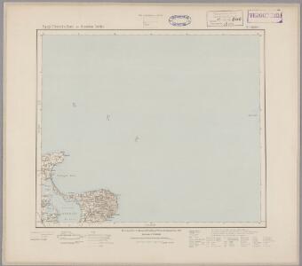
Meßtischblatt 260, 261 : Sagard, 1920
1 : 250000 Sagard. - Aufn. 1885, Nachtr. 1920. - 1:25000. - [Berlin]: Reichsamt für Landesaufnahme, 1920. - 1 Kt.
Meßtischblatt 259 : Rappin, 1936
1 : 250000 Rappin. - Hrsg. 1886, bericht. 1925. - 1:25000. - [Berlin]: Reichsamt für Landesaufnahme, 1936. - 1 Kt.
Meßtischblatt 1346 : Altenkirchen, 1932
1 : 250000 Altenkirchen. - Hrsg. 1886, bericht. 1924, letzte Nachtr. 1932. - 1:25000. - [Berlin]: Reichsamt für Landesaufnahme, 1932. - 1 Kt.
Meßtischblatt 213 : Altenkirchen, 1924
1 : 250000 Altenkirchen. - Hrsg. 1885, bericht. 1924. - 1:25000. - [Berlin]: Reichsamt für Landesaufnahme, 1924. - 1 Kt.
Falsterbo 13, uit: Special-Karte von Mittel-Europa / nach amtlichen Quellen bearbeitet von W. Liebenow
1 : 300000 titelvariant: W. Liebenow's Mittel-Europa; Annotatie: Titel boven de bladen: W. Liebenow's Mittel-Europa Johannes Wilhelm Liebenow 1822-1897 Frankfurt a. M. : Ludwig Ravenstein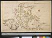
Nieuwe afteekening van het eyland Rügen en de Straat sond als meede de stad Straelsond en't Nieuwe diep alles seer naeukeurig afgeteekent
Germany Johannes van Keulen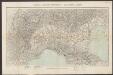
Nova Famigerabilis Insulae Ac Ducatus Rugiae Descriptio. [Karte], in: Gerardi Mercatoris et I. Hondii Newer Atlas, oder, Grosses Weltbuch, Bd. 1, S. 325.
1 Karte aus Atlas Mercator, Gerhard und Hondius, Jodocus Jansson, Jan
RVGIA | INSVLA AC DVCATVS
accuratissimè descripta ab E. Lubino. | Adjecta sunt ad utrumque latus Baronum et Nobilium | antiquissimarum familiarum in Insula Rugia habi- | tantium, juxta alphabeti ordinem, Insignia. Amsterdami | Apud Guiljelmum Blaeuw.
Reise Karte von der Insel Rügen
Rujana (Německo) Hagenow, Friedrich von Janssonius, Johannes
Rvgia insvla ac dvcatvs
1 : 270000 Rujana (Německo) Lubin, Eilhard Janssonius, Johannes Ioannis Ianßonius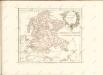

Meßtischblatt 316 : Lubkow, 1925
1 : 250000 Lubkow. - Aufn. 1885, bericht. 1925. - 1:25000. - [Berlin]: Reichsamt für Landesaufnahme, 1925. - 1 Kt.
Meßtischblatt 1546 : Bergen (auf Rügen), 1936
1 : 250000 Bergen (auf Rügen). - Hrsg. 1887, bericht. 1925. - 1:25000. - [Berlin]: Reichsamt für Landesaufnahme, 1936. - 1 Kt.
Composite: 64. Bergen a. Rugen. (Germany)
1 : 100000 Reichsamt fur Landesaufnahme
Sect. 3: Rügenwalde, uit: Geologische Karte des Deutschen Reichs in 27 Blaettern / [von] Richard Lepsius ; Red. von C. Vogel
1 : 500000 Annotatie: Blad 18 ontbreekt; Een aantal bladen op linnen; Een aantal bladen gereviseerd 1913-1914; Annotatie geografische gegevens: Met schaalstokken o.a. in kilometers; Legenda Carl Vogel 1828-1897 Gotha : Justus Perthes
Sect. 2: Stralsund, uit: Geologische Karte des Deutschen Reichs in 27 Blaettern / [von] Richard Lepsius ; Red. von C. Vogel
1 : 500000 Annotatie: Blad 18 ontbreekt; Een aantal bladen op linnen; Een aantal bladen gereviseerd 1913-1914; Annotatie geografische gegevens: Met schaalstokken o.a. in kilometers; Legenda Carl Vogel 1828-1897 Gotha : Justus Perthes
Rugiae, Usedomiae, Et Iulinae, Wandalicarum insularum vera descriptio. [Karte], in: Theatrum orbis terrarum, S. 209.
1 Karte aus Atlas Ortelius, Abraham Vrients, Jan Baptista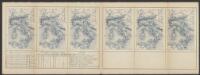
Rugia Insula Ac Ducatus accuratissimè descripta ab E. Lubino. [Karte], in: Le théâtre du monde, ou, Nouvel atlas contenant les chartes et descriptions de tous les païs de la terre, Bd. 1, S. 122.
1 Karte aus Atlas Blaeu, Willem Janszoon und Blaeu, Joan Blaeu, Willem Janszoon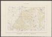
Rugia Insula Ac Ducatus accuratissimè descritpta [...] [Karte], in: Theatrum orbis terrarum, sive, Atlas novus, Bd. 1, S. 171.
1 Karte aus Atlas Blaeu, Joan Blaeu, Willem Janszoon
Rugia Insula Ac Ducatus accuratissimè descripta [Karte], in: Novus Atlas, das ist, Weltbeschreibung, Bd. 1, S. 93.
1 Karte aus Atlas Blaeu, Joan Blaeu, Willem Janszoon
Rugia Insula Ac Ducatus accuratissime descripta [Karte], in: Novus atlas absolutissimus, Bd. 2, S. 48.
1 Karte aus Atlas Janssonius Offizin
Rugiae, Usedomiae, Et Iulinae, Wandalicarum insularum Vera descriptio
Mollova mapová sbírka Ortelius, Abraham
Stralsund 23, uit: Special-Karte von Mittel-Europa / nach amtlichen Quellen bearbeitet von W. Liebenow
1 : 300000 titelvariant: W. Liebenow's Mittel-Europa; Annotatie: Titel boven de bladen: W. Liebenow's Mittel-Europa Johannes Wilhelm Liebenow 1822-1897 Frankfurt a. M. : Ludwig Ravenstein

26. Stralsund, uit: Topographische Uebersichtskarte des Deutschen Reiches / herausgegeben v. d. Kartogr. Abt. d. Königl. Preuß. Landesaufnahme
1 : 200000 titelvariant: Topogr. Übersichtskarte des Deutschen Reiches; Annotatie: Titel boven bladen ook: Topogr. Übersichtskarte des Deutschen Reiches; Annotatie geografische gegevens: Op elk blad twee maatstokken: 10 Kilometer = 5,5 cm; 1 geogr. Meile = 3,6 cm; Legenda onder op elk blad Königlich Preußische Landesaufnahme. Kartographische Abtheilung [S.l : Königlich Preußische Landesaufnahme, Kartographische Abtheilung]
In Bornholm 14, uit: Special-Karte von Mittel-Europa / nach amtlichen Quellen bearbeitet von W. Liebenow
1 : 300000 titelvariant: W. Liebenow's Mittel-Europa; Annotatie: Titel boven de bladen: W. Liebenow's Mittel-Europa Johannes Wilhelm Liebenow 1822-1897 Frankfurt a. M. : Ludwig Ravenstein
Karte von Neu-Vorpommern und der Insel Rügen
1 : 200000 Přední Pomořansko (Německo) Hagenow, Fr. von Hube, C. A. Fr. v. Hagenow