Maps of Africa
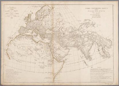
Orbis veteribus notus scilicet: Europa, Asia, Africa : publici juris factus / auctor d'Anville
1 : 16250000 Annotatie geografische gegevens: Met 8 schaalstokken Jean-Baptiste Bourguignon d' Anville 1697-1782 Norimbergae : prostat in officina Adami Theophili Schneideri-Weigeliana
Orbis Veteribus Notus
Schul-Atlas der alten Welt bei Justus Perthes
Schul-Atlas für die alte Erdbeschreibung : zur allgemeinen Schul-encyclopädie gehörig
J. H. Campe Zusammensetzung und Zeichnung von [...] Dufour, unter Leitung von Heusinger ; gestochen von Frentzel. Braunschweig : Schulbuchhandlung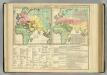
World as Known to the Ancients; Division ...among the Posterity of Noah.
1 : 54400000 Lavoisne, M.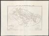
Carta generale del mondo conosciuto dagli antichi
1 : 25000000 Marzolla, Benedetto Reale Litografia Militare
Generalkarte saemmtlicher Entdeckungen auf den drei grossen Weltreissen des Kapit. Jakob Cook
Afrika Roberts, Heinrich Schraembl, Franz Anton F.A. Schraembl
Asien
1 : 33633000 gezeichnet von H. Kiepert gestochen von W. Weiler Weimar : Geographisches Institut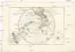
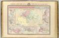
Mappe-monde sur un plan horisontal
Austrálie André
Verbreitung der vorzuglicheren Saugethiere der Neuen Welt.
1 : 50000000 Berghaus, Heinrich
Resource-Relief Maps of: Europe and Australia.
Hammond, C.S.
Asia
Schul-Atlas über alle Theile der Erde nach dem neuesten Zustande, und über das Weltgebäude Stieler, Adolf bei Justus Perthes
Mountain Chains in Asia & Europe
The physical atlas Johnston, Alexander Keith William Blackwood & Sons
[Asien, Politische Übersicht]
E. von Sydow's Schul-Atlas in sechs und dreissig Karten Sydow, Emil von bei Justus Perthes
Tabv Gran Rvssie / diefert sitvs orbis hydrographorvm ab eo qvem Ptolomevs posvit
1 : 39000000 1 Karte : Holzschnitt ; 28 x 45 cm Ptolemaeus, Claudius [Lorenz Fries]
(Facsimile) America by Ortelius.
1 : 52000000 Ortelius, Abraham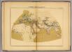
Le Monde connu des anciens au deuxieme siecle de Iere. chretienne.
1 : 32000000 Vivien de Saint-Martin, M.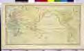
CHART of the WORLD

Geographie de l'antiquite.
Garnier, F. A., 1803-1863
Stiller Ozean
1 : 10000000 Tichý oceán Justus Perthes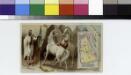
Arabia.
From [Series of advertising cards issued by Arbuckle Bros. Coffee Company, each consisting of a map of a country of the world with related illustrations.]
Asien
Neuer Handatlas über alle Theile der Erde Kiepert, Heinrich Verlag von Dietrich Reimer
Asien
Adolf Stieler's Handatlas über alle Theile der Erde und über das Weltgebäude Stieler, Adolf Justus Perthes
Asia
Schul-Atlas über alle Theile der Erde nach dem neuesten Zustande, und über das Weltgebäude Stieler, Adolf Justus Perthes
Asien und Europa
Atlas der Geologie Zittel, K.v. ; Berghaus, Hermann Justus Perthes
Verbreitung der vorzuglicheren Saugethiere der Alten Welt.
1 : 50000000 Berghaus, Heinrich
Index chart of hydropac messages / Under the authority of the Secretary of the Navy [by the] Hydrographic Office
Hydrographic Office Washington D.C. Washington D.C. : Hydrographic Office
Grosser Ocean.
1 : 75000000 Andree, Richard